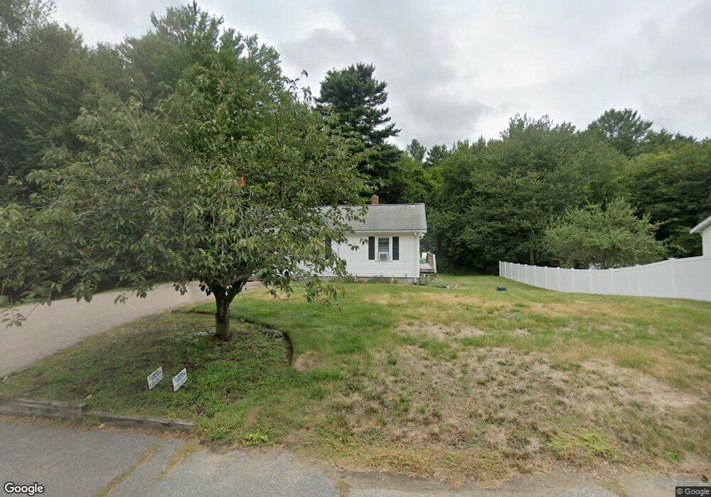
1063 Hanover St Hanover, MA 02339
Estimated Value: $455,000 - $599,000
3
Beds
1
Bath
1,048
Sq Ft
$502/Sq Ft
Est. Value
About This Home
This home is located at 1063 Hanover St, Hanover, MA 02339 and is currently estimated at $525,676, approximately $501 per square foot. 1063 Hanover St is a home located in Plymouth County with nearby schools including Hanover High School and Cardinal Cushing Centers.
Ownership History
Date
Name
Owned For
Owner Type
Purchase Details
Closed on
Jul 21, 2006
Sold by
Shea James P and Shea Meaghan H
Bought by
Gear Christopher and Gear Karolyn
Current Estimated Value
Purchase Details
Closed on
Apr 8, 2004
Sold by
Sullivan Sean S and Sullivan Sean J
Bought by
Shea James P and Waggett Meaghan H
Purchase Details
Closed on
Feb 28, 2000
Sold by
Parsons Dorothy J
Bought by
Sullivan Sean S
Create a Home Valuation Report for This Property
The Home Valuation Report is an in-depth analysis detailing your home's value as well as a comparison with similar homes in the area
Home Values in the Area
Average Home Value in this Area
Purchase History
| Date | Buyer | Sale Price | Title Company |
|---|---|---|---|
| Gear Christopher | $324,000 | -- | |
| Gear Christopher | $324,000 | -- | |
| Shea James P | $305,000 | -- | |
| Shea James P | $305,000 | -- | |
| Sullivan Sean S | $183,500 | -- | |
| Sullivan Sean S | $183,500 | -- |
Source: Public Records
Mortgage History
| Date | Status | Borrower | Loan Amount |
|---|---|---|---|
| Open | Sullivan Sean S | $327,141 | |
| Closed | Sullivan Sean S | $325,307 |
Source: Public Records
Tax History Compared to Growth
Tax History
| Year | Tax Paid | Tax Assessment Tax Assessment Total Assessment is a certain percentage of the fair market value that is determined by local assessors to be the total taxable value of land and additions on the property. | Land | Improvement |
|---|---|---|---|---|
| 2025 | $5,616 | $454,700 | $235,900 | $218,800 |
| 2024 | $5,838 | $454,700 | $235,900 | $218,800 |
| 2023 | $5,376 | $398,500 | $214,500 | $184,000 |
| 2022 | $5,293 | $347,100 | $203,800 | $143,300 |
| 2021 | $1,750 | $304,300 | $165,800 | $138,500 |
| 2020 | $5,056 | $310,000 | $175,500 | $134,500 |
| 2019 | $4,831 | $294,400 | $175,500 | $118,900 |
| 2018 | $4,708 | $289,200 | $175,500 | $113,700 |
| 2017 | $4,480 | $271,200 | $167,900 | $103,300 |
| 2016 | $4,316 | $256,000 | $152,700 | $103,300 |
| 2015 | $3,747 | $232,000 | $141,400 | $90,600 |
Source: Public Records
Map
Nearby Homes
- 1055 Hanover St
- 1054 Hanover St
- 1078 Hanover St
- 1078 Hanover St Unit 2
- 1078 Hanover St Unit 1
- 1078 Hanover St
- 1052 Hanover St Unit 3
- 1052 Hanover St Unit 4
- 1088 Hanover St
- 104 Plain St
- 119 Plain St
- 1102 Hanover St Unit h
- 1102 Hanover St Unit G&H
- 1102 Hanover St Unit J
- 1102 Hanover St Unit D
- 111 Plain St
- 126 Plain St
- 1118 Hanover St
- 129 Plain St
- 138 Plain St