Estimated Value: $268,844 - $344,000
3
Beds
2
Baths
1,188
Sq Ft
$270/Sq Ft
Est. Value
About This Home
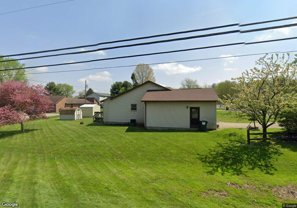
This home is located at 1063 Joann Ct, Heath, OH 43056 and is currently estimated at $320,961, approximately $270 per square foot. 1063 Joann Ct is a home located in Licking County with nearby schools including Garfield Elementary School, Stevenson Elementary School, and Heath Middle School.
Ownership History
Date
Name
Owned For
Owner Type
Purchase Details
Closed on
Aug 17, 2009
Sold by
Pennington Jacqueline
Bought by
Not Provided Timothy M
Current Estimated Value
Purchase Details
Closed on
May 30, 2007
Sold by
Rockey Connie G and Scott Rockey R
Bought by
Forgrave Timothy and Pennington Jacqueline
Home Financials for this Owner
Home Financials are based on the most recent Mortgage that was taken out on this home.
Original Mortgage
$144,696
Interest Rate
6.2%
Mortgage Type
FHA
Create a Home Valuation Report for This Property
The Home Valuation Report is an in-depth analysis detailing your home's value as well as a comparison with similar homes in the area
Home Values in the Area
Average Home Value in this Area
Purchase History
| Date | Buyer | Sale Price | Title Company |
|---|---|---|---|
| Not Provided Timothy M | -- | None Available | |
| Forgrave Timothy | $145,900 | First Am |
Source: Public Records
Mortgage History
| Date | Status | Borrower | Loan Amount |
|---|---|---|---|
| Previous Owner | Forgrave Timothy | $144,696 |
Source: Public Records
Tax History Compared to Growth
Tax History
| Year | Tax Paid | Tax Assessment Tax Assessment Total Assessment is a certain percentage of the fair market value that is determined by local assessors to be the total taxable value of land and additions on the property. | Land | Improvement |
|---|---|---|---|---|
| 2024 | $3,087 | $71,760 | $24,890 | $46,870 |
| 2023 | $3,417 | $71,760 | $24,890 | $46,870 |
| 2022 | $3,010 | $55,550 | $18,410 | $37,140 |
| 2021 | $3,072 | $55,550 | $18,410 | $37,140 |
| 2020 | $3,091 | $55,550 | $18,410 | $37,140 |
| 2019 | $2,486 | $45,470 | $13,160 | $32,310 |
| 2018 | $2,513 | $0 | $0 | $0 |
| 2017 | $2,732 | $0 | $0 | $0 |
| 2016 | $2,902 | $0 | $0 | $0 |
| 2015 | $2,952 | $0 | $0 | $0 |
| 2014 | $4,151 | $0 | $0 | $0 |
| 2013 | $2,723 | $0 | $0 | $0 |
Source: Public Records
Map
Nearby Homes
- 164 Orchard St
- 767 Francis Dr
- 730 Francis Dr
- 722 Francis Dr
- 748 Francis Dr
- Yosemite Plan at Heron Manor - Maple Street Collection
- Cumberland Plan at Heron Manor - Maple Street Collection
- Wesley Plan at Linnview Crossing - Maple Street Collection
- Breckenridge Plan at Heron Manor - Maple Street Collection
- Yosemite Plan at Linnview Crossing - Maple Street Collection
- DaVinci Plan at Heron Manor - Maple Street Collection
- Fairfax Plan at Linnview Crossing - Maple Street Collection
- Greenbriar Plan at Linnview Crossing - Maple Street Collection
- Jensen Plan at Linnview Crossing - Maple Street Collection
- Jensen Plan at Heron Manor - Maple Street Collection
- Cumberland Plan at Linnview Crossing - Maple Street Collection
- Wesley Plan at Heron Manor - Maple Street Collection
- Preston Plan at Heron Manor - Maple Street Collection
- Denali Plan at Linnview Crossing - Maple Street Collection
- Fairfax Plan at Heron Manor - Maple Street Collection
- 1063 Joanne Ct
- 1065 Joanne Ct
- 1067 Joanne Ct
- 987 Professional Pkwy
- 1064 Joann Ct
- 569 Franklin Ave
- 1064 Joanne Ct
- 1069 Joann Ct
- 1066 Joanne Ct
- 1069 Joanne Ct
- 1068 Joann Ct
- 567 Franklin Ave
- 1068 Joanne Ct
- 983 Professional Pkwy
- 0 Franklin Ave
- 1070 Joanne Ct
- 1071 Joanne Ct
- 981 Professional Pkwy
- 1105 Lizabeth Cir
- 1101 Lizabeth Cir