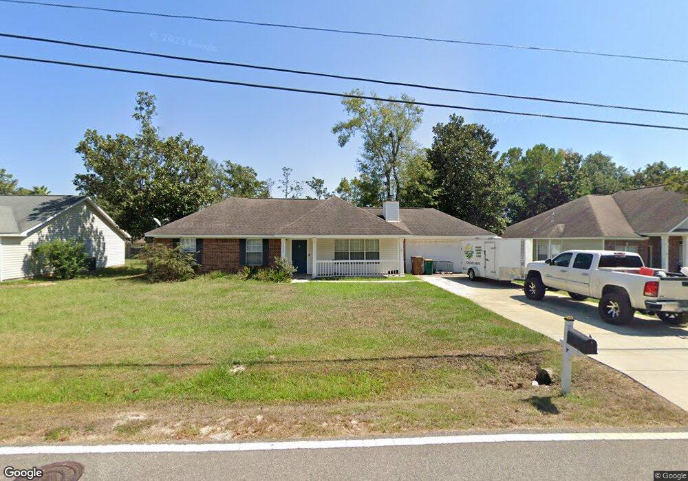
10638 Shorecrest Rd Biloxi, MS 39532
Estimated Value: $222,837 - $240,000
3
Beds
2
Baths
1,511
Sq Ft
$154/Sq Ft
Est. Value
About This Home
This home is located at 10638 Shorecrest Rd, Biloxi, MS 39532 and is currently estimated at $232,459, approximately $153 per square foot. 10638 Shorecrest Rd is a home located in Harrison County with nearby schools including Woolmarket Elementary School, North Woolmarket Elementary/Middle School, and D'Iberville Senior High School.
Ownership History
Date
Name
Owned For
Owner Type
Purchase Details
Closed on
May 4, 2018
Sold by
Tanner Justin and Tanner Karen
Bought by
Seymour Kristen and Seymour Anthony J
Current Estimated Value
Create a Home Valuation Report for This Property
The Home Valuation Report is an in-depth analysis detailing your home's value as well as a comparison with similar homes in the area
Home Values in the Area
Average Home Value in this Area
Purchase History
| Date | Buyer | Sale Price | Title Company |
|---|---|---|---|
| Seymour Kristen | -- | -- |
Source: Public Records
Tax History Compared to Growth
Tax History
| Year | Tax Paid | Tax Assessment Tax Assessment Total Assessment is a certain percentage of the fair market value that is determined by local assessors to be the total taxable value of land and additions on the property. | Land | Improvement |
|---|---|---|---|---|
| 2025 | $1,166 | $12,720 | $0 | $0 |
| 2024 | $1,112 | $12,269 | $0 | $0 |
| 2023 | $1,125 | $12,320 | $0 | $0 |
| 2022 | $1,134 | $12,320 | $0 | $0 |
| 2021 | $1,139 | $12,320 | $0 | $0 |
| 2020 | $1,028 | $11,001 | $0 | $0 |
| 2019 | $1,036 | $11,001 | $0 | $0 |
| 2018 | $1,047 | $11,001 | $0 | $0 |
| 2017 | $1,047 | $11,001 | $0 | $0 |
| 2015 | $2,036 | $16,346 | $0 | $0 |
| 2014 | -- | $18,646 | $0 | $0 |
| 2013 | -- | $16,346 | $3,450 | $12,896 |
Source: Public Records
Map
Nearby Homes
- 10555 Pak Cove
- 10574 Shore Cove
- 10242 Webb Ln
- 10556 Shore Cove
- 0 W River Vue
- 10124 Skyhawk Ct
- 10415 Pin Oak Dr
- 10355 Pin Oak Dr
- 11025 Pin Oak Dr
- 10452 Riviere Vue Dr
- 11044 Pin Oak Dr
- 11209 Shorecrest Rd
- 0 Eagle Point Cir Unit 4112102
- 0 N River Vue Cir
- Kai Plan at River Oaks
- Opal Plan at River Oaks
- 9700 W Oaklawn Rd
- 9626 W Oaklawn Rd
- 9658 W Oaklawn Rd
- 9642 W Oaklawn Rd
- 10626 Shorecrest Rd
- 10644 Shorecrest Rd
- 10625 Oak Crest Dr S
- 10655 Oak Crest Dr S
- 10635 Oakcrest Dr N
- 10635 Oak Crest Dr S
- 10616 Shorecrest Rd
- 10191 Ridgewood Ln
- 10647 Oak Crest Dr S
- 10620 Oak Crest Dr S
- 10604 Shorecrest Rd
- 10594 Shorecrest Rd
- 10661 Shorecrest Rd
- 10626 Oak Crest Dr S
- 10670 Shorecrest Rd
- 10577 Pak Cove
- 10642 Oak Crest Dr S
- 10578 Pak Cove
- 10632 Oak Crest Dr S
- 10661 Oak Crest Dr N