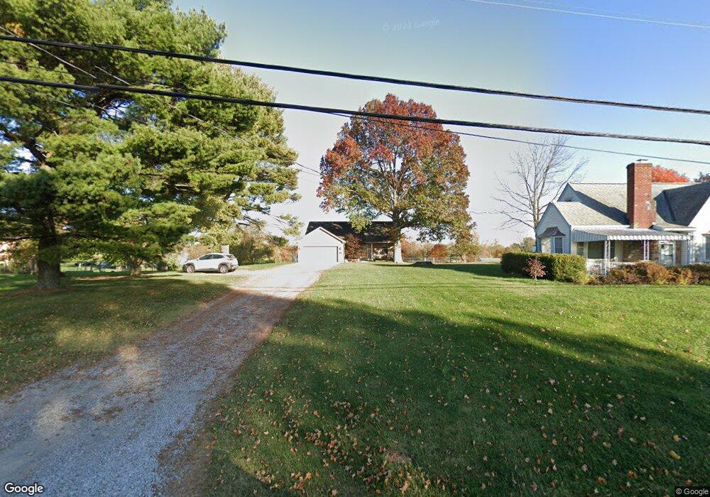
10639 Taylor Mill Rd Independence, KY 41051
Estimated Value: $243,000 - $329,000
3
Beds
2
Baths
1,380
Sq Ft
$214/Sq Ft
Est. Value
About This Home
This home is located at 10639 Taylor Mill Rd, Independence, KY 41051 and is currently estimated at $294,952, approximately $213 per square foot. 10639 Taylor Mill Rd is a home located in Kenton County with nearby schools including White's Tower Elementary School, Twenhofel Middle School, and Simon Kenton High School.
Ownership History
Date
Name
Owned For
Owner Type
Purchase Details
Closed on
Jun 14, 2001
Sold by
Ellison Enterprises Inc
Bought by
Winterman David G and Winterman Patricia A
Current Estimated Value
Home Financials for this Owner
Home Financials are based on the most recent Mortgage that was taken out on this home.
Original Mortgage
$14,400
Outstanding Balance
$5,473
Interest Rate
7.11%
Mortgage Type
New Conventional
Estimated Equity
$289,479
Purchase Details
Closed on
Oct 19, 2000
Sold by
Robinson Gerald
Bought by
Ellison Glenn
Create a Home Valuation Report for This Property
The Home Valuation Report is an in-depth analysis detailing your home's value as well as a comparison with similar homes in the area
Home Values in the Area
Average Home Value in this Area
Purchase History
| Date | Buyer | Sale Price | Title Company |
|---|---|---|---|
| Winterman David G | $182,500 | -- | |
| Ellison Glenn | $28,000 | -- |
Source: Public Records
Mortgage History
| Date | Status | Borrower | Loan Amount |
|---|---|---|---|
| Open | Winterman David G | $14,400 |
Source: Public Records
Tax History Compared to Growth
Tax History
| Year | Tax Paid | Tax Assessment Tax Assessment Total Assessment is a certain percentage of the fair market value that is determined by local assessors to be the total taxable value of land and additions on the property. | Land | Improvement |
|---|---|---|---|---|
| 2024 | $2,497 | $203,800 | $25,000 | $178,800 |
| 2023 | $2,572 | $203,800 | $25,000 | $178,800 |
| 2022 | $2,631 | $203,800 | $25,000 | $178,800 |
| 2021 | $2,670 | $203,800 | $25,000 | $178,800 |
| 2020 | $2,544 | $189,800 | $20,000 | $169,800 |
| 2019 | $2,551 | $189,800 | $20,000 | $169,800 |
| 2018 | $2,565 | $189,800 | $20,000 | $169,800 |
| 2017 | $2,495 | $189,800 | $20,000 | $169,800 |
| 2015 | $2,424 | $189,800 | $28,000 | $161,800 |
| 2014 | $2,389 | $189,800 | $28,000 | $161,800 |
Source: Public Records
Map
Nearby Homes
- 3531 Finnell Ct
- 10864 Griststone Cir
- 6550 Sugar Camp Dr
- 6457 Adahi Dr
- 1 Willow Green Dr
- 2 Willow Green Dr
- 761 Cox Rd
- 860 Stephens Rd
- 3131 Chipping Camden
- 3135 Chipping Camden
- 10990 Taylor Mill Rd
- 6416 Taylor Mill Rd
- 6416 Walnut Dr
- 3141 Willowhurst Trace
- 3091 Belleglade Dr
- 3095 Belleglade Dr
- Greenbriar Plan at Willow Green - Maple Street Collection
- Jensen Plan at Willow Green - Maple Street Collection
- Yosemite Plan at Willow Green - Maple Street Collection
- Beacon Plan at Willow Green - Maple Street Collection
- 10649 Taylor Mill Rd
- 10629 Taylor Mill Rd
- 10659 Taylor Mill Rd
- 10611 Taylor Mill Rd
- 0 Taylor Mill Unit 520372
- 0 Taylor Mill Unit 191448
- 10591 Taylor Mill Rd
- 10632 Taylor Mill Rd
- 10638 Taylor Mill Rd
- 10603 Taylor Mill Rd
- 705 Bear Ct
- 10589 Taylor Mill Rd
- 709 Bear Ct
- 10684 Taylor Mill Rd
- 704 Bear Ct
- 10665 Taylor Mill Rd
- 713 Bear Ct
- 708 Bear Ct
- 10674 Taylor Mill Rd
- 10562 Taylor Mill Rd