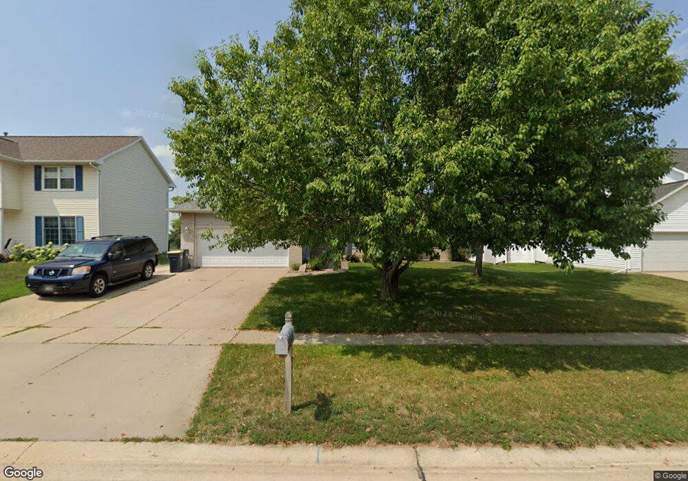
1064 Milstead Dr Hiawatha, IA 52233
Estimated Value: $263,000 - $298,000
3
Beds
2
Baths
1,633
Sq Ft
$170/Sq Ft
Est. Value
About This Home
This home is located at 1064 Milstead Dr, Hiawatha, IA 52233 and is currently estimated at $277,409, approximately $169 per square foot. 1064 Milstead Dr is a home located in Linn County with nearby schools including Hiawatha Elementary School, Harding Middle School, and John F. Kennedy High School.
Ownership History
Date
Name
Owned For
Owner Type
Purchase Details
Closed on
Apr 29, 1999
Sold by
Murrell David B and Murrell Debra S
Bought by
Deboer Curtis J and Deboer Denise A
Current Estimated Value
Home Financials for this Owner
Home Financials are based on the most recent Mortgage that was taken out on this home.
Original Mortgage
$123,200
Interest Rate
6.92%
Purchase Details
Closed on
Nov 26, 1997
Sold by
Overton Mark L and Overton Kathryn A
Bought by
Murrell David B and Murrell Debra S
Home Financials for this Owner
Home Financials are based on the most recent Mortgage that was taken out on this home.
Original Mortgage
$141,450
Interest Rate
7.46%
Create a Home Valuation Report for This Property
The Home Valuation Report is an in-depth analysis detailing your home's value as well as a comparison with similar homes in the area
Home Values in the Area
Average Home Value in this Area
Purchase History
| Date | Buyer | Sale Price | Title Company |
|---|---|---|---|
| Deboer Curtis J | $153,500 | -- | |
| Murrell David B | $148,500 | -- |
Source: Public Records
Mortgage History
| Date | Status | Borrower | Loan Amount |
|---|---|---|---|
| Closed | Deboer Curtis J | $123,200 | |
| Previous Owner | Murrell David B | $141,450 |
Source: Public Records
Tax History Compared to Growth
Tax History
| Year | Tax Paid | Tax Assessment Tax Assessment Total Assessment is a certain percentage of the fair market value that is determined by local assessors to be the total taxable value of land and additions on the property. | Land | Improvement |
|---|---|---|---|---|
| 2025 | $3,822 | $258,300 | $40,900 | $217,400 |
| 2024 | $4,328 | $243,000 | $40,900 | $202,100 |
| 2023 | $4,328 | $243,000 | $40,900 | $202,100 |
| 2022 | $4,272 | $222,300 | $40,900 | $181,400 |
| 2021 | $4,438 | $222,300 | $40,900 | $181,400 |
| 2020 | $4,438 | $215,700 | $40,900 | $174,800 |
| 2019 | $4,054 | $198,600 | $36,300 | $162,300 |
| 2018 | $3,978 | $198,600 | $36,300 | $162,300 |
| 2017 | $4,036 | $189,000 | $36,300 | $152,700 |
| 2016 | $4,036 | $189,000 | $36,300 | $152,700 |
| 2015 | $4,046 | $189,000 | $36,300 | $152,700 |
| 2014 | $3,860 | $189,000 | $36,300 | $152,700 |
| 2013 | $3,754 | $189,000 | $36,300 | $152,700 |
Source: Public Records
Map
Nearby Homes
- 40 11th Ave
- 1026 Eisenhower Rd
- 1364 Cress Pkwy
- 1284 Rainbow Blvd
- 2838 Anne Dr
- 2596 Anne Ln
- 1213 Raney St
- 250 N 16th Ave
- 306 10th Ave
- 1213 Bowler St
- 115 N 18th Ave
- 3 N Center Point Rd
- 1 N Center Point Rd
- 1816 Emmy Ln
- 114 Northwood Dr
- 5455 Blairs Ferry Rd NE
- 780 Ryan Ave
- 1011 Kacena Rd
- 3990 Blairs Ferry Rd NE
- 3700 Fir Tree Dr NE
- 1060 Milstead Dr
- 1072 Milstead Dr
- 1052 Milstead Dr
- 1078 Milstead Dr
- 1046 Milstead Dr
- 1086 Milstead Dr
- 1063 Milstead Dr
- 1071 Milstead Dr
- 1057 Milstead Dr
- 1077 Milstead Dr
- 1040 Milstead Dr
- 1090 Milstead Dr
- 1049 Milstead Dr
- 1085 Milstead Dr
- 1041 Milstead Dr
- 1034 Milstead Dr
- 1091 Milstead Dr
- 1064 Lyndhurst Dr
- 1094 Milstead Dr
- 1058 Lyndhurst Dr