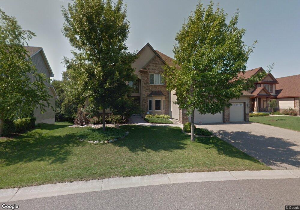
10640 Mccool Dr W Burnsville, MN 55337
Estimated Value: $781,000 - $827,000
4
Beds
4
Baths
3,724
Sq Ft
$216/Sq Ft
Est. Value
About This Home
This home is located at 10640 Mccool Dr W, Burnsville, MN 55337 and is currently estimated at $803,955, approximately $215 per square foot. 10640 Mccool Dr W is a home located in Dakota County with nearby schools including Burnsville High School, Gateway STEM Academy, and Sunrise International Montessori School.
Ownership History
Date
Name
Owned For
Owner Type
Purchase Details
Closed on
Sep 26, 2014
Sold by
Lee Moung Goo and Kim Mee Ae
Bought by
Rivard Brandon S and Rivard Lynn M
Current Estimated Value
Home Financials for this Owner
Home Financials are based on the most recent Mortgage that was taken out on this home.
Original Mortgage
$51,900
Interest Rate
4.09%
Mortgage Type
Credit Line Revolving
Purchase Details
Closed on
Jun 29, 2009
Sold by
Wachovia Mortgage Fsb
Bought by
Kim Mee Ae and Lee Moung Goo
Purchase Details
Closed on
May 5, 2005
Sold by
Manley Brothers Construction Inc
Bought by
Rud Rick R
Create a Home Valuation Report for This Property
The Home Valuation Report is an in-depth analysis detailing your home's value as well as a comparison with similar homes in the area
Home Values in the Area
Average Home Value in this Area
Purchase History
| Date | Buyer | Sale Price | Title Company |
|---|---|---|---|
| Rivard Brandon S | $520,000 | Gibraltar Title | |
| Kim Mee Ae | $445,000 | -- | |
| Rud Rick R | $750,000 | -- |
Source: Public Records
Mortgage History
| Date | Status | Borrower | Loan Amount |
|---|---|---|---|
| Closed | Rivard Brandon S | $51,900 | |
| Open | Rivard Brandon S | $416,000 |
Source: Public Records
Tax History Compared to Growth
Tax History
| Year | Tax Paid | Tax Assessment Tax Assessment Total Assessment is a certain percentage of the fair market value that is determined by local assessors to be the total taxable value of land and additions on the property. | Land | Improvement |
|---|---|---|---|---|
| 2024 | $8,198 | $747,300 | $242,300 | $505,000 |
| 2023 | $8,198 | $729,300 | $242,500 | $486,800 |
| 2022 | $7,266 | $718,300 | $241,900 | $476,400 |
| 2021 | $6,972 | $642,000 | $210,400 | $431,600 |
| 2020 | $7,258 | $591,400 | $200,300 | $391,100 |
| 2019 | $7,170 | $593,100 | $190,800 | $402,300 |
| 2018 | $6,998 | $561,300 | $181,700 | $379,600 |
| 2017 | $6,542 | $535,900 | $173,000 | $362,900 |
| 2016 | $6,835 | $497,400 | $164,800 | $332,600 |
| 2015 | $6,455 | $498,700 | $160,000 | $338,700 |
| 2014 | -- | $492,400 | $157,000 | $335,400 |
| 2013 | -- | $466,100 | $143,800 | $322,300 |
Source: Public Records
Map
Nearby Homes
- 3113 Chandler Ct
- 3108 Foxpoint Cir
- 2177 Cool Stream Cir
- 4165 Old Sibley Hwy
- 10934 Southview Dr
- 11017 27th Ave S
- 11036 27th Ave S
- 2079 Garnet Ln
- 2074 Carnelian Ln
- 2127 Silver Bell Rd
- 2119 Cedar Grove Trail
- 11459 Galtier Dr
- 4247 Limestone Dr
- 4413 Slater Rd
- 4370 Nicols Rd
- 2001 Woods Ln
- 4425 Cinnamon Ridge Cir
- 4427 Cinnamon Ridge Cir
- 2081 Copper Ln
- 3898 Rahn Rd
- 10630 Mccool Dr W
- 10650 Mccool Dr W
- 10655 Mccool Dr W
- 10610 Mccool Ct
- 10670 Mccool Dr W
- 10675 Mccool Dr W
- 10621 Mccool Ct
- 10660 Mccool Dr E
- 10660 10660 McCool-drive-e
- 10685 Mccool Dr W
- 10600 Mccool Ct
- 10680 Mccool Dr W
- 10585 Mccool Ct
- 10631 10631 McCool-drive-e
- 10676 Mccool Dr E
- 10570 Mccool Ct
- 10707 Mccool Dr W
- 10690 Mccool Dr E
- 10700 Mccool Dr W
- 10631 Mccool Dr E