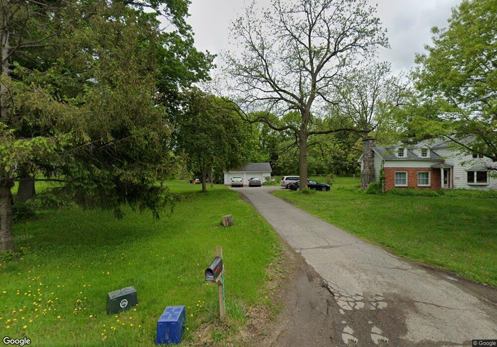
10649 Davisburg Rd Davisburg, MI 48350
Estimated Value: $382,000 - $453,000
4
Beds
3
Baths
2,045
Sq Ft
$205/Sq Ft
Est. Value
About This Home
This home is located at 10649 Davisburg Rd, Davisburg, MI 48350 and is currently estimated at $418,733, approximately $204 per square foot. 10649 Davisburg Rd is a home located in Oakland County with nearby schools including Springfield Christian Academy.
Ownership History
Date
Name
Owned For
Owner Type
Purchase Details
Closed on
Jan 31, 2014
Sold by
Stanley Marvin A and Stanley Nancy C
Bought by
Carr Stacia and Stanley Scott
Current Estimated Value
Purchase Details
Closed on
Oct 30, 2012
Sold by
Stanley Marvin A and Stanley Nancy C
Bought by
The Stanley Family Trust
Purchase Details
Closed on
Aug 23, 2012
Sold by
Smith D Pauline
Bought by
Smith Lester J and Trust Agreement Of Lester J Smith & Marg
Home Financials for this Owner
Home Financials are based on the most recent Mortgage that was taken out on this home.
Original Mortgage
$50,000
Interest Rate
3.32%
Mortgage Type
New Conventional
Create a Home Valuation Report for This Property
The Home Valuation Report is an in-depth analysis detailing your home's value as well as a comparison with similar homes in the area
Home Values in the Area
Average Home Value in this Area
Purchase History
| Date | Buyer | Sale Price | Title Company |
|---|---|---|---|
| Carr Stacia | -- | None Available | |
| The Stanley Family Trust | -- | Mason Burgess Title Agency | |
| Stanley Marvin A | $143,000 | Mason Burgess Title Agency | |
| Smith Lester J | -- | Mason Burgess Title Agency |
Source: Public Records
Mortgage History
| Date | Status | Borrower | Loan Amount |
|---|---|---|---|
| Previous Owner | Smith Lester J | $50,000 |
Source: Public Records
Tax History Compared to Growth
Tax History
| Year | Tax Paid | Tax Assessment Tax Assessment Total Assessment is a certain percentage of the fair market value that is determined by local assessors to be the total taxable value of land and additions on the property. | Land | Improvement |
|---|---|---|---|---|
| 2024 | $3,687 | $119,420 | $0 | $0 |
| 2023 | $3,514 | $99,390 | $0 | $0 |
| 2022 | $4,181 | $93,280 | $0 | $0 |
| 2021 | $3,918 | $105,860 | $0 | $0 |
| 2020 | $3,208 | $104,500 | $0 | $0 |
| 2018 | $3,758 | $103,400 | $28,100 | $75,300 |
| 2015 | -- | $85,900 | $0 | $0 |
| 2014 | -- | $83,200 | $0 | $0 |
| 2011 | -- | $68,800 | $0 | $0 |
Source: Public Records
Map
Nearby Homes
- 10438 King Rd
- 10418 King Rd
- 10086 King Rd
- 9765 Dixie Hwy
- 9877 Dixie Hwy
- 9876 Dixie Hwy
- 9318 Wildflower Way Unit 11
- 0 Dixie Hwy Unit 20251027429
- 9751 Kingston Pointe Dr Unit 20
- 11197 Bigelow Rd
- 9830 Oak Valley Dr Unit 24
- 9635 Norman Rd
- 00 Dixie Hwy
- 8453 Harbortowne Dr
- 7565 Old Pond Dr
- 8636 Tindall Rd
- 7644 Dilley Rd
- 9060 Tindall Rd
- 9266 Hillcrest
- 8381 Tindall Rd
- 10703 Davisburg Rd
- 10590 Davisburg Rd
- 10755 Davisburg Rd
- 10551 Davisburg Rd
- 10560 Davisburg Rd
- 10530 Davisburg Rd
- 10801 Davisburg Rd
- 10770 Davisburg Rd
- 10770 Davisburg Rd
- 10680 Davisburg Rd
- 10601 Davisburg Rd
- 10825 Davisburg Rd
- 10531 Davisburg Rd
- 10849 Davisburg Rd
- 8201 Pine Lake Dr
- 10860 Davisburg Rd
- 10450 Davisburg Rd
- 10503 Bigelow Rd
- 10525 Bigelow Rd Unit Bldg-Unit
- 10525 Bigelow Rd