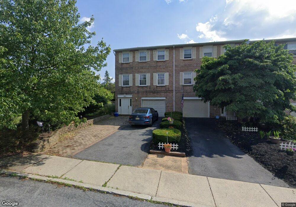
1065 Barnside Rd Allentown, PA 18103
Estimated Value: $330,938 - $371,000
3
Beds
3
Baths
1,932
Sq Ft
$180/Sq Ft
Est. Value
About This Home
This home is located at 1065 Barnside Rd, Allentown, PA 18103 and is currently estimated at $347,735, approximately $179 per square foot. 1065 Barnside Rd is a home located in Lehigh County with nearby schools including Wescosville Elementary School, Lower Macungie Middle School, and Emmaus High School.
Ownership History
Date
Name
Owned For
Owner Type
Purchase Details
Closed on
Feb 5, 2021
Sold by
Morrow Robert A
Bought by
Morrow Robert A and Robert A Morrow Irrevocable Trust
Current Estimated Value
Purchase Details
Closed on
May 7, 2004
Sold by
Kelley Claude L and Kelley Esther S
Bought by
Morrow Robert A
Home Financials for this Owner
Home Financials are based on the most recent Mortgage that was taken out on this home.
Original Mortgage
$129,500
Outstanding Balance
$61,783
Interest Rate
5.75%
Mortgage Type
Purchase Money Mortgage
Estimated Equity
$285,952
Purchase Details
Closed on
Jun 25, 1986
Bought by
Kelley Esther S
Create a Home Valuation Report for This Property
The Home Valuation Report is an in-depth analysis detailing your home's value as well as a comparison with similar homes in the area
Home Values in the Area
Average Home Value in this Area
Purchase History
| Date | Buyer | Sale Price | Title Company |
|---|---|---|---|
| Morrow Robert A | -- | None Available | |
| Morrow Robert A | $161,900 | -- | |
| Kelley Esther S | $15,000 | -- |
Source: Public Records
Mortgage History
| Date | Status | Borrower | Loan Amount |
|---|---|---|---|
| Open | Morrow Robert A | $129,500 |
Source: Public Records
Tax History Compared to Growth
Tax History
| Year | Tax Paid | Tax Assessment Tax Assessment Total Assessment is a certain percentage of the fair market value that is determined by local assessors to be the total taxable value of land and additions on the property. | Land | Improvement |
|---|---|---|---|---|
| 2025 | $4,797 | $187,900 | $30,300 | $157,600 |
| 2024 | $4,641 | $187,900 | $30,300 | $157,600 |
| 2023 | $4,548 | $187,900 | $30,300 | $157,600 |
| 2022 | $4,441 | $187,900 | $157,600 | $30,300 |
| 2021 | $4,346 | $187,900 | $30,300 | $157,600 |
| 2020 | $4,305 | $187,900 | $30,300 | $157,600 |
| 2019 | $4,232 | $187,900 | $30,300 | $157,600 |
| 2018 | $4,176 | $187,900 | $30,300 | $157,600 |
| 2017 | $4,103 | $187,900 | $30,300 | $157,600 |
| 2016 | -- | $187,900 | $30,300 | $157,600 |
| 2015 | -- | $187,900 | $30,300 | $157,600 |
| 2014 | -- | $187,900 | $30,300 | $157,600 |
Source: Public Records
Map
Nearby Homes
- 4626 N Hedgerow Dr
- 1045 Barnside Rd
- 1270 Minesite Rd
- 4881 Spruce Rd
- 1385 Brookside Rd
- 5300 Hanover Dr
- 997 Village Round Unit K
- 997K Village Round Unit 104K
- 1037 Village Round Unit L
- 5133 Meadow Ln
- 5475 Hamilton Blvd Unit 7
- 5524 Stonecroft Ln
- 5280 Townsquare Dr
- 1675 Hamlet Dr
- 5619 Stonecroft Ln
- 5673 Wedge Ln
- 5736 Greens Dr
- 5175 Meadowview Dr
- 1141 Glick Ave
- 2117 Isabel Ln
- 1069 Barnside Rd
- 1073 Barnside Rd
- 1077 Barnside Rd
- 1057 Barnside Rd
- 4868 S Hedgerow Dr
- 1081 Barnside Rd
- 4858 S Hedgerow Dr
- 1053 Barnside Rd
- 1085 Barnside Rd
- 4838 S Hedgerow Dr
- 4628 N Hedgerow Dr
- 4848 S Hedgerow Dr
- 4848 S Hedgerow Dr
- 1089 Barnside Rd
- 1084 Barnside Rd
- 1041 Barnside Rd
- 4624 N Hedgerow Dr
- 4878 S Hedgerow Dr
- 1093 Barnside Rd
- 4622 N Hedgerow Dr