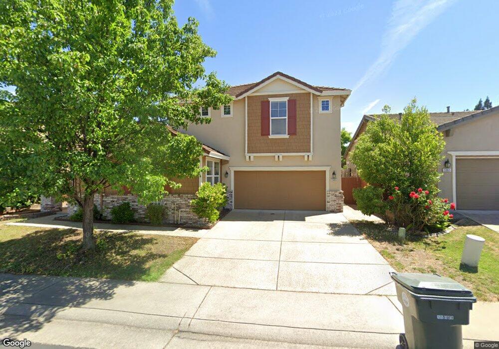
1065 Cornerstone Dr Folsom, CA 95630
Prairie Oaks NeighborhoodEstimated Value: $678,000 - $1,082,000
5
Beds
3
Baths
3,056
Sq Ft
$282/Sq Ft
Est. Value
About This Home
This home is located at 1065 Cornerstone Dr, Folsom, CA 95630 and is currently estimated at $860,736, approximately $281 per square foot. 1065 Cornerstone Dr is a home located in Sacramento County with nearby schools including Gold Ridge Elementary School, Sutter Middle School, and Folsom High School.
Ownership History
Date
Name
Owned For
Owner Type
Purchase Details
Closed on
Jul 24, 2006
Sold by
Beazer Homes Holdings Corp
Bought by
Sajjanagandla Mallikarjuna and Sajjanagandla Jyothi
Current Estimated Value
Home Financials for this Owner
Home Financials are based on the most recent Mortgage that was taken out on this home.
Original Mortgage
$447,992
Outstanding Balance
$238,993
Interest Rate
4.87%
Mortgage Type
New Conventional
Estimated Equity
$621,743
Create a Home Valuation Report for This Property
The Home Valuation Report is an in-depth analysis detailing your home's value as well as a comparison with similar homes in the area
Home Values in the Area
Average Home Value in this Area
Purchase History
| Date | Buyer | Sale Price | Title Company |
|---|---|---|---|
| Sajjanagandla Mallikarjuna | $560,000 | First American Title Co |
Source: Public Records
Mortgage History
| Date | Status | Borrower | Loan Amount |
|---|---|---|---|
| Open | Sajjanagandla Mallikarjuna | $447,992 |
Source: Public Records
Tax History
| Year | Tax Paid | Tax Assessment Tax Assessment Total Assessment is a certain percentage of the fair market value that is determined by local assessors to be the total taxable value of land and additions on the property. | Land | Improvement |
|---|---|---|---|---|
| 2025 | $7,938 | $750,248 | $267,948 | $482,300 |
| 2024 | $7,938 | $735,539 | $262,695 | $472,844 |
| 2023 | $7,796 | $721,118 | $257,545 | $463,573 |
| 2022 | $7,681 | $706,980 | $252,496 | $454,484 |
| 2021 | $7,577 | $693,119 | $247,546 | $445,573 |
| 2020 | $7,483 | $686,013 | $245,008 | $441,005 |
| 2019 | $7,357 | $672,562 | $240,204 | $432,358 |
| 2018 | $6,934 | $637,617 | $182,176 | $455,441 |
| 2017 | $6,159 | $595,904 | $170,258 | $425,646 |
| 2016 | $6,130 | $556,920 | $159,120 | $397,800 |
| 2015 | $5,780 | $535,500 | $153,000 | $382,500 |
| 2014 | $5,485 | $525,000 | $150,000 | $375,000 |
Source: Public Records
Map
Nearby Homes
- 1054 Ledgestone Dr
- 102 Black Gold Ln
- 757 Hatherden Ct
- 0 Figueroa St Unit 225034113
- 110 Northolt Ct
- 104 Hesser Ct
- 631 Rogers Cir
- 101 Duxbury Way
- 205 Briarcliff Dr
- 115 Winchester Ct
- 1121 Elderberry Cir
- 260 Flower Dr
- 617 Wales Dr
- 1325 Tippens Way
- 692 Humbert St
- 110 Fargo Way
- 470 S Lexington Dr
- 101 Kerr Ct
- 1425 Humbug Creek Dr
- 1212 Vessona Cir Unit 1212
- 1069 Cornerstone Dr
- 1061 Cornerstone Dr
- 1058 Ledgestone Dr
- 1050 Ledgestone Dr
- 1073 Cornerstone Dr
- 1064 Cornerstone Dr
- 1068 Cornerstone Dr
- 1062 Ledgestone Dr
- 1060 Cornerstone Dr
- 1072 Cornerstone Dr
- 1077 Cornerstone Dr
- 1066 Ledgestone Dr
- 776 Bluestone Cir
- 780 Bluestone Cir
- 772 Bluestone Cir
- 1076 Cornerstone Dr
- 1075 Limestone Dr
- 1055 Ledgestone Dr
- 784 Bluestone Cir
- 1079 Limestone Dr
Your Personal Tour Guide
Ask me questions while you tour the home.