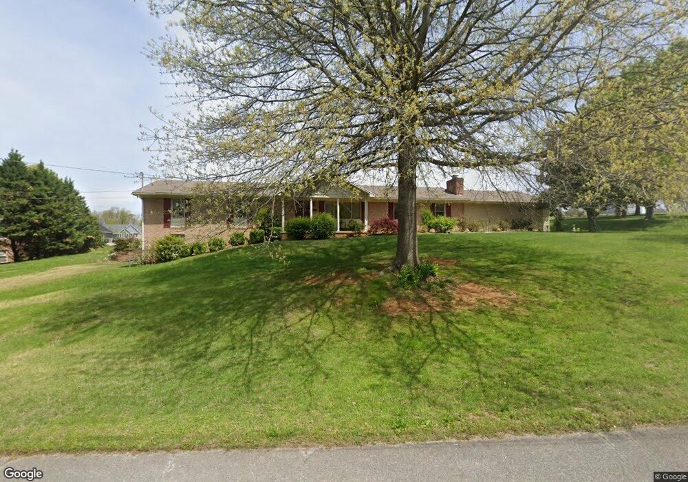
1065 Keith Ln Morristown, TN 37813
Estimated Value: $333,000 - $438,000
3
Beds
2
Baths
2,619
Sq Ft
$146/Sq Ft
Est. Value
About This Home
This home is located at 1065 Keith Ln, Morristown, TN 37813 and is currently estimated at $383,677, approximately $146 per square foot. 1065 Keith Ln is a home located in Hamblen County with nearby schools including Alpha Elementary School, West View Middle School, and Morristown West High School.
Ownership History
Date
Name
Owned For
Owner Type
Purchase Details
Closed on
May 27, 2016
Sold by
Smith Janice J
Bought by
Hill Steven T and Hill Terri A
Current Estimated Value
Home Financials for this Owner
Home Financials are based on the most recent Mortgage that was taken out on this home.
Original Mortgage
$102,000
Outstanding Balance
$44,011
Interest Rate
3.66%
Mortgage Type
New Conventional
Estimated Equity
$339,666
Purchase Details
Closed on
Feb 2, 2004
Sold by
Slagle Dennis F
Bought by
Smith Johnny C
Purchase Details
Closed on
May 17, 1978
Bought by
Slagle Dennis F
Create a Home Valuation Report for This Property
The Home Valuation Report is an in-depth analysis detailing your home's value as well as a comparison with similar homes in the area
Home Values in the Area
Average Home Value in this Area
Purchase History
| Date | Buyer | Sale Price | Title Company |
|---|---|---|---|
| Hill Steven T | $169,900 | -- | |
| Smith Johnny C | $115,000 | -- | |
| Slagle Dennis F | $46,000 | -- |
Source: Public Records
Mortgage History
| Date | Status | Borrower | Loan Amount |
|---|---|---|---|
| Open | Hill Steven T | $102,000 |
Source: Public Records
Tax History
| Year | Tax Paid | Tax Assessment Tax Assessment Total Assessment is a certain percentage of the fair market value that is determined by local assessors to be the total taxable value of land and additions on the property. | Land | Improvement |
|---|---|---|---|---|
| 2025 | $1,445 | $98,275 | $11,800 | $86,475 |
| 2024 | $949 | $48,150 | $6,875 | $41,275 |
| 2023 | $949 | $48,150 | $0 | $0 |
| 2022 | $949 | $48,150 | $6,875 | $41,275 |
| 2021 | $940 | $47,700 | $6,425 | $41,275 |
| 2020 | $940 | $47,700 | $6,425 | $41,275 |
| 2019 | $904 | $42,425 | $6,175 | $36,250 |
| 2018 | $904 | $42,425 | $6,175 | $36,250 |
| 2017 | $904 | $42,425 | $6,175 | $36,250 |
| 2016 | $844 | $42,425 | $6,175 | $36,250 |
| 2015 | $785 | $42,425 | $6,175 | $36,250 |
| 2014 | -- | $42,425 | $6,175 | $36,250 |
| 2013 | -- | $44,350 | $0 | $0 |
Source: Public Records
Map
Nearby Homes
- 5101 Aspen Ave
- 5208 Aspen Ave
- 5154 Grist Ln
- 5102 Grist Ln
- 5133 Lost Creek Dr
- 5093 Grist Ln
- 5129 Lost Creek Dr
- 5089 Grist Ln
- 5094 Grist Ln
- 5090 Grist Ln
- 5182 Runnerstone Rd
- 5177 Runnerstone Rd
- 5172 Runnerstone Rd
- 5128 Lost Creek Dr
- 5166 Runnerstone Rd
- 5158 Runnerstone Rd
- 5152 Runnerstone Rd
- 5148 Runnerstone Rd
- 420 Furrow Dr
- 5142 Runnerstone Rd
- 0 Keith Rd
- 5166 Aspen Ave
- 5166 Aspen Ave Unit 12
- 5172 Aspen Ave
- 5172 Aspen Ave Unit 13
- 5160 Aspen Ave
- 1087 Keith Ln
- 1043 Keith Ln
- 5154 Aspen Ave
- 1080 Keith Ln
- 5178 Aspen Ave
- 5170 Aspen Ave
- 5137 Aspen Ave
- 5137 Aspen Ave Unit 41
- 5143 Aspen Ave
- 5131 Aspen Ave
- 5148 Aspen Ave
- 5174 Aspen Ave
- 5184 Aspen Ave
- 5125 Aspen Ave Unit 43
Your Personal Tour Guide
Ask me questions while you tour the home.