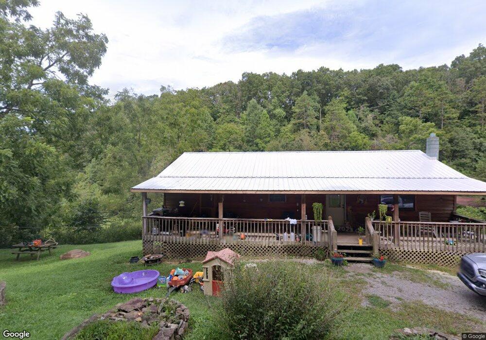
1065 Low Gap Rd La Follette, TN 37766
Estimated Value: $156,000 - $503,000
--
Bed
2
Baths
1,152
Sq Ft
$236/Sq Ft
Est. Value
About This Home
This home is located at 1065 Low Gap Rd, La Follette, TN 37766 and is currently estimated at $271,920, approximately $236 per square foot. 1065 Low Gap Rd is a home located in Campbell County.
Ownership History
Date
Name
Owned For
Owner Type
Purchase Details
Closed on
Apr 6, 2018
Sold by
Evans L A and Evans Melissa A
Bought by
Phillips Joshua Allen and Phillips Felisha Nicole
Current Estimated Value
Purchase Details
Closed on
Sep 27, 2001
Sold by
Federal Home Loan
Bought by
Evans L A
Purchase Details
Closed on
Aug 31, 1999
Bought by
Federal Home Loan Mortgage Corp % Mellon Mort
Purchase Details
Closed on
May 31, 1991
Bought by
Morton James and Morton Trula
Purchase Details
Closed on
Feb 17, 1989
Bought by
Morton James and Morton Trula
Purchase Details
Closed on
Apr 23, 1984
Bought by
Nelson Merl Wayne and Dorothy Jean
Purchase Details
Closed on
Jan 4, 1900
Purchase Details
Closed on
Jan 3, 1900
Purchase Details
Closed on
Jan 2, 1900
Create a Home Valuation Report for This Property
The Home Valuation Report is an in-depth analysis detailing your home's value as well as a comparison with similar homes in the area
Home Values in the Area
Average Home Value in this Area
Purchase History
| Date | Buyer | Sale Price | Title Company |
|---|---|---|---|
| Phillips Joshua Allen | $6,851 | None Available | |
| Evans L A | $42,000 | -- | |
| Federal Home Loan Mortgage Corp % Mellon Mort | $72,000 | -- | |
| Morton James | $21,500 | -- | |
| Morton James | $15,000 | -- | |
| Nelson Merl Wayne | -- | -- | |
| -- | -- | -- | |
| -- | -- | -- | |
| -- | -- | -- |
Source: Public Records
Tax History Compared to Growth
Tax History
| Year | Tax Paid | Tax Assessment Tax Assessment Total Assessment is a certain percentage of the fair market value that is determined by local assessors to be the total taxable value of land and additions on the property. | Land | Improvement |
|---|---|---|---|---|
| 2025 | $531 | $43,700 | $0 | $0 |
| 2024 | $531 | $43,700 | $6,200 | $37,500 |
| 2023 | $472 | $22,850 | $3,675 | $19,175 |
| 2022 | $472 | $22,850 | $3,675 | $19,175 |
| 2021 | $472 | $22,850 | $3,675 | $19,175 |
| 2020 | $463 | $22,850 | $3,675 | $19,175 |
| 2019 | $472 | $22,850 | $3,675 | $19,175 |
| 2018 | $546 | $24,275 | $2,375 | $21,900 |
| 2017 | $546 | $24,275 | $2,375 | $21,900 |
| 2016 | $546 | $24,275 | $2,375 | $21,900 |
| 2015 | $483 | $24,275 | $2,375 | $21,900 |
| 2014 | -- | $24,275 | $2,375 | $21,900 |
| 2013 | -- | $24,275 | $2,375 | $21,900 |
Source: Public Records
Map
Nearby Homes
- 0 Low Gap Rd Unit 18767562
- 0 Low Gap Rd Unit 11277254
- 268 Cross View Ln
- 0 Cross View Ln Unit 1312951
- 519 Whitman Hollow Rd
- 0 Whitman Hollow Rd Unit 1271817
- 0 Grantsboro Rd
- 0 Clearwater View Ln Unit 1317048
- 4160 Demory Rd
- 1971 Demory Rd
- 00 Chestnut Stump Rd
- 165 Parkview Dr
- 0 Carp Ln Unit 1258153
- 0 Rainbow Cir
- 258 Marina Ln
- 0 Rainbow View Rd
- Lots 8 & 9 Rainbow Ln
- 309 Marina Ln
- 00 Shanghai Lake Ln
- lot 12 Norris View Dr
- 1109 Low Gap Rd
- 1119 Low Gap Rd
- 999 Low Gap Rd
- 1139 Low Gap Rd
- 1000 Low Gap Rd
- 1076 Low Gap Rd
- 1145 Low Gap Rd
- 1144 Low Gap Rd
- 1190 Low Gap Rd
- 0 Low Gap Rd
- 3219 Demory Rd
- 1265 Low Gap Rd
- 3281 Demory Rd
- 3160 Demory Rd
- 496 Leroy Day Ln
- 274 Grantsboro Rd
- 274 Grantsboro Rd
- 3209 Demory Rd
- 281 Housley Ln
- 3201 Demory Rd