Estimated Value: $68,000 - $134,000
Studio
--
Bath
998
Sq Ft
$93/Sq Ft
Est. Value
About This Home
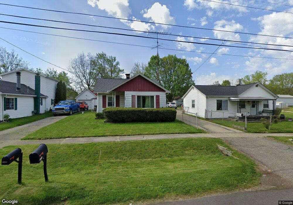
This home is located at 1065 W Scottwood Ave, Flint, MI 48507 and is currently estimated at $92,349, approximately $92 per square foot. 1065 W Scottwood Ave is a home located in Genesee County with nearby schools including Carman-Ainsworth High School.
Ownership History
Date
Name
Owned For
Owner Type
Purchase Details
Closed on
Nov 14, 2022
Sold by
Moore Patricia L
Bought by
Burwell Kayla and Burwell Joshua
Current Estimated Value
Home Financials for this Owner
Home Financials are based on the most recent Mortgage that was taken out on this home.
Original Mortgage
$45,000
Outstanding Balance
$43,637
Interest Rate
7.08%
Mortgage Type
New Conventional
Estimated Equity
$48,712
Purchase Details
Closed on
Mar 11, 2021
Sold by
Moore Patricia L and Moore Carl H
Bought by
Moore Patricia L and Burwell Kayla
Purchase Details
Closed on
Oct 20, 2009
Sold by
Moore Patricia L
Bought by
Moore Carl H and Moore Patricia L
Create a Home Valuation Report for This Property
The Home Valuation Report is an in-depth analysis detailing your home's value as well as a comparison with similar homes in the area
Home Values in the Area
Average Home Value in this Area
Purchase History
| Date | Buyer | Sale Price | Title Company |
|---|---|---|---|
| Burwell Kayla | -- | -- | |
| Moore Patricia L | -- | None Available | |
| Moore Carl H | -- | None Available |
Source: Public Records
Mortgage History
| Date | Status | Borrower | Loan Amount |
|---|---|---|---|
| Open | Burwell Kayla | $45,000 |
Source: Public Records
Tax History Compared to Growth
Tax History
| Year | Tax Paid | Tax Assessment Tax Assessment Total Assessment is a certain percentage of the fair market value that is determined by local assessors to be the total taxable value of land and additions on the property. | Land | Improvement |
|---|---|---|---|---|
| 2025 | $736 | $35,700 | $0 | $0 |
| 2024 | $319 | $31,700 | $0 | $0 |
| 2023 | $304 | $26,800 | $0 | $0 |
| 2022 | $370 | $22,900 | $0 | $0 |
| 2021 | $883 | $22,100 | $0 | $0 |
| 2020 | $493 | $18,600 | $0 | $0 |
| 2019 | $487 | $18,500 | $0 | $0 |
| 2018 | $814 | $14,400 | $0 | $0 |
| 2017 | $775 | $14,400 | $0 | $0 |
| 2016 | $779 | $13,200 | $0 | $0 |
| 2015 | $636 | $11,400 | $0 | $0 |
| 2014 | $455 | $11,000 | $0 | $0 |
| 2012 | -- | $17,600 | $17,600 | $0 |
Source: Public Records
Map
Nearby Homes
- 1097 W Buder Ave
- 1051 W Mclean Ave
- 1111 W Mclean Ave
- 1041 Schumacher Ave
- 1203 Pickwick Place
- 4277 Ashlawn Dr
- VACANT Green Briar Blvd
- 4493 Fenton Rd
- 3322 Fenton Rd
- 1247 Catalina Dr
- 1151 Wells St
- 1408 Williamsburg Rd
- 1183 Norton St
- 1345 Williamsburg Rd
- 1186 E Decamp St
- 1219 Norton St
- 1335 Connell St
- 1044 W Rowland St
- 1122 Markham St
- 912 Markham St
- 1061 W Scottwood Ave
- 1064 W Buder Ave
- 1058 W Buder Ave
- 1074 W Buder Ave
- 1051 W Scottwood Ave
- 1069 W Scottwood Ave
- 1066 W Scottwood Ave
- 1060 W Scottwood Ave
- 1070 W Scottwood Ave
- 1079 W Scottwood Ave
- 1080 W Buder Ave
- 1056 W Scottwood Ave
- 1044 W Buder Ave
- 1041 W Scottwood Ave
- 1076 W Scottwood Ave
- 1050 W Scottwood Ave
- 1084 W Buder Ave
- 1046 W Scottwood Ave
- 1067 W Parkwood Ave
- 1063 W Buder Ave