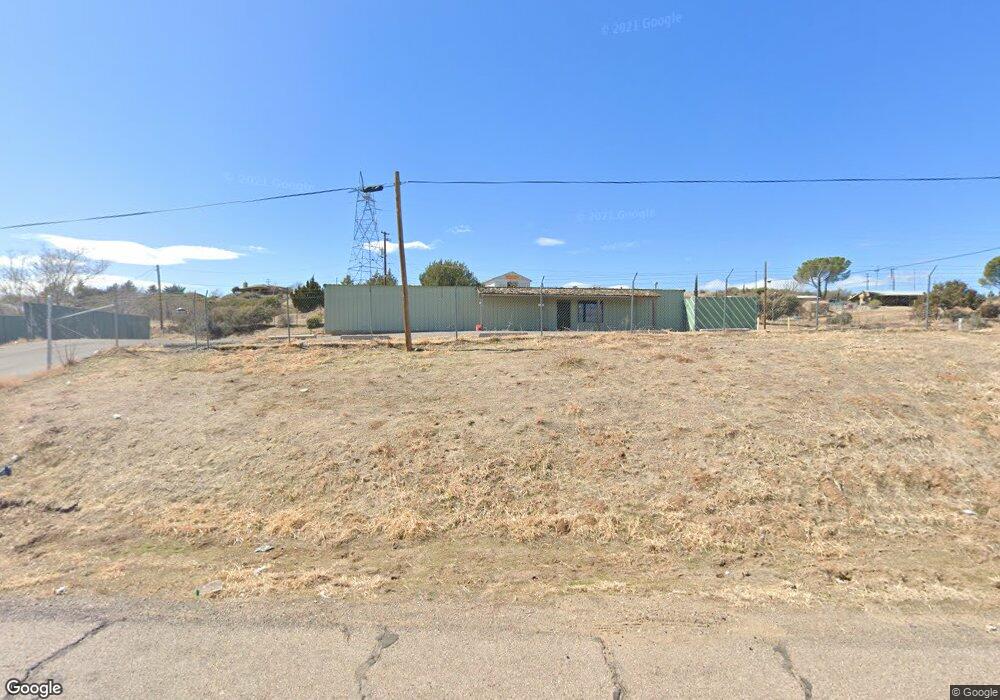
10650 S State Route 69 Mayer, AZ 86333
Mayer Neighborhood
--
Bed
1
Bath
4,300
Sq Ft
0.48
Acres
About This Home
This home is located at 10650 S State Route 69, Mayer, AZ 86333. 10650 S State Route 69 is a home located in Yavapai County with nearby schools including Mayer Elementary School and Mayer High School.
Ownership History
Date
Name
Owned For
Owner Type
Purchase Details
Closed on
Apr 25, 2021
Sold by
10650 S 69 Llc
Bought by
Tdh Investments Llc
Home Financials for this Owner
Home Financials are based on the most recent Mortgage that was taken out on this home.
Original Mortgage
$280,000
Outstanding Balance
$252,806
Interest Rate
3%
Mortgage Type
Purchase Money Mortgage
Purchase Details
Closed on
May 20, 2019
Sold by
Tdh Investments Llc
Bought by
10650 S 69 Llc
Purchase Details
Closed on
Nov 14, 2018
Sold by
Lough Donald R
Bought by
Lough Donald R and Lough Judy A
Purchase Details
Closed on
Nov 13, 2018
Sold by
Lough Donald R and Lough Judy A
Bought by
Tdh Investments Llc
Create a Home Valuation Report for This Property
The Home Valuation Report is an in-depth analysis detailing your home's value as well as a comparison with similar homes in the area
Home Values in the Area
Average Home Value in this Area
Purchase History
| Date | Buyer | Sale Price | Title Company |
|---|---|---|---|
| Tdh Investments Llc | $280,000 | Yavapai Title | |
| 10650 S 69 Llc | $250,000 | Yavapai Title | |
| Lough Donald R | -- | Yavapai Title | |
| Tdh Investments Llc | $150,000 | Yavapai Title |
Source: Public Records
Mortgage History
| Date | Status | Borrower | Loan Amount |
|---|---|---|---|
| Open | Tdh Investments Llc | $280,000 |
Source: Public Records
Tax History Compared to Growth
Tax History
| Year | Tax Paid | Tax Assessment Tax Assessment Total Assessment is a certain percentage of the fair market value that is determined by local assessors to be the total taxable value of land and additions on the property. | Land | Improvement |
|---|---|---|---|---|
| 2026 | $2,974 | -- | -- | -- |
| 2024 | $3,048 | -- | -- | -- |
| 2023 | $3,040 | $47,495 | $4,676 | $42,819 |
| 2022 | $3,048 | $34,925 | $3,605 | $31,320 |
| 2021 | $3,230 | $34,999 | $3,605 | $31,394 |
| 2020 | $3,121 | $0 | $0 | $0 |
| 2019 | $3,094 | $0 | $0 | $0 |
| 2018 | $2,993 | $0 | $0 | $0 |
| 2017 | $2,912 | $0 | $0 | $0 |
| 2016 | $2,791 | $0 | $0 | $0 |
| 2015 | -- | $0 | $0 | $0 |
| 2014 | -- | $0 | $0 | $0 |
Source: Public Records
Map
Nearby Homes
- 13635 E Paloma Trail
- 10700 S Austin Ln
- 10603 S Cholla Dr
- 13430 E Summit Ave
- 13400 E High View Rd
- 13650 E Soleil Down Rd
- 12955 E Border St
- 13190 E Central Ave
- 14420 E Jagged Tooth Tr
- 10198 Miami St
- 12996 E Central Ave
- 12921 E Central Ave
- 10022 S Wicks Ave
- 10029 1st St
- 144s S Cobalt Rd Unit 5
- 144s S Cobalt Rd
- 11425 S Hackberry Rd
- 12529 E Central Ave
- 11425 S Hackberry Trail
- 11425 S Hackberry Trail
- 13700 E Main St
- 13670 E Main St
- 10740 S Highway 69
- 10740 S State Route 69
- 13710 E Main St
- 1922 Main St
- 10630 S State Route 69 --
- 10630 S State Route 69
- 10748 S State Route 69 --
- 13626 E Main St
- 13775 E Main St
- 0 S Renegade Way Unit PAR974653
- 0 S Renegade Way Unit PAR422178
- 0 S Renegade Way Unit PAR422179
- 0 S Renegade Way Unit PAR393995
- 0 S Renegade Way Unit PAR888841
- 0 S Renegade Way Unit PAR393993
- 0 S Renegade Way Unit PAR393994
- 0 S Renegade Way Unit 1037374
- 0 S Renegade Way Unit 1043944