Estimated payment $4,135/month
Highlights
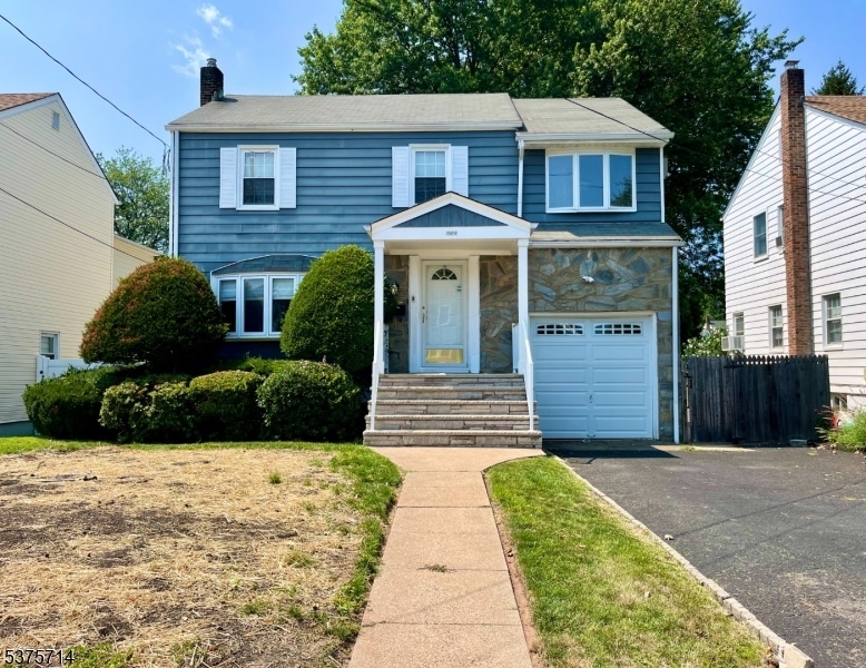
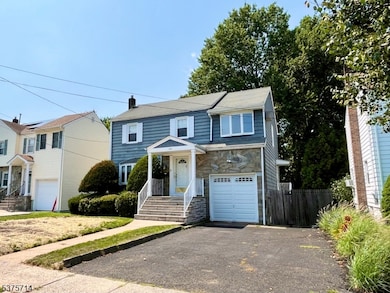
- Colonial Architecture
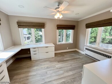
- Home Office
- Butlers Pantry
- Recreation Room
- Formal Dining Room
- 1 Car Attached Garage
About This Home
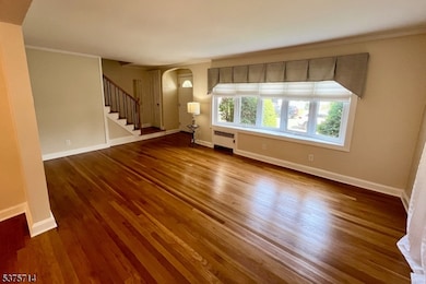
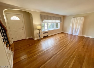
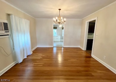
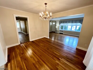
Lovely 3 Bedroom, 2 1/2 Bath Colonial Home featuring Fresh Paint and Newly Refinished Hardwood Floors. Large open flow Living Room to Dining Room area. Eat in kitchen with Pantry. Work from home in the well appointed Office space. Spacious Bedroom on second floor with Double Cedar Closet, A Main Bedroom Suite with Full Bath and Walk-in closet. Finished Basement with Large Rec space, Laundry area, Bathroom, Storage area, and Walkout Door to rear yard. The Yard features a two Tiered Patio with beautiful Mature Plantings that would be great for Entertaining. Close to Town center, Parks, Shops, Restaurants, Houses of worship and Easy Access to Major Highways and NYC Transportation, Trains, and Buses. An amazing place to call Home.
Listing Agent
FABIO BARBATO
KELLER WILLIAMS REALTY Brokerage Phone: 908-917-6312 Listed on: 08/01/2025
Home Details
Home Type
- Single Family
Est. Annual Taxes
- $11,734
Year Built
- Built in 1941
Lot Details
- 5,663 Sq Ft Lot
- Property is zoned NOT FLOOD
Parking
- 1 Car Attached Garage
Home Design
- Colonial Architecture
- Aluminum Siding
Interior Spaces
- Living Room
- Formal Dining Room
- Home Office
- Recreation Room
- Storage Room
- Laundry Room
- Finished Basement
- Walk-Out Basement
- Carbon Monoxide Detectors
Kitchen
- Butlers Pantry
- Gas Oven or Range
- Dishwasher
Bedrooms and Bathrooms
- 3 Bedrooms
- Primary bedroom located on second floor
Utilities
- Cooling System Mounted In Outer Wall Opening
- Window Unit Cooling System
- Radiator
- Standard Electricity
- Gas Water Heater
Listing and Financial Details
- Assessor Parcel Number 2919-04507-0000-00007-0000-
Map
Home Values in the Area
Average Home Value in this Area
Tax History
| Year | Tax Paid | Tax Assessment Tax Assessment Total Assessment is a certain percentage of the fair market value that is determined by local assessors to be the total taxable value of land and additions on the property. | Land | Improvement |
|---|---|---|---|---|
| 2025 | $11,734 | $52,500 | $21,200 | $31,300 |
| 2024 | $11,376 | $52,500 | $21,200 | $31,300 |
| 2023 | $10,981 | $52,500 | $21,200 | $31,300 |
| 2022 | $10,981 | $52,500 | $21,200 | $31,300 |
| 2021 | $10,715 | $52,500 | $21,200 | $31,300 |
| 2020 | $10,501 | $52,500 | $21,200 | $31,300 |
| 2019 | $10,360 | $52,500 | $21,200 | $31,300 |
| 2018 | $10,183 | $52,500 | $21,200 | $31,300 |
| 2017 | $10,033 | $52,500 | $21,200 | $31,300 |
| 2016 | $9,788 | $52,500 | $21,200 | $31,300 |
| 2015 | $9,626 | $52,500 | $21,200 | $31,300 |
| 2014 | $9,410 | $52,500 | $21,200 | $31,300 |
Property History
| Date | Event | Price | List to Sale | Price per Sq Ft |
|---|---|---|---|---|
| 11/12/2025 11/12/25 | Pending | -- | -- | -- |
| 08/21/2025 08/21/25 | Price Changed | $599,000 | -6.4% | -- |
| 08/01/2025 08/01/25 | For Sale | $639,900 | -- | -- |
Purchase History
| Date | Type | Sale Price | Title Company |
|---|---|---|---|
| Interfamily Deed Transfer | -- | Mosaic Title & Abstract Llc |
Mortgage History
| Date | Status | Loan Amount | Loan Type |
|---|---|---|---|
| Closed | $275,000 | Purchase Money Mortgage |
Source: Garden State MLS
MLS Number: 3978886
APN: 19-04507-0000-00007
Disclaimer: Certain information contained herein is derived from information provided by parties other than Homes.com. All information provided is deemed reliable, but is not guaranteed to be accurate and should be independently verified.
![]() The data relating to real estate for sale on this website comes in part from the IDX Program of Garden State Multiple Listing Service, L.L.C. Real estate listings held by other brokerage firms are marked as IDX Listing.
The data relating to real estate for sale on this website comes in part from the IDX Program of Garden State Multiple Listing Service, L.L.C. Real estate listings held by other brokerage firms are marked as IDX Listing.
Information deemed reliable but not guaranteed.
Copyright © 2025 Garden State Multiple Listing Service, L.L.C. All rights reserved.
Notice: The dissemination of listings on this website does not constitute the consent required by N.J.A.C. 11:5.6.1 (n) for the advertisement of listings exclusively for sale by another broker. Any such consent must be obtained in writing from the listing broker.
This information is being provided for Consumers’ personal, non-commercial use and may not be used for any purpose other than to identify prospective properties Consumers may be interested in purchasing.
- 1071 Battle Hill Terrace
- 1042 Battle Hill Terrace
- 2785 Larchmont Rd
- 980 Moessner Ave
- 2620 Eleanor Terrace
- 2641 Burns Place
- 960 Moessner Ave
- 2615 Burns Place
- 30 Washington Ave
- 2636 Frederick Terrace
- 1214 Carlton Terrace
- 19 Warner Ave
- 67 Battle Hill Ave
- 2 Bashford-B Unit B
- 17 Alvin Terrace
- 1270 Carlton Terrace
- 97 Battle Hill Ave
- 8 Bashford Ave Unit 8
- 798 Pinewood Rd
- 1239 Rony Rd