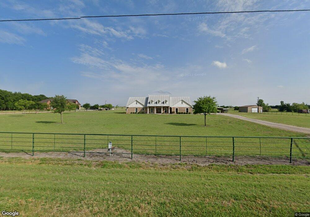
1066 West Rd Waxahachie, TX 75165
Estimated Value: $657,591 - $782,000
4
Beds
4
Baths
2,908
Sq Ft
$248/Sq Ft
Est. Value
About This Home
This home is located at 1066 West Rd, Waxahachie, TX 75165 and is currently estimated at $719,796, approximately $247 per square foot. 1066 West Rd is a home located in Ellis County with nearby schools including Oliver E Clift Elementary School, Robbie E Howard Jr High School, and Waxahachie High School.
Ownership History
Date
Name
Owned For
Owner Type
Purchase Details
Closed on
Dec 15, 2011
Sold by
Fannie Mae
Bought by
Buchholz Kathy
Current Estimated Value
Home Financials for this Owner
Home Financials are based on the most recent Mortgage that was taken out on this home.
Original Mortgage
$195,000
Outstanding Balance
$133,521
Interest Rate
4.03%
Estimated Equity
$586,275
Purchase Details
Closed on
May 3, 2011
Sold by
Paul Dicky and Paul Cynthia
Bought by
Citimortgage Inc
Create a Home Valuation Report for This Property
The Home Valuation Report is an in-depth analysis detailing your home's value as well as a comparison with similar homes in the area
Home Values in the Area
Average Home Value in this Area
Purchase History
| Date | Buyer | Sale Price | Title Company |
|---|---|---|---|
| Buchholz Kathy | -- | None Available | |
| Citimortgage Inc | $162,579 | None Available |
Source: Public Records
Mortgage History
| Date | Status | Borrower | Loan Amount |
|---|---|---|---|
| Open | Buchholz Kathy | $195,000 |
Source: Public Records
Tax History Compared to Growth
Tax History
| Year | Tax Paid | Tax Assessment Tax Assessment Total Assessment is a certain percentage of the fair market value that is determined by local assessors to be the total taxable value of land and additions on the property. | Land | Improvement |
|---|---|---|---|---|
| 2025 | $8,556 | $573,622 | $64,125 | $509,497 |
| 2024 | $8,556 | $563,760 | $8,994 | $554,766 |
| 2023 | $8,556 | $548,913 | $8,863 | $540,050 |
| 2022 | $6,210 | $368,145 | $5,083 | $363,062 |
| 2021 | $6,456 | $401,250 | $38,350 | $362,900 |
| 2020 | $7,047 | $406,710 | $38,350 | $368,360 |
| 2019 | $5,594 | $298,480 | $0 | $0 |
| 2018 | $5,482 | $287,940 | $16,570 | $271,370 |
| 2017 | $5,378 | $280,380 | $20,250 | $260,130 |
| 2016 | $5,052 | $298,230 | $57,680 | $240,550 |
| 2015 | $4,492 | $300,480 | $57,680 | $242,800 |
| 2014 | $4,492 | $288,260 | $0 | $0 |
Source: Public Records
Map
Nearby Homes
- TBD West Rd
- TBD Fm-55
- 201 West Rd
- TBD 6.922ac Farm To Market Road 877
- TBD 2.75 ac Farm To Market Road 877
- 217 Hunter Pass
- 0 E Pecan Tree Rd
- 4026 Howard Rd
- 784 Fm 55
- Belmont Plan at Lakeway Estates
- Wimberly Plan at Lakeway Estates
- Emerson Plan at Lakeway Estates
- Yukon Plan at Lakeway Estates
- Halsted Plan at Lakeway Estates
- Somerset Plan at Lakeway Estates
- Verona Plan at Lakeway Estates
- Lyndon Plan at Lakeway Estates
- 156 Swan Lake Dr
- 148 Swan Lake Dr
- 137 Swan Lake