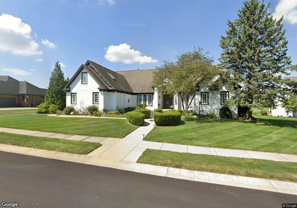
10660 Burning Ridge Ln Fishers, IN 46037
Estimated Value: $756,995 - $827,000
4
Beds
4
Baths
5,971
Sq Ft
$133/Sq Ft
Est. Value
About This Home
This home is located at 10660 Burning Ridge Ln, Fishers, IN 46037 and is currently estimated at $792,249, approximately $132 per square foot. 10660 Burning Ridge Ln is a home located in Hamilton County with nearby schools including Sigourney Elementary School, Lantern Road Elementary School, and Riverside Junior High School.
Ownership History
Date
Name
Owned For
Owner Type
Purchase Details
Closed on
Nov 18, 2024
Sold by
Terrance M And Eva Janean Lee Revocable and Lee Terrance M
Bought by
Lee Terrance M and Lee Eva Janean
Current Estimated Value
Purchase Details
Closed on
Aug 14, 2001
Sold by
Lee Terrance M and Lee Eva Janean
Bought by
The Terrance M & Eva Janean Lee Revocabl
Create a Home Valuation Report for This Property
The Home Valuation Report is an in-depth analysis detailing your home's value as well as a comparison with similar homes in the area
Home Values in the Area
Average Home Value in this Area
Purchase History
| Date | Buyer | Sale Price | Title Company |
|---|---|---|---|
| Lee Terrance M | -- | None Listed On Document | |
| Lee Terrance M | -- | None Listed On Document | |
| The Terrance M & Eva Janean Lee Revocabl | -- | -- | |
| The Terrance M & Eva Janean Lee Revocabl | -- | -- |
Source: Public Records
Tax History Compared to Growth
Tax History
| Year | Tax Paid | Tax Assessment Tax Assessment Total Assessment is a certain percentage of the fair market value that is determined by local assessors to be the total taxable value of land and additions on the property. | Land | Improvement |
|---|---|---|---|---|
| 2024 | $6,952 | $598,000 | $102,700 | $495,300 |
| 2023 | $6,861 | $591,300 | $102,700 | $488,600 |
| 2022 | $6,658 | $551,900 | $102,700 | $449,200 |
| 2021 | $6,185 | $511,000 | $102,700 | $408,300 |
| 2020 | $5,402 | $442,900 | $102,700 | $340,200 |
| 2019 | $5,537 | $453,800 | $110,000 | $343,800 |
| 2018 | $5,613 | $459,600 | $110,000 | $349,600 |
| 2017 | $5,431 | $452,500 | $97,700 | $354,800 |
| 2016 | $5,429 | $452,600 | $97,700 | $354,900 |
| 2014 | $4,735 | $434,700 | $97,700 | $337,000 |
| 2013 | $4,735 | $443,100 | $97,700 | $345,400 |
Source: Public Records
Map
Nearby Homes
- 10661 Burning Ridge Ln
- 10515 Collingswood Rd
- 10846 Hamilton Pass
- 10334 Hillsborough Dr
- 9972 Woods Edge Dr
- 10272 Whitetail Cir
- 10019 Niagara Dr
- 10747 Red Pine Dr
- 10244 Red Tail Dr
- 10384 Glenn Abbey Ln
- 10602 Fall Rd
- 9259 Oak Knoll Ln
- 10563 Brixton Ln
- 10026 Parkway Dr
- 10263 Brixton Ln
- 11262 Whitewater Way
- 11310 Knightsbridge Ln
- 11226 Reflection Point Dr
- 10844 Fairwoods Dr
- 10518 Greenway Dr
- 10660 Burning Ridge
- 10708 Burning Ridge Ln
- 10708 Burning Ridge
- 10650 Burning Ridge
- 10650 Burning Ridge Ln
- 10661 Burning Ridge
- 10718 Burning Ridge
- 10718 Burning Ridge Ln
- 10707 Burning Ridge
- 10641 Burning Ridge
- 10640 Burning Ridge Ln
- 10640 Burning Ridge
- 10717 Burning Ridge Ln
- 10717 Burning Ridge
- 10724 Burning Ridge
- 10102 Quaker Ridge Ct
- 10727 Burning Ridge Ln
- 10727 Burning Ridge
- 10123 Quaker Ridge Ct
- 10715 Hamilton Pass