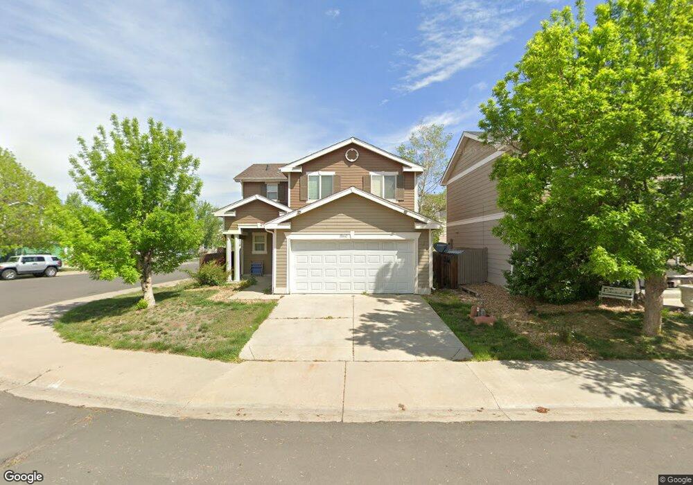
10661 Upper Ridge Rd Longmont, CO 80504
Estimated Value: $428,000 - $465,000
3
Beds
3
Baths
1,601
Sq Ft
$280/Sq Ft
Est. Value
About This Home
This home is located at 10661 Upper Ridge Rd, Longmont, CO 80504 and is currently estimated at $448,646, approximately $280 per square foot. 10661 Upper Ridge Rd is a home located in Weld County with nearby schools including Centennial Elementary School, Coal Ridge Middle School, and Mead High School.
Ownership History
Date
Name
Owned For
Owner Type
Purchase Details
Closed on
Mar 26, 2018
Sold by
Hartwell James M
Bought by
Hartwell James M and Hartwell Vanessa M
Current Estimated Value
Home Financials for this Owner
Home Financials are based on the most recent Mortgage that was taken out on this home.
Original Mortgage
$156,700
Outstanding Balance
$91,935
Interest Rate
4.38%
Mortgage Type
New Conventional
Estimated Equity
$356,711
Purchase Details
Closed on
Apr 10, 2006
Sold by
Kb Home Colorado Inc
Bought by
Hartwell James M
Home Financials for this Owner
Home Financials are based on the most recent Mortgage that was taken out on this home.
Original Mortgage
$201,673
Interest Rate
6.32%
Mortgage Type
VA
Create a Home Valuation Report for This Property
The Home Valuation Report is an in-depth analysis detailing your home's value as well as a comparison with similar homes in the area
Home Values in the Area
Average Home Value in this Area
Purchase History
| Date | Buyer | Sale Price | Title Company |
|---|---|---|---|
| Hartwell James M | -- | None Available | |
| Hartwell James M | $201,673 | Security Title |
Source: Public Records
Mortgage History
| Date | Status | Borrower | Loan Amount |
|---|---|---|---|
| Open | Hartwell James M | $156,700 | |
| Closed | Hartwell James M | $201,673 |
Source: Public Records
Tax History Compared to Growth
Tax History
| Year | Tax Paid | Tax Assessment Tax Assessment Total Assessment is a certain percentage of the fair market value that is determined by local assessors to be the total taxable value of land and additions on the property. | Land | Improvement |
|---|---|---|---|---|
| 2025 | $2,561 | $28,390 | $5,380 | $23,010 |
| 2024 | $2,561 | $28,390 | $5,380 | $23,010 |
| 2023 | $2,456 | $31,260 | $5,820 | $25,440 |
| 2022 | $2,138 | $22,690 | $4,450 | $18,240 |
| 2021 | $2,179 | $23,350 | $4,580 | $18,770 |
| 2020 | $2,112 | $22,840 | $3,040 | $19,800 |
| 2019 | $2,137 | $22,840 | $3,040 | $19,800 |
| 2018 | $1,716 | $18,560 | $3,020 | $15,540 |
| 2017 | $1,647 | $18,560 | $3,020 | $15,540 |
| 2016 | $1,403 | $15,710 | $2,150 | $13,560 |
| 2015 | $1,356 | $15,710 | $2,150 | $13,560 |
| 2014 | $1,046 | $12,140 | $1,990 | $10,150 |
Source: Public Records
Map
Nearby Homes
- 10688 Durango Place
- 10691 Durango Place
- 10592 Butte Dr
- 10910 Turner Blvd Unit 203
- 10910 Turner Blvd Unit 127
- 10752 County Road 7
- 0 Del Camino Business Park Lot 1 Unit 986024
- 9746 County Road 7
- 4616 Tilbury Ct
- 10555 Aspen St Unit 198
- 10684 Aspen St
- 10684 Aspen St Unit 72
- 10529 Bald Eagle Cir Unit 394
- 10529 Bald Eagle Cir
- 4795 Audrey St Unit 260
- 10597 Bald Eagle Cir Unit 244
- 10611 Barron Cir Unit 426
- 10574 Bald Eagle Cir
- 4768 Silverleaf Ave
- 10686 Baily St Unit 153
- 10663 Upper Ridge Rd
- 10672 Forester Place
- 10665 Upper Ridge Rd
- 10674 Forester Place
- 10667 Upper Ridge Rd
- 10659 Upper Highland Dr
- 10657 Upper Highland Dr
- 10661 Upper Highland Dr
- 10660 Upper Ridge Rd
- 10662 Upper Ridge Rd
- 10678 Forester Place
- 10664 Upper Ridge Rd
- 10669 Upper Ridge Rd
- 10668 Upper Ridge Rd
- 10680 Forester Place
- 10658 Forester Place
- 10656 Forester Place
- 10662 Forester Place
- 10433 Lower Ridge Rd
- 10654 Forester Place