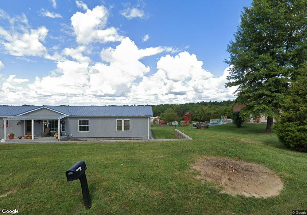
10662 Dalby Rd Georgetown, IN 47122
Estimated Value: $316,000 - $495,000
3
Beds
2
Baths
2,000
Sq Ft
$204/Sq Ft
Est. Value
About This Home
This home is located at 10662 Dalby Rd, Georgetown, IN 47122 and is currently estimated at $407,422, approximately $203 per square foot. 10662 Dalby Rd is a home located in Floyd County with nearby schools including Georgetown Elementary School, Highland Hills Middle School, and Floyd Central High School.
Ownership History
Date
Name
Owned For
Owner Type
Purchase Details
Closed on
Jun 15, 2006
Sold by
Homesales Inc
Bought by
Richmond Randy and Chancey Kelly J
Current Estimated Value
Home Financials for this Owner
Home Financials are based on the most recent Mortgage that was taken out on this home.
Original Mortgage
$128,800
Outstanding Balance
$76,400
Interest Rate
6.73%
Mortgage Type
New Conventional
Estimated Equity
$331,022
Purchase Details
Closed on
Apr 25, 2006
Sold by
Page David and Page Rebecca
Bought by
Homesales Inc
Home Financials for this Owner
Home Financials are based on the most recent Mortgage that was taken out on this home.
Original Mortgage
$128,800
Outstanding Balance
$76,400
Interest Rate
6.73%
Mortgage Type
New Conventional
Estimated Equity
$331,022
Create a Home Valuation Report for This Property
The Home Valuation Report is an in-depth analysis detailing your home's value as well as a comparison with similar homes in the area
Home Values in the Area
Average Home Value in this Area
Purchase History
| Date | Buyer | Sale Price | Title Company |
|---|---|---|---|
| Richmond Randy | -- | None Available | |
| Homesales Inc | $162,449 | None Available |
Source: Public Records
Mortgage History
| Date | Status | Borrower | Loan Amount |
|---|---|---|---|
| Open | Richmond Randy | $128,800 | |
| Previous Owner | Homesales Inc | $128,800 |
Source: Public Records
Tax History Compared to Growth
Tax History
| Year | Tax Paid | Tax Assessment Tax Assessment Total Assessment is a certain percentage of the fair market value that is determined by local assessors to be the total taxable value of land and additions on the property. | Land | Improvement |
|---|---|---|---|---|
| 2024 | $2,699 | $309,400 | $72,300 | $237,100 |
| 2023 | $2,441 | $287,500 | $72,300 | $215,200 |
| 2022 | $2,294 | $262,400 | $72,300 | $190,100 |
| 2021 | $2,064 | $239,100 | $72,300 | $166,800 |
| 2020 | $1,917 | $225,300 | $72,300 | $153,000 |
| 2019 | $1,860 | $226,000 | $72,300 | $153,700 |
| 2018 | $1,618 | $201,000 | $72,300 | $128,700 |
| 2017 | $1,768 | $203,600 | $72,300 | $131,300 |
| 2016 | $1,623 | $202,400 | $72,300 | $130,100 |
| 2014 | $1,752 | $179,800 | $72,300 | $107,500 |
| 2013 | -- | $171,200 | $72,300 | $98,900 |
Source: Public Records
Map
Nearby Homes
- 6950 Pioneer Trail NE
- 9410 Wolfe Cemetery Rd
- 9180 Robin Rd
- 7003- LOT 970 Mitsch Ln
- 6614 State Road 64 Vacant Land
- 7005- LOT 969 Mitsch Ln
- 7006- LOT 920 Mitsch Ln
- 6015 Addison Springs Ct
- 4279 Highway 64 NE
- 8890 High St
- 6382 Jacobs Ridge NE
- 7725 Greenbrier Rd NE
- 0 Areva Dr Unit 2025012155
- 0 Benjamins Ct Unit LOT 62 2025010393
- 0 Benjamins Ct Unit Lot 68 2025010395
- 0 Benjamins Ct Unit Lot 70 2025010397
- 0 Benjamins Ct Unit Lot 87 2025010399
- 0 Benjamins Ct Unit LOT 61 2025010391
- 0 Benjamins Ct Unit Lot 65 2025010394
- 0 Benjamins Ct Unit Lot 69 2025010396
- 10990 Dalby Rd
- 10688 Dalby Rd
- 10700 Dalby Rd
- 6133 Gun Club Rd NE
- 6031 Gun Club Rd NE
- 10602 Dalby Rd
- 6243 Gun Club Rd NE
- 5995 Gun Club Rd NE
- 10620 Dalby Rd
- 10648 Dalby Rd
- 10745 Malinee Ott Rd
- 10683 Malinee Ott Rd
- 5955 Gun Club Rd NE
- 10645 Malinee Ott Rd
- 5905 Gun Club Rd NE
- 10627 Malinee Ott Rd
- 6312 Highway 64 NE
- 5950 Gun Club Rd NE
- 6022 Highway 64 NE
- 5865 Gun Club Rd NE