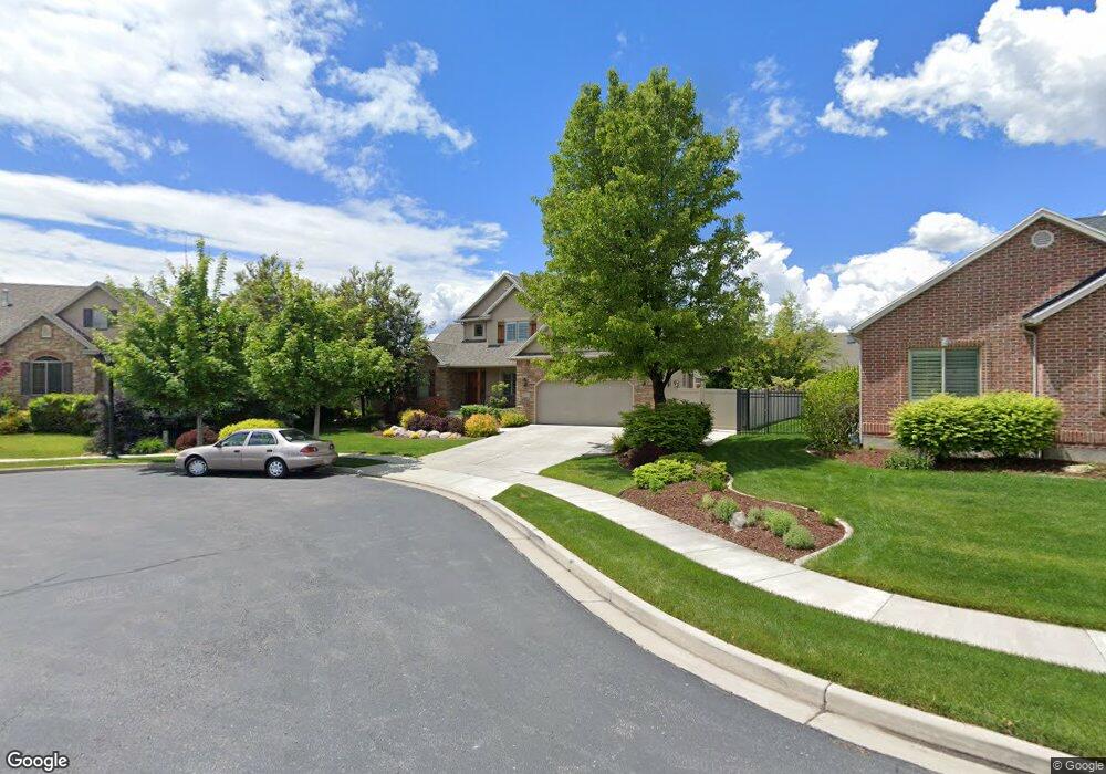
10663 Avery Ave Highland, UT 84003
Estimated Value: $804,222 - $921,000
3
Beds
3
Baths
2,224
Sq Ft
$393/Sq Ft
Est. Value
About This Home
This home is located at 10663 Avery Ave, Highland, UT 84003 and is currently estimated at $873,306, approximately $392 per square foot. 10663 Avery Ave is a home located in Utah County with nearby schools including Freedom Elementary School, Mountain Ridge Junior High School, and Lone Peak High School.
Ownership History
Date
Name
Owned For
Owner Type
Purchase Details
Closed on
May 20, 2019
Sold by
Anderson Derek and Anderson Brooke
Bought by
Nelson Curtis and Nelson Kimberly
Current Estimated Value
Home Financials for this Owner
Home Financials are based on the most recent Mortgage that was taken out on this home.
Original Mortgage
$210,000
Outstanding Balance
$184,257
Interest Rate
4.1%
Mortgage Type
New Conventional
Estimated Equity
$689,049
Purchase Details
Closed on
Nov 19, 2004
Sold by
Dove Construction Inc
Bought by
Anderson Derek and Anderson Brooke
Home Financials for this Owner
Home Financials are based on the most recent Mortgage that was taken out on this home.
Original Mortgage
$82,200
Interest Rate
5.79%
Mortgage Type
Purchase Money Mortgage
Create a Home Valuation Report for This Property
The Home Valuation Report is an in-depth analysis detailing your home's value as well as a comparison with similar homes in the area
Home Values in the Area
Average Home Value in this Area
Purchase History
| Date | Buyer | Sale Price | Title Company |
|---|---|---|---|
| Nelson Curtis | -- | Stewart Ttl Ins Agcy Of Uta | |
| Anderson Derek | -- | Signature Title Insurance A |
Source: Public Records
Mortgage History
| Date | Status | Borrower | Loan Amount |
|---|---|---|---|
| Open | Nelson Curtis | $210,000 | |
| Previous Owner | Anderson Derek | $82,200 |
Source: Public Records
Tax History Compared to Growth
Tax History
| Year | Tax Paid | Tax Assessment Tax Assessment Total Assessment is a certain percentage of the fair market value that is determined by local assessors to be the total taxable value of land and additions on the property. | Land | Improvement |
|---|---|---|---|---|
| 2025 | $2,877 | $378,620 | $280,900 | $407,500 |
| 2024 | $2,877 | $355,410 | $0 | $0 |
| 2023 | $2,733 | $364,155 | $0 | $0 |
| 2022 | $2,881 | $372,185 | $0 | $0 |
| 2021 | $2,830 | $544,700 | $196,100 | $348,600 |
| 2020 | $2,697 | $508,900 | $170,500 | $338,400 |
| 2019 | $2,541 | $501,600 | $170,500 | $331,100 |
| 2018 | $2,408 | $451,800 | $163,900 | $287,900 |
| 2017 | $2,259 | $226,215 | $0 | $0 |
| 2016 | $2,329 | $218,020 | $0 | $0 |
| 2015 | $2,275 | $201,795 | $0 | $0 |
| 2014 | $2,156 | $189,585 | $0 | $0 |
Source: Public Records
Map
Nearby Homes
- 1610 E Center Pointe Dr
- 1602 E Center Pointe Dr
- 1602 E Center Pointe Dr Unit 1
- 6373 W 10500 N
- 10434 N 6400 W
- 6271 W 10830 St N
- 6372 W 10400 N
- 975 E 2850 N
- 6399 W 10150 N
- 6602 W Normandy Way
- 9967 N 6670 W
- 10818 N 6000 W
- 9924 N 6630 W Unit 9
- 3368 N 700 E
- 6190 W 10050 N
- 11248 Hawkstone Way Unit 109
- 6024 Hawkstone Way Unit 108
- 11228 Hawkstone Way Unit 110
- 11124 N 6000 W
- 11578 N Broadleaf Hollow Ln
- 10663 N Avery Ave
- 6709 Avery Ave
- 10673 N Avery Ave
- 10673 Avery Ave
- 6737 Canterbury Dr
- 6749 Canterbury Dr
- 6719 Canterbury Dr
- 10681 Avery Ave
- 10681 N Avery Ave
- 6697 W Avery Ave
- 6697 Avery Ave
- 6696 Avery Ave
- 6765 W Canterbury Dr
- 6765 W Canterbury Dr Unit 199
- 6765 Canterbury Dr
- 6765 Canterbury Dr Unit 199
- 6669 Canterbury Dr
- 6669 Canterbury Dr Unit 172
- 6685 W Avery Ave
- 6685 Avery Ave