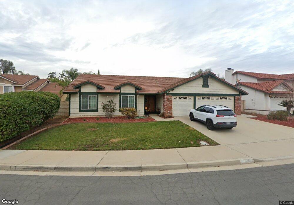
10669 Park Rim Cir Moreno Valley, CA 92557
North Moreno Valley NeighborhoodEstimated Value: $561,549 - $619,000
4
Beds
2
Baths
1,921
Sq Ft
$309/Sq Ft
Est. Value
About This Home
This home is located at 10669 Park Rim Cir, Moreno Valley, CA 92557 and is currently estimated at $593,137, approximately $308 per square foot. 10669 Park Rim Cir is a home located in Riverside County with nearby schools including Sugar Hill Elementary School, Palm Middle School, and Canyon Springs High School.
Ownership History
Date
Name
Owned For
Owner Type
Purchase Details
Closed on
May 7, 2001
Sold by
Fischer Steve and Fischer Margaret
Bought by
Reynolds Lloyd G and Reynolds Bea Ann
Current Estimated Value
Home Financials for this Owner
Home Financials are based on the most recent Mortgage that was taken out on this home.
Original Mortgage
$177,493
Interest Rate
7.14%
Mortgage Type
FHA
Purchase Details
Closed on
Sep 20, 1996
Sold by
Sandoval Gregory A and Sandoval Kathryn J
Bought by
Schoben Rodney Dean and Schoben Londeen Marie
Home Financials for this Owner
Home Financials are based on the most recent Mortgage that was taken out on this home.
Original Mortgage
$126,350
Interest Rate
8.11%
Create a Home Valuation Report for This Property
The Home Valuation Report is an in-depth analysis detailing your home's value as well as a comparison with similar homes in the area
Home Values in the Area
Average Home Value in this Area
Purchase History
| Date | Buyer | Sale Price | Title Company |
|---|---|---|---|
| Reynolds Lloyd G | -- | Lawyers Title Company | |
| Schoben Rodney Dean | $133,000 | Commonwealth Land Title Co |
Source: Public Records
Mortgage History
| Date | Status | Borrower | Loan Amount |
|---|---|---|---|
| Previous Owner | Reynolds Lloyd G | $177,493 | |
| Previous Owner | Schoben Rodney Dean | $126,350 |
Source: Public Records
Tax History Compared to Growth
Tax History
| Year | Tax Paid | Tax Assessment Tax Assessment Total Assessment is a certain percentage of the fair market value that is determined by local assessors to be the total taxable value of land and additions on the property. | Land | Improvement |
|---|---|---|---|---|
| 2025 | $2,523 | $223,546 | $32,555 | $190,991 |
| 2023 | $2,523 | $214,868 | $31,292 | $183,576 |
| 2022 | $2,426 | $210,656 | $30,679 | $179,977 |
| 2021 | $2,380 | $206,527 | $30,078 | $176,449 |
| 2020 | $2,354 | $204,410 | $29,770 | $174,640 |
| 2019 | $2,314 | $200,403 | $29,187 | $171,216 |
| 2018 | $2,268 | $196,474 | $28,615 | $167,859 |
| 2017 | $2,218 | $192,622 | $28,054 | $164,568 |
| 2016 | $2,195 | $188,846 | $27,504 | $161,342 |
| 2015 | $2,162 | $186,011 | $27,092 | $158,919 |
| 2014 | $2,015 | $182,369 | $26,562 | $155,807 |
Source: Public Records
Map
Nearby Homes
- 10560 Canyon Vista Rd
- 23878 Bouquet Canyon Place
- 24309 Rimview Rd
- 24321 Rimview Rd
- 23760 Timber Bluff Ct
- 24472 Old Country Rd
- 23752 Timber Bluff Ct
- 24321 Barley Rd
- 24118 Forsyte St
- 10991 Mendoza Rd
- 23702 Cedar Creek Terrace
- 24461 Willow Run Rd
- 10199 Caribou Cir
- 10479 Sagecrest Dr
- 23638 Airosa Place
- 23614 Tonada Ln
- 24022 Forsyte St
- 11119 Silver Run
- 23759 Heliotrope Way
- 23639 Lake Valley Dr
- 10661 Park Rim Cir
- 10675 Park Rim Cir
- 24065 Stone Creek Cir
- 24075 Stone Creek Cir
- 10679 Park Rim Cir
- 10690 Park Rim Cir
- 10681 Canyon Vista Rd
- 10685 Park Rim Cir
- 24055 Stone Creek Cir
- 10710 Park Rim Cir
- 10691 Park Rim Cir
- 10630 Canyon Vista Rd
- 24060 Stone Creek Cir
- 10707 Park Rim Cir
- 10720 Park Rim Cir
- 24090 Stone Creek Cir
- 10620 Canyon Vista Rd
- 10620 Canyon Vista Rd
- 24080 Stone Creek Cir
- 10701 Canyon Vista Rd