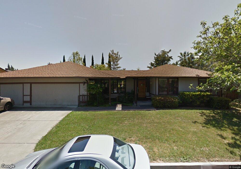
1067 Bancroft Ct Walnut Creek, CA 94598
Shadelands NeighborhoodEstimated Value: $1,313,000 - $1,495,000
5
Beds
3
Baths
2,659
Sq Ft
$541/Sq Ft
Est. Value
About This Home
This home is located at 1067 Bancroft Ct, Walnut Creek, CA 94598 and is currently estimated at $1,437,373, approximately $540 per square foot. 1067 Bancroft Ct is a home located in Contra Costa County with nearby schools including Bancroft Elementary School, Oak Grove Middle School, and Ygnacio Valley High School.
Ownership History
Date
Name
Owned For
Owner Type
Purchase Details
Closed on
Dec 31, 2019
Sold by
Las Trampas School Inc
Bought by
Pink Cleone L
Current Estimated Value
Home Financials for this Owner
Home Financials are based on the most recent Mortgage that was taken out on this home.
Original Mortgage
$350,000
Outstanding Balance
$309,239
Interest Rate
3.6%
Mortgage Type
New Conventional
Estimated Equity
$1,128,134
Create a Home Valuation Report for This Property
The Home Valuation Report is an in-depth analysis detailing your home's value as well as a comparison with similar homes in the area
Home Values in the Area
Average Home Value in this Area
Purchase History
| Date | Buyer | Sale Price | Title Company |
|---|---|---|---|
| Pink Cleone L | $930,000 | Placer Title Company |
Source: Public Records
Mortgage History
| Date | Status | Borrower | Loan Amount |
|---|---|---|---|
| Open | Pink Cleone L | $350,000 |
Source: Public Records
Tax History
| Year | Tax Paid | Tax Assessment Tax Assessment Total Assessment is a certain percentage of the fair market value that is determined by local assessors to be the total taxable value of land and additions on the property. | Land | Improvement |
|---|---|---|---|---|
| 2025 | $12,109 | $1,017,085 | $546,820 | $470,265 |
| 2024 | $11,641 | $997,144 | $536,099 | $461,045 |
| 2023 | $11,641 | $977,593 | $525,588 | $452,005 |
| 2022 | $11,541 | $958,426 | $515,283 | $443,143 |
| 2021 | $11,286 | $939,634 | $505,180 | $434,454 |
| 2019 | $724 | $412,597 | $138,971 | $273,626 |
| 2018 | $693 | $404,508 | $136,247 | $268,261 |
| 2017 | $656 | $396,577 | $133,576 | $263,001 |
| 2016 | $629 | $388,802 | $130,957 | $257,845 |
| 2015 | $598 | $382,962 | $128,990 | $253,972 |
| 2014 | $566 | $375,462 | $126,464 | $248,998 |
Source: Public Records
Map
Nearby Homes
- 2117 Gill Port Ln
- 1889 Countrywood Ct
- 1520 Candelero Dr
- 1746 Candelero Ct
- 1988 Pomar Way
- 1877 Pomar Way
- 1520 Arkell Rd
- 1900 Pomar Way
- 207 Normandy Ln
- 1844 Pomar Way
- 1273 Honey Trail
- 582 La Corso Dr
- 1936 Nero Ct
- 126 Ready Rd
- 192 Mayhew Way
- 1214 Honey Trail
- 1218 Hookston Rd
- 1052 Bancroft Rd
- 959 Chandler Ct
- 2042 Smith Ln
- 1033 Bancroft Ct
- 1095 Bancroft Ct
- 2038 Dorsch Rd
- 2068 Dorsch Rd
- 2030 Dorsch Rd
- 2112 Gill Port Ln
- 850 Bancroft Rd
- 2122 Gill Port Ln
- 2090 Dorsch Rd
- 2026 Dorsch Rd
- 1837 Gill Port Ct
- 1807 Gill Port Ct
- 2039 Dorsch Rd
- 2067 Dorsch Rd
- 2035 Dorsch Rd
- 2091 Dorsch Rd
- 1866 Gill Port Ct
- 2029 Dorsch Rd
- 2102 Dorsch Rd
- 975 Bancroft Ct
Your Personal Tour Guide
Ask me questions while you tour the home.