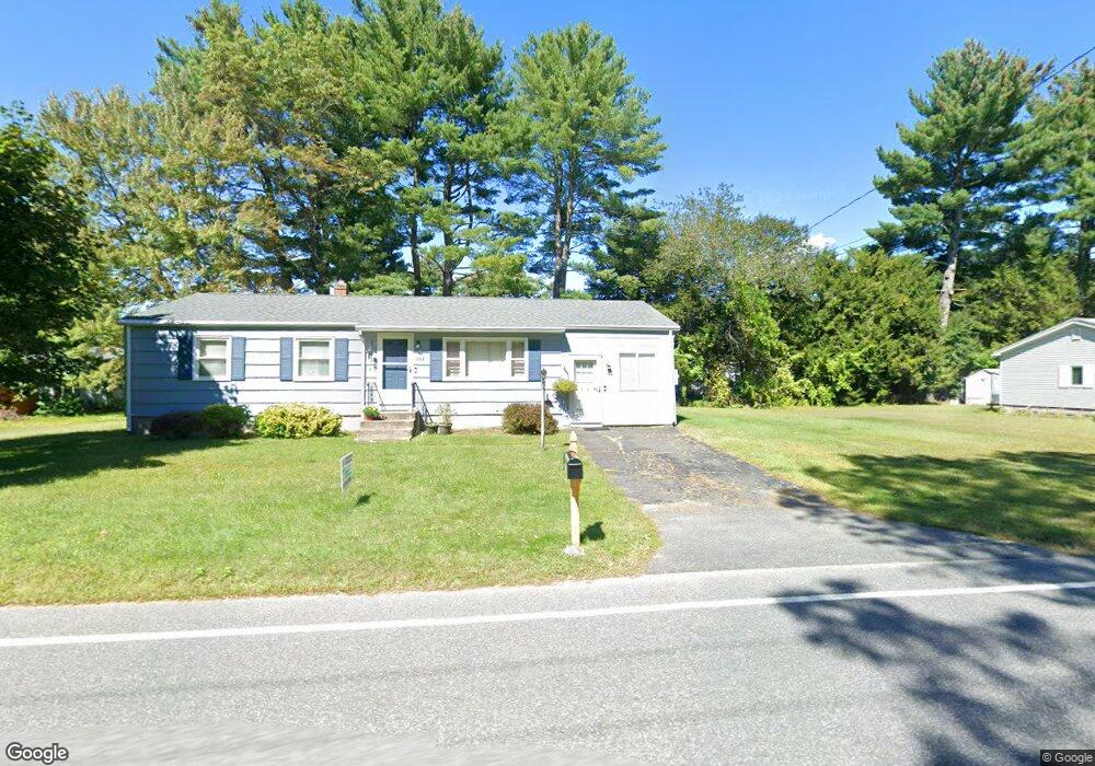
1067 Burts Pit Rd Northampton, MA 01062
Florence NeighborhoodEstimated Value: $397,000 - $433,000
3
Beds
1
Bath
1,071
Sq Ft
$383/Sq Ft
Est. Value
About This Home
This home is located at 1067 Burts Pit Rd, Northampton, MA 01062 and is currently estimated at $410,235, approximately $383 per square foot. 1067 Burts Pit Rd is a home located in Hampshire County with nearby schools including Northampton High School.
Ownership History
Date
Name
Owned For
Owner Type
Purchase Details
Closed on
Jan 30, 2003
Sold by
Rodriguez Colleen S and Rodriguez Pedro J
Bought by
Eklund Allen C and Eklund Victoria A
Current Estimated Value
Home Financials for this Owner
Home Financials are based on the most recent Mortgage that was taken out on this home.
Original Mortgage
$102,000
Outstanding Balance
$44,130
Interest Rate
6.09%
Mortgage Type
Purchase Money Mortgage
Estimated Equity
$366,105
Purchase Details
Closed on
Jan 24, 1997
Sold by
Ahearn Brian S and Ahearn Neal T
Bought by
Rodriguez Pedro J and Stpierre Colleen S
Create a Home Valuation Report for This Property
The Home Valuation Report is an in-depth analysis detailing your home's value as well as a comparison with similar homes in the area
Home Values in the Area
Average Home Value in this Area
Purchase History
We collect this data history from publicly available records. To have your information removed, we recommend requesting removal directly through your county’s website.
| Date | Buyer | Sale Price | Title Company |
|---|---|---|---|
| Eklund Allen C | $165,000 | -- | |
| Rodriguez Pedro J | $96,500 | -- |
Source: Public Records
Mortgage History
We collect this data history from publicly available records. To have your information removed, we recommend requesting removal directly through your county’s website.
| Date | Status | Borrower | Loan Amount |
|---|---|---|---|
| Open | Rodriguez Pedro J | $102,000 | |
| Closed | Rodriguez Pedro J | $33,000 | |
| Previous Owner | Rodriguez Pedro J | $124,791 | |
| Previous Owner | Rodriguez Pedro J | $15,000 |
Source: Public Records
Tax History
| Year | Tax Paid | Tax Assessment Tax Assessment Total Assessment is a certain percentage of the fair market value that is determined by local assessors to be the total taxable value of land and additions on the property. | Land | Improvement |
|---|---|---|---|---|
| 2025 | $5,116 | $367,300 | $122,000 | $245,300 |
| 2024 | $5,131 | $337,800 | $122,000 | $215,800 |
| 2023 | $4,720 | $298,000 | $110,900 | $187,100 |
| 2022 | $4,388 | $245,300 | $110,900 | $134,400 |
| 2021 | $3,747 | $215,700 | $105,900 | $109,800 |
| 2020 | $3,624 | $215,700 | $105,900 | $109,800 |
| 2019 | $3,354 | $193,100 | $90,900 | $102,200 |
| 2018 | $3,156 | $185,200 | $90,900 | $94,300 |
| 2017 | $3,091 | $185,200 | $90,900 | $94,300 |
| 2016 | $2,993 | $185,200 | $90,900 | $94,300 |
| 2015 | $3,005 | $190,200 | $90,900 | $99,300 |
| 2014 | $2,927 | $190,200 | $90,900 | $99,300 |
Source: Public Records
Map
Nearby Homes
- 792 Ryan Rd
- 723 Lot B Ryan Rd
- 788 Burts Pit Rd
- 142 Spruce Hill Ave
- 30 Birch Hill Rd
- 44 Westhampton Rd
- 42 Clark St
- 0 W Farms Rd
- 422 Park Hill Rd
- 1024 Westhampton Rd
- 296 Old Wilson Rd
- 20-11 Sylvester Rd
- 33 Landy Ave
- 60 Norwood Ave
- 76 Maple St
- 41 N Main St
- 25 Ballard St
- 1260 Westhampton Rd
- 67 Milton St
- 267 Locust St Unit 1A
- 1067 Burts Pit Rd
- 27 Winchester Terrace
- 1053 Burts Pit Rd
- 35 Winchester Terrace
- 1070 Burts Pit Rd
- 19 Winchester Terrace
- 1079 Burts Pit Rd
- 1078 Burts Pit Rd
- 1078 Burts Pit Rd
- 11 Winchester Terrace
- 28 Winchester Terrace
- 20 Winchester Terrace
- 1086 Burts Pit Rd
- 1091 Burts Pit Rd
- 17 Redford Dr
- 1041 Burts Pit Rd
- 5 Winchester Terrace
- 9 Redford Dr
- 12 Winchester Terrace
- 25 Redford Dr
Your Personal Tour Guide
Ask me questions while you tour the home.