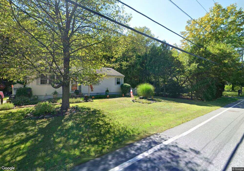
1070 Burts Pit Rd Florence, MA 01062
Florence NeighborhoodEstimated Value: $338,000 - $382,000
About This Home
This home is located at 1070 Burts Pit Rd, Florence, MA 01062 and is currently estimated at $355,873, approximately $370 per square foot. 1070 Burts Pit Rd is a home located in Hampshire County with nearby schools including Northampton High School, Hilltown Cooperative Charter Public School, and The Montessori School of Northampton.
Ownership History
We collect this data history from publicly available records. To have your information removed, we recommend requesting removal directly through your county’s website.
Purchase Details
Home Financials for this Owner
Home Financials are based on the most recent Mortgage that was taken out on this home.Home Values in the Area
Average Home Value in this Area
Purchase History
We collect this data history from publicly available records. To have your information removed, we recommend requesting removal directly through your county’s website.
| Date | Buyer | Sale Price | Title Company |
|---|---|---|---|
| $89,000 | -- |
Mortgage History
We collect this data history from publicly available records. To have your information removed, we recommend requesting removal directly through your county’s website.
| Date | Status | Borrower | Loan Amount |
|---|---|---|---|
| Closed | $73,000 | ||
| Closed | $69,000 |
Tax History
We collect this data history from publicly available records. To have your information removed, we recommend requesting removal directly through your county’s website.
| Year | Tax Paid | Tax Assessment Tax Assessment Total Assessment is a certain percentage of the fair market value that is determined by local assessors to be the total taxable value of land and additions on the property. | Land | Improvement |
|---|---|---|---|---|
| 2025 | $4,034 | $289,600 | $121,800 | $167,800 |
| 2024 | $4,031 | $265,400 | $121,800 | $143,600 |
| 2023 | $3,420 | $215,900 | $110,700 | $105,200 |
| 2022 | $3,734 | $208,700 | $110,700 | $98,000 |
| 2021 | $3,248 | $187,000 | $105,700 | $81,300 |
| 2020 | $3,142 | $187,000 | $105,700 | $81,300 |
| 2019 | $2,929 | $168,600 | $90,700 | $77,900 |
| 2018 | $2,864 | $168,100 | $90,700 | $77,400 |
| 2017 | $2,806 | $168,100 | $90,700 | $77,400 |
| 2016 | $2,716 | $168,100 | $90,700 | $77,400 |
| 2015 | $2,695 | $170,600 | $90,700 | $79,900 |
| 2014 | $2,626 | $170,600 | $90,700 | $79,900 |
Map
- 866 Burts Pit Rd
- 792 Ryan Rd
- 36 Sovereign Way
- 723 Lot B Ryan Rd
- 788 Burts Pit Rd
- 142 Spruce Hill Ave
- 1467 Westhampton Rd
- 30 Birch Hill Rd
- 44 Westhampton Rd
- 0 W Farms Rd
- 42 Clark St
- 422 Park Hill Rd
- 1024 Westhampton Rd
- 296 Old Wilson Rd
- 20-11 Sylvester Rd
- 60 Norwood Ave
- 76 Maple St
- 41 N Main St
- 25 Ballard St
- 67 Milton St
- 1078 Burts Pit Rd
- 1078 Burts Pit Rd
- 1067 Burts Pit Rd
- 1067 Burts Pit Rd
- 1079 Burts Pit Rd
- 1086 Burts Pit Rd
- 1053 Burts Pit Rd
- 27 Winchester Terrace
- 19 Winchester Terrace
- 35 Winchester Terrace
- 1091 Burts Pit Rd
- 11 Winchester Terrace
- 1094 Burts Pit Rd
- 5 Winchester Terrace
- 1041 Burts Pit Rd
- 28 Winchester Terrace
- 20 Winchester Terrace
- 9 Redford Dr
- 1104 Burts Pit Rd
- 12 Winchester Terrace
Ask me questions while you tour the home.