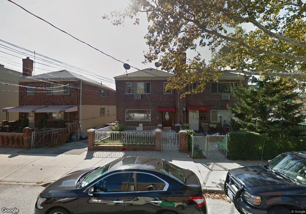
1067 Calhoun Ave Bronx, NY 10465
Throgs Neck-Edgewater Park NeighborhoodEstimated Value: $813,769 - $964,000
--
Bed
--
Bath
2,200
Sq Ft
$403/Sq Ft
Est. Value
About This Home
This home is located at 1067 Calhoun Ave, Bronx, NY 10465 and is currently estimated at $887,692, approximately $403 per square foot. 1067 Calhoun Ave is a home located in Bronx County with nearby schools including P.S. 14 Senator John Calandra, Herbert H Lehman High School, and Bronx Arts & Science Charter School.
Ownership History
Date
Name
Owned For
Owner Type
Purchase Details
Closed on
Jun 12, 2014
Sold by
Sahadeo Nalini P
Bought by
Rosario Enmanuel and Rosario Gisel
Current Estimated Value
Home Financials for this Owner
Home Financials are based on the most recent Mortgage that was taken out on this home.
Original Mortgage
$463,941
Outstanding Balance
$351,818
Interest Rate
4.12%
Mortgage Type
New Conventional
Estimated Equity
$535,874
Purchase Details
Closed on
Aug 20, 2001
Sold by
Sahadeo Aurobindo and Sahadeo Nalini P
Bought by
Sahadeo Nalini P
Purchase Details
Closed on
Apr 18, 1997
Sold by
Mirabile Villaizan Frank and Mirabile Villaizan Christine
Bought by
Sahadeo Aurobindo and Sahadeo Nalini P
Home Financials for this Owner
Home Financials are based on the most recent Mortgage that was taken out on this home.
Original Mortgage
$230,860
Interest Rate
8.08%
Create a Home Valuation Report for This Property
The Home Valuation Report is an in-depth analysis detailing your home's value as well as a comparison with similar homes in the area
Home Values in the Area
Average Home Value in this Area
Purchase History
| Date | Buyer | Sale Price | Title Company |
|---|---|---|---|
| Rosario Enmanuel | $472,500 | -- | |
| Sahadeo Nalini P | -- | -- | |
| Sahadeo Aurobindo | $248,000 | Commonwealth Land Title Ins |
Source: Public Records
Mortgage History
| Date | Status | Borrower | Loan Amount |
|---|---|---|---|
| Open | Rosario Enmanuel | $463,941 | |
| Previous Owner | Sahadeo Aurobindo | $230,860 |
Source: Public Records
Tax History Compared to Growth
Tax History
| Year | Tax Paid | Tax Assessment Tax Assessment Total Assessment is a certain percentage of the fair market value that is determined by local assessors to be the total taxable value of land and additions on the property. | Land | Improvement |
|---|---|---|---|---|
| 2025 | $8,139 | $42,956 | $9,033 | $33,923 |
| 2024 | $8,139 | $40,525 | $9,344 | $31,181 |
| 2023 | $7,765 | $38,232 | $7,739 | $30,493 |
| 2022 | $7,632 | $50,640 | $11,040 | $39,600 |
| 2021 | $7,986 | $41,100 | $11,040 | $30,060 |
| 2020 | $7,577 | $45,420 | $11,040 | $34,380 |
| 2019 | $7,065 | $41,580 | $11,040 | $30,540 |
| 2018 | $6,495 | $31,860 | $11,040 | $20,820 |
| 2017 | $6,495 | $31,860 | $11,040 | $20,820 |
| 2016 | $6,376 | $31,896 | $10,970 | $20,926 |
| 2015 | $3,847 | $31,896 | $11,635 | $20,261 |
| 2014 | $3,847 | $31,655 | $11,547 | $20,108 |
Source: Public Records
Map
Nearby Homes
- 945 Swinton Ave
- 1009 Brinsmade Ave
- 1049 Huntington Ave
- 946 Balcom Ave
- 1239 Edison Ave
- 3021 Barkley Ave
- 836 Revere Ave
- 837 Swinton Ave
- 831 Swinton Ave
- 2916 Sullivan Place
- 3014 Baisley Ave
- 815 Swinton Ave
- 854 Logan Ave
- - Ave
- 2808 Philip Ave
- 2976 Waterbury Ave
- 1156 Fairfax Ave
- 2943 Waterbury Ave
- 840 Hollywood Ave
- 819 Hollywood Ave
- 1065 Calhoun Ave
- 1069 Calhoun Ave
- 1063 Calhoun Ave
- 2830 Bruckner Blvd
- 1061 Calhoun Ave
- 1062 Quincy Ave
- 2826 Bruckner Blvd
- 2850 Bruckner Blvd
- 2850 Bruckner Blvd Unit 2
- 1060 Quincy Ave
- 1055 Calhoun Ave
- 2852 Bruckner Blvd
- 1056 Quincy Ave
- 1049 Calhoun Ave
- 1062 Calhoun Ave
- 1060 Calhoun Ave
- 2854 Bruckner Blvd
- 1058 Calhoun Ave
- 1047 Calhoun Ave
- 2856 Bruckner Blvd