Estimated Value: $463,000 - $530,000
4
Beds
3
Baths
1,730
Sq Ft
$288/Sq Ft
Est. Value
About This Home
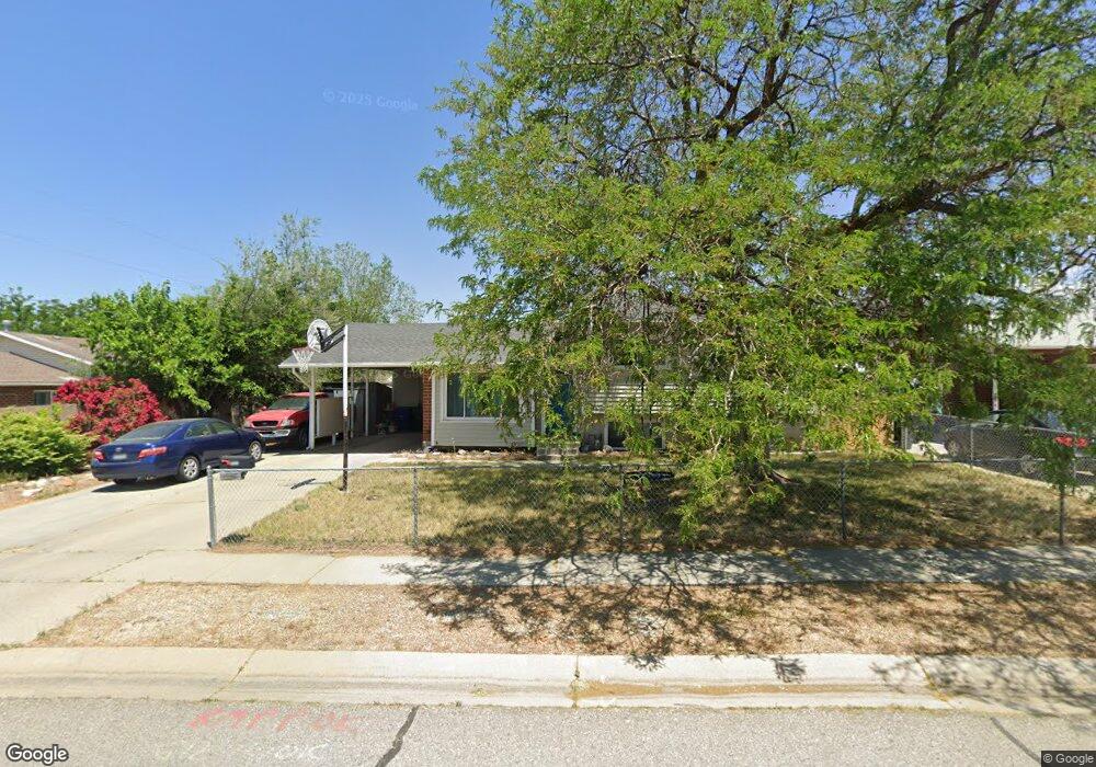
This home is located at 1067 E Diamond Way, Sandy, UT 84094 and is currently estimated at $497,741, approximately $287 per square foot. 1067 E Diamond Way is a home located in Salt Lake County with nearby schools including Eastmont Middle School, Jordan High, and Blessed Sacrament Catholic School.
Ownership History
Date
Name
Owned For
Owner Type
Purchase Details
Closed on
Aug 14, 2017
Sold by
Broadbent Christian S and Broadbent Karine G
Bought by
Krukowski Holly K and Krukowski Christopher J
Current Estimated Value
Home Financials for this Owner
Home Financials are based on the most recent Mortgage that was taken out on this home.
Original Mortgage
$257,427
Outstanding Balance
$214,338
Interest Rate
3.88%
Mortgage Type
FHA
Estimated Equity
$283,403
Purchase Details
Closed on
Sep 18, 2009
Sold by
American Pension Services Inc
Bought by
Broadbent Christian S and Broadbent Karine G
Home Financials for this Owner
Home Financials are based on the most recent Mortgage that was taken out on this home.
Original Mortgage
$174,775
Interest Rate
5.08%
Mortgage Type
FHA
Purchase Details
Closed on
Jan 5, 2007
Sold by
Roberts Billy and Roberts Linda
Bought by
American Pension Services Inc and Michael S Robinson Jr Ira #7792
Purchase Details
Closed on
Jul 10, 2001
Sold by
Anderson Dale L
Bought by
Roberts Billy and Roberts Lynda
Home Financials for this Owner
Home Financials are based on the most recent Mortgage that was taken out on this home.
Original Mortgage
$107,600
Interest Rate
11.12%
Mortgage Type
Purchase Money Mortgage
Purchase Details
Closed on
Jun 5, 2001
Sold by
Anderson Dale L
Bought by
Anderson Dale L and Roberts Billy
Home Financials for this Owner
Home Financials are based on the most recent Mortgage that was taken out on this home.
Original Mortgage
$107,600
Interest Rate
11.12%
Mortgage Type
Purchase Money Mortgage
Purchase Details
Closed on
Oct 10, 1997
Sold by
Anderson Dale L and Roberts Billy K
Bought by
Anderson Dale L
Home Financials for this Owner
Home Financials are based on the most recent Mortgage that was taken out on this home.
Original Mortgage
$34,332
Interest Rate
7.54%
Mortgage Type
Purchase Money Mortgage
Create a Home Valuation Report for This Property
The Home Valuation Report is an in-depth analysis detailing your home's value as well as a comparison with similar homes in the area
Home Values in the Area
Average Home Value in this Area
Purchase History
| Date | Buyer | Sale Price | Title Company |
|---|---|---|---|
| Krukowski Holly K | -- | First American Title | |
| Broadbent Christian S | -- | Investors Title Ins Agency | |
| American Pension Services Inc | -- | None Available | |
| Roberts Billy | -- | First American Title | |
| Anderson Dale L | -- | First American Title | |
| Anderson Dale L | -- | -- |
Source: Public Records
Mortgage History
| Date | Status | Borrower | Loan Amount |
|---|---|---|---|
| Open | Krukowski Holly K | $257,427 | |
| Previous Owner | Broadbent Christian S | $174,775 | |
| Previous Owner | Roberts Billy | $107,600 | |
| Previous Owner | Anderson Dale L | $34,332 | |
| Closed | American Pension Services Inc | $0 |
Source: Public Records
Tax History
| Year | Tax Paid | Tax Assessment Tax Assessment Total Assessment is a certain percentage of the fair market value that is determined by local assessors to be the total taxable value of land and additions on the property. | Land | Improvement |
|---|---|---|---|---|
| 2025 | $2,954 | $455,500 | $123,500 | $332,000 |
| 2024 | $2,954 | $442,000 | $115,400 | $326,600 |
| 2023 | $3,013 | $441,000 | $109,700 | $331,300 |
| 2022 | $3,001 | $434,600 | $107,600 | $327,000 |
| 2021 | $2,540 | $322,000 | $83,600 | $238,400 |
| 2020 | $2,484 | $294,500 | $83,600 | $210,900 |
| 2019 | $2,296 | $270,000 | $78,900 | $191,100 |
| 2016 | $1,569 | $178,600 | $78,900 | $99,700 |
Source: Public Records
Map
Nearby Homes
- 1062 E Diamond Way
- 1123 E Sego Lily Dr
- 941 E Carnation Dr
- 954 E Carnation Dr
- 9976 Tamara St E
- 10366 S Larkspur Cir
- 9968 S Blossom Dr
- 845 Larkspur Dr
- 10517 S Larkspur Dr
- 10172 Snow Iris Way
- 10351 S Zinnia Way
- 1119 E 10600 S
- 1420 E Firelight Way
- 9633 S 1210 E
- 837 E 10515 S
- 9587 S 1040 E
- 10491 Amaryllis St
- 10642 S 1090 E
- 10522 Amaryllis St
- 10538 S Bay Meadow Dr
- 1067 Diamond Way
- 1075 E Diamond Way
- 1075 Diamond Way
- 10049 Flint Dr
- 10049 S Flint Dr
- 1082 Platinum Way
- 1088 E Platinum Way
- 1088 Platinum Way
- 1078 Platinum Way
- 1078 E Platinum Way
- 1081 E Diamond Way
- 1081 Diamond Way
- 1062 Diamond Way
- 1068 Diamond Way
- 1068 E Diamond Way
- 10069 Flint Dr
- 1092 Platinum Way
- 1076 Diamond Way
- 10044 S Flint Dr
- 10044 Flint Dr
Your Personal Tour Guide
Ask me questions while you tour the home.