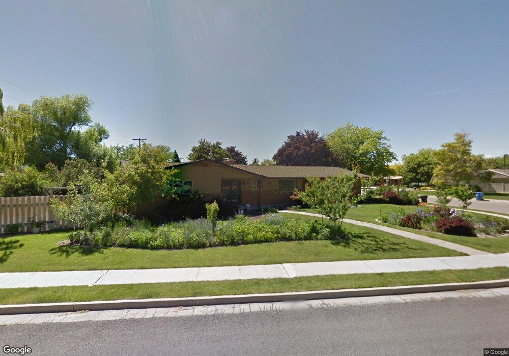
1067 N 1730 E Logan, UT 84341
Hillcrest NeighborhoodEstimated Value: $570,000 - $599,278
4
Beds
3
Baths
3,494
Sq Ft
$167/Sq Ft
Est. Value
About This Home
This home is located at 1067 N 1730 E, Logan, UT 84341 and is currently estimated at $582,320, approximately $166 per square foot. 1067 N 1730 E is a home located in Cache County with nearby schools including Hillcrest Elementary School, Mount Logan Middle School, and Logan High School.
Ownership History
Date
Name
Owned For
Owner Type
Purchase Details
Closed on
Jan 21, 2015
Sold by
Chudoba Katherine M and Powelson David K
Bought by
Powelson Chuboda Trust and Powelson David K
Current Estimated Value
Purchase Details
Closed on
Aug 24, 2007
Sold by
Willey Lynn R and Willey Marie P
Bought by
Chudoba Katherine M and Powelson David K
Home Financials for this Owner
Home Financials are based on the most recent Mortgage that was taken out on this home.
Original Mortgage
$100,000
Outstanding Balance
$63,250
Interest Rate
6.73%
Mortgage Type
Credit Line Revolving
Estimated Equity
$519,070
Create a Home Valuation Report for This Property
The Home Valuation Report is an in-depth analysis detailing your home's value as well as a comparison with similar homes in the area
Home Values in the Area
Average Home Value in this Area
Purchase History
| Date | Buyer | Sale Price | Title Company |
|---|---|---|---|
| Powelson Chuboda Trust | -- | None Available | |
| Chudoba Katherine M | -- | Cache Title Company |
Source: Public Records
Mortgage History
| Date | Status | Borrower | Loan Amount |
|---|---|---|---|
| Open | Chudoba Katherine M | $100,000 |
Source: Public Records
Tax History Compared to Growth
Tax History
| Year | Tax Paid | Tax Assessment Tax Assessment Total Assessment is a certain percentage of the fair market value that is determined by local assessors to be the total taxable value of land and additions on the property. | Land | Improvement |
|---|---|---|---|---|
| 2025 | $2,468 | $319,190 | $0 | $0 |
| 2024 | $2,548 | $319,190 | $0 | $0 |
| 2023 | $2,659 | $317,540 | $0 | $0 |
| 2022 | $2,478 | $276,290 | $0 | $0 |
| 2021 | $2,273 | $391,550 | $75,000 | $316,550 |
| 2020 | $2,054 | $318,500 | $75,000 | $243,500 |
| 2019 | $2,147 | $318,500 | $75,000 | $243,500 |
| 2018 | $2,012 | $272,456 | $75,000 | $197,456 |
| 2017 | $1,777 | $127,215 | $0 | $0 |
| 2016 | $1,842 | $127,215 | $0 | $0 |
| 2015 | $1,844 | $127,215 | $0 | $0 |
| 2014 | $1,667 | $127,215 | $0 | $0 |
| 2013 | -- | $117,325 | $0 | $0 |
Source: Public Records
Map
Nearby Homes
- 975 N 1600 E
- 1405 N Aspen Dr
- Cedar Ridge Plan at Foothill Lofts
- Viewside Plan at Foothill Lofts
- Crimson Plan at Foothill Lofts
- Chamberlain Plan at Foothill Lofts
- Lincoln Plan at Foothill Lofts
- Hamilton Plan at Foothill Lofts
- Fairway Plan at Foothill Lofts
- Huntington Plan at Foothill Lofts
- Jefferson Plan at Foothill Lofts
- Monroe Plan at Foothill Lofts
- 1393 Davis Ave
- 1451 N Aspen Dr
- 1357 E 1220 N
- 1465 N Stonecrest Ln Unit 14
- 1454 N 1400 E
- 1902 E 1500 N
- 1891 E 1500 N
- 820 Hillcrest Ave