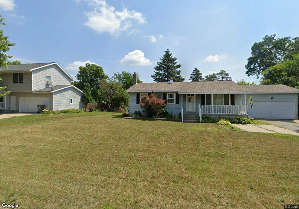
1067 N Hudson St Lowell, MI 49331
Estimated Value: $248,196 - $361,000
3
Beds
1
Bath
1,000
Sq Ft
$282/Sq Ft
Est. Value
About This Home
This home is located at 1067 N Hudson St, Lowell, MI 49331 and is currently estimated at $282,299, approximately $282 per square foot. 1067 N Hudson St is a home located in Kent County with nearby schools including Bushnell Elementary School, Cherry Creek Elementary School, and Lowell Middle School.
Ownership History
Date
Name
Owned For
Owner Type
Purchase Details
Closed on
Nov 5, 2014
Sold by
Serne Patrick A and Serne June H
Bought by
Serne Family Protection Trust and Serne June H
Current Estimated Value
Purchase Details
Closed on
Jun 14, 2014
Sold by
Serne Patrick A and Serne June H
Bought by
Serne Patrick A and Serne June H
Purchase Details
Closed on
Jan 17, 2007
Sold by
Seme Patrick A
Bought by
Seme Patrick A and Seme June H
Purchase Details
Closed on
Apr 1, 1977
Bought by
Serne P and Serne Patrick A
Create a Home Valuation Report for This Property
The Home Valuation Report is an in-depth analysis detailing your home's value as well as a comparison with similar homes in the area
Home Values in the Area
Average Home Value in this Area
Purchase History
| Date | Buyer | Sale Price | Title Company |
|---|---|---|---|
| Serne Family Protection Trust | -- | None Available | |
| Serne Patrick A | -- | None Available | |
| Seme Patrick A | -- | None Available | |
| Serne P | $25,000 | -- |
Source: Public Records
Tax History Compared to Growth
Tax History
| Year | Tax Paid | Tax Assessment Tax Assessment Total Assessment is a certain percentage of the fair market value that is determined by local assessors to be the total taxable value of land and additions on the property. | Land | Improvement |
|---|---|---|---|---|
| 2025 | $2,225 | $101,600 | $0 | $0 |
| 2024 | $2,225 | $101,500 | $0 | $0 |
| 2023 | $2,124 | $90,500 | $0 | $0 |
| 2022 | $2,412 | $78,100 | $0 | $0 |
| 2021 | $2,344 | $69,200 | $0 | $0 |
| 2020 | $1,943 | $64,000 | $0 | $0 |
| 2019 | $2,282 | $61,700 | $0 | $0 |
| 2018 | $2,233 | $59,800 | $0 | $0 |
| 2017 | $2,177 | $54,700 | $0 | $0 |
| 2016 | $2,117 | $52,700 | $0 | $0 |
| 2015 | -- | $52,700 | $0 | $0 |
| 2013 | -- | $46,400 | $0 | $0 |
Source: Public Records
Map
Nearby Homes
- 610 Birchwood Ct SE
- 725 N Lafayette St SE
- 913 N Monroe St
- 926 N Washington St
- 1060 N Washington St
- 510 N Hudson St SE
- 1080 N Washington St SE
- Cedarwood Plan at Flat River Estates
- Sycamore Plan at Flat River Estates
- Elmwood Plan at Flat River Estates
- Chestnut Plan at Flat River Estates
- Redwood Plan at Flat River Estates
- Whitby Plan at Flat River Estates
- Bay Harbor Plan at Flat River Estates
- Pentwater Plan at Flat River Estates
- Maplewood Plan at Flat River Estates
- Harbor Springs Plan at Flat River Estates
- Sequoia Plan at Flat River Estates
- Oakwood Plan at Flat River Estates
- Northport Plan at Flat River Estates
- 1061 N Hudson St
- 1181 Flat River Dr SE
- 1064 Riverside Dr
- 1055 N Hudson St
- 1044 Riverside Dr
- 1052 N Hudson St SE
- 1043 N Hudson St
- 1052 N Hudson St
- 1043 N Hudson St SE
- 1046 N Hudson St SE
- 1034 Riverside Dr
- 1046 N Hudson St
- 1069 Lincoln Lake
- 1017 N Hudson St SE
- 1043 Lincoln Lake
- 1042 N Hudson St
- 1017 N Hudson St
- 5133 Lincoln Lake Ave
- 3385 Lincoln Lake Ave
- 1043 Lincoln Lake