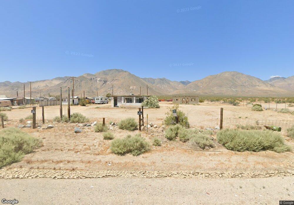
1067 Sterling Rd Inyokern, CA 93527
Estimated Value: $39,862 - $299,000
--
Bed
--
Bath
525
Sq Ft
$242/Sq Ft
Est. Value
About This Home
This home is located at 1067 Sterling Rd, Inyokern, CA 93527 and is currently estimated at $126,954, approximately $241 per square foot. 1067 Sterling Rd is a home located in Inyo County with nearby schools including Lo-Inyo Elementary School and Lone Pine High School.
Ownership History
Date
Name
Owned For
Owner Type
Purchase Details
Closed on
Aug 21, 2020
Sold by
Rfp Investments Llc
Bought by
Garrison Ronnie Gordo and Quan Garrison Hongfeng
Current Estimated Value
Purchase Details
Closed on
Aug 15, 2020
Sold by
Rfp Investments Llc
Bought by
Garrison Ronnie Gordon and Quan-Garrison Hongfeng
Purchase Details
Closed on
Feb 14, 2017
Sold by
Stieble Shepard L
Bought by
Rfp Investments Llc
Purchase Details
Closed on
Feb 9, 2006
Sold by
Boyer Jacqueline S
Bought by
Stieble Shepard L
Purchase Details
Closed on
Feb 4, 2006
Sold by
Nay Rosemary L
Bought by
Stieble Shepard L
Purchase Details
Closed on
Jan 28, 2006
Sold by
Eades Barbara L
Bought by
Stieble Shepard L
Create a Home Valuation Report for This Property
The Home Valuation Report is an in-depth analysis detailing your home's value as well as a comparison with similar homes in the area
Home Values in the Area
Average Home Value in this Area
Purchase History
| Date | Buyer | Sale Price | Title Company |
|---|---|---|---|
| Garrison Ronnie Gordo | $30,000 | Inyo Mono Title Company | |
| Garrison Ronnie Gordon | -- | Inyo-Mono Title | |
| Rfp Investments Llc | $6,025 | None Available | |
| Stieble Shepard L | $14,000 | None Available | |
| Stieble Shepard L | $14,000 | None Available | |
| Stieble Shepard L | $14,000 | None Available |
Source: Public Records
Tax History Compared to Growth
Tax History
| Year | Tax Paid | Tax Assessment Tax Assessment Total Assessment is a certain percentage of the fair market value that is determined by local assessors to be the total taxable value of land and additions on the property. | Land | Improvement |
|---|---|---|---|---|
| 2025 | $421 | $32,470 | $19,483 | $12,987 |
| 2024 | $368 | $31,834 | $19,101 | $12,733 |
| 2023 | $362 | $31,211 | $18,727 | $12,484 |
| 2022 | $350 | $30,600 | $18,360 | $12,240 |
| 2021 | $350 | $30,000 | $18,000 | $12,000 |
| 2020 | $123 | $7,427 | $5,306 | $2,121 |
| 2019 | $123 | $7,282 | $5,202 | $2,080 |
| 2018 | $121 | $7,140 | $5,100 | $2,040 |
| 2017 | $344 | $29,426 | $27,077 | $2,349 |
| 2016 | $339 | $28,850 | $26,547 | $2,303 |
| 2015 | $334 | $28,418 | $26,149 | $2,269 |
| 2014 | $329 | $27,862 | $25,637 | $2,225 |
Source: Public Records
Map
Nearby Homes
- 0 Sterling Unit 2607307
- 0 U S 395
- 0 Apn 056-071-39 Onyx Peak
- 9000 Brown Rd
- 056-302-10 Vl
- 8845 Eve Ave
- 0 N Crestview St
- 7614 Bull Run St
- 7542 Bull Run
- 7910 Hazen Ave
- 8028 Arsenault Rd
- 7920 Neal Ranch Rd
- 0 Walden Ave
- 0 Greasewood Ave Unit 56-34 2606904
- 0 Greasewood Ave Unit 56-34
- 0 Quail St
- 5141 Carr Rd
- 0 Sierra Trail
- 4708 Hawk St
- 0 N Sierra Vista St Unit HD25217356