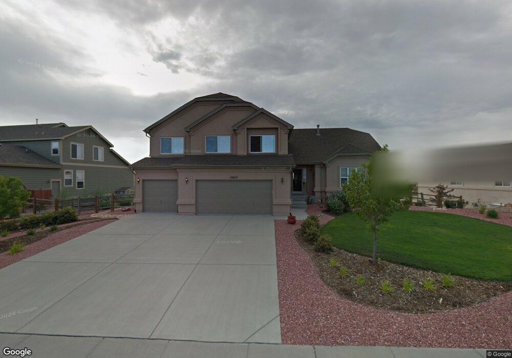
10675 Pictured Rocks Dr Peyton, CO 80831
Falcon NeighborhoodEstimated Value: $651,049 - $775,000
4
Beds
4
Baths
4,994
Sq Ft
$139/Sq Ft
Est. Value
About This Home
This home is located at 10675 Pictured Rocks Dr, Peyton, CO 80831 and is currently estimated at $695,012, approximately $139 per square foot. 10675 Pictured Rocks Dr is a home located in El Paso County with nearby schools including Meridian Ranch Elementary School, Falcon Middle School, and Falcon High School.
Ownership History
Date
Name
Owned For
Owner Type
Purchase Details
Closed on
Jul 21, 2017
Sold by
Willocjk Vii Janes and Willocjk Sabine B
Bought by
Gharat Lance Shiva
Current Estimated Value
Home Financials for this Owner
Home Financials are based on the most recent Mortgage that was taken out on this home.
Original Mortgage
$368,125
Outstanding Balance
$306,018
Interest Rate
3.91%
Mortgage Type
New Conventional
Estimated Equity
$388,994
Purchase Details
Closed on
Dec 21, 2005
Sold by
Lennar Colorado Llc
Bought by
Willock Vii James and Willock Sabine B
Home Financials for this Owner
Home Financials are based on the most recent Mortgage that was taken out on this home.
Original Mortgage
$303,750
Interest Rate
6.3%
Mortgage Type
VA
Create a Home Valuation Report for This Property
The Home Valuation Report is an in-depth analysis detailing your home's value as well as a comparison with similar homes in the area
Home Values in the Area
Average Home Value in this Area
Purchase History
| Date | Buyer | Sale Price | Title Company |
|---|---|---|---|
| Gharat Lance Shiva | $387,500 | North American Title | |
| Willock Vii James | $343,145 | North American Title |
Source: Public Records
Mortgage History
| Date | Status | Borrower | Loan Amount |
|---|---|---|---|
| Open | Gharat Lance Shiva | $368,125 | |
| Previous Owner | Willock Vii James | $303,750 |
Source: Public Records
Tax History
| Year | Tax Paid | Tax Assessment Tax Assessment Total Assessment is a certain percentage of the fair market value that is determined by local assessors to be the total taxable value of land and additions on the property. | Land | Improvement |
|---|---|---|---|---|
| 2025 | $4,799 | $49,640 | -- | -- |
| 2024 | $4,661 | $50,460 | $7,200 | $43,260 |
| 2022 | $3,575 | $35,420 | $5,910 | $29,510 |
| 2021 | $3,705 | $36,440 | $6,080 | $30,360 |
| 2020 | $3,553 | $32,400 | $5,510 | $26,890 |
| 2019 | $3,533 | $32,400 | $5,510 | $26,890 |
| 2018 | $3,203 | $29,070 | $5,040 | $24,030 |
| 2017 | $3,029 | $29,070 | $5,040 | $24,030 |
| 2016 | $3,058 | $30,050 | $5,570 | $24,480 |
| 2015 | $3,060 | $30,050 | $5,570 | $24,480 |
| 2014 | $2,817 | $27,330 | $4,780 | $22,550 |
Source: Public Records
Map
Nearby Homes
- 10803 Greenbelt Dr
- 10467 Pictured Rocks Dr
- 10488 Cedar Breaks Dr
- 12320 Grand Teton Dr
- 10489 Cedar Breaks Dr
- 10429 Cedar Breaks Dr
- 12705 Angelina Dr
- 10603 Ross Lake Dr
- 12534 Angelina Dr
- 10476 Ross Lake Dr
- 10952 Torreys Peak Way
- 10342 Biscayne Dr
- 11674 Allendale Dr
- 10932 Huron Peak Place
- 12144 Point Reyes Dr
- 12252 Point Reyes Dr
- 10952 Checo Way
- 12431 Mount Bross Place
- 12272 Isle Royale Dr
- 10135 Kings Canyon Dr
- 10659 Pictured Rocks Dr
- 10691 Pictured Rocks Dr
- 10712 Greenbelt Dr
- 10730 Greenbelt Dr
- 10694 Greenbelt Dr
- 10674 Pictured Rocks Dr
- 10643 Pictured Rocks Dr
- 10647 Pictured Rocks Dr
- 10690 Pictured Rocks Dr
- 10658 Pictured Rocks Dr
- 10819 Glen Canyon Dr
- 10713 Greenbelt Dr
- 10803 Glen Canyon Dr
- 10731 Greenbelt Dr
- 10627 Pictured Rocks Dr
- 10835 Glen Canyon Dr
- 10642 Pictured Rocks Dr
- 10850 Glen Canyon Dr
- 10749 Greenbelt Dr
- 10658 Greenbelt Dr
Your Personal Tour Guide
Ask me questions while you tour the home.