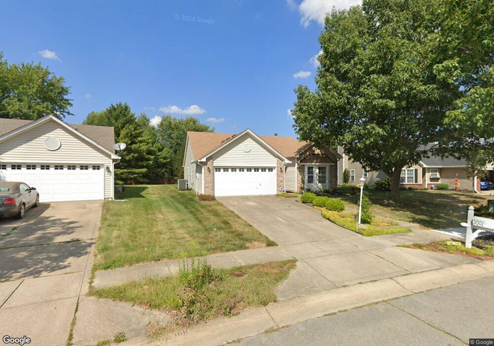
10682 Springston Ct Fishers, IN 46037
Estimated Value: $327,941 - $355,000
3
Beds
2
Baths
1,490
Sq Ft
$227/Sq Ft
Est. Value
About This Home
This home is located at 10682 Springston Ct, Fishers, IN 46037 and is currently estimated at $337,985, approximately $226 per square foot. 10682 Springston Ct is a home located in Hamilton County with nearby schools including Sigourney Elementary School, Lantern Road Elementary School, and Riverside Junior High School.
Ownership History
Date
Name
Owned For
Owner Type
Purchase Details
Closed on
Jul 13, 2018
Sold by
Sterchi Jerry W and Sterchi Norma M
Bought by
Sterchi Jerry W
Current Estimated Value
Purchase Details
Closed on
Jun 5, 2013
Sold by
Sterchi Norma M
Bought by
Sterchi Jerry W and Sterchi Norma M
Purchase Details
Closed on
Sep 28, 2007
Sold by
Dietzen John
Bought by
Sterchi Norma M
Home Financials for this Owner
Home Financials are based on the most recent Mortgage that was taken out on this home.
Original Mortgage
$132,800
Outstanding Balance
$84,118
Interest Rate
6.49%
Mortgage Type
Purchase Money Mortgage
Estimated Equity
$253,867
Purchase Details
Closed on
Sep 30, 2003
Sold by
Behling Julie A
Bought by
Dietzen John
Home Financials for this Owner
Home Financials are based on the most recent Mortgage that was taken out on this home.
Original Mortgage
$114,400
Interest Rate
6.23%
Mortgage Type
Purchase Money Mortgage
Create a Home Valuation Report for This Property
The Home Valuation Report is an in-depth analysis detailing your home's value as well as a comparison with similar homes in the area
Home Values in the Area
Average Home Value in this Area
Purchase History
| Date | Buyer | Sale Price | Title Company |
|---|---|---|---|
| Sterchi Jerry W | -- | None Available | |
| Sterchi Jerry W | -- | None Available | |
| Sterchi Norma M | -- | Stewart Title | |
| Dietzen John | -- | -- |
Source: Public Records
Mortgage History
| Date | Status | Borrower | Loan Amount |
|---|---|---|---|
| Open | Sterchi Norma M | $132,800 | |
| Previous Owner | Dietzen John | $114,400 |
Source: Public Records
Tax History Compared to Growth
Tax History
| Year | Tax Paid | Tax Assessment Tax Assessment Total Assessment is a certain percentage of the fair market value that is determined by local assessors to be the total taxable value of land and additions on the property. | Land | Improvement |
|---|---|---|---|---|
| 2024 | $2,846 | $273,400 | $51,000 | $222,400 |
| 2023 | $2,846 | $266,900 | $51,000 | $215,900 |
| 2022 | $2,817 | $237,700 | $51,000 | $186,700 |
| 2021 | $2,477 | $212,200 | $51,000 | $161,200 |
| 2020 | $2,239 | $192,900 | $51,000 | $141,900 |
| 2019 | $2,027 | $178,000 | $39,100 | $138,900 |
| 2018 | $1,894 | $169,100 | $39,100 | $130,000 |
| 2017 | $1,715 | $158,400 | $39,100 | $119,300 |
| 2016 | $1,637 | $153,800 | $39,100 | $114,700 |
| 2014 | $1,371 | $143,800 | $47,000 | $96,800 |
| 2013 | $1,371 | $148,200 | $47,000 | $101,200 |
Source: Public Records
Map
Nearby Homes
- 10384 Glenn Abbey Ln
- 10737 Springston Ct
- 10290 Glenn Abbey Ln
- 10244 Red Tail Dr
- 10844 Fairwoods Dr
- 10334 Hillsborough Dr
- 10515 Collingswood Rd
- 10602 Fall Rd
- 10272 Whitetail Cir
- 10518 Greenway Dr
- 9831 Carefree Dr
- 10026 Parkway Dr
- 10661 Burning Ridge Ln
- 11216 Windermere Blvd
- 10946 Geist Woods South Dr
- 10846 Hamilton Pass
- 9972 Woods Edge Dr
- 11240 E 106th St
- 10132 Lauren Pass
- 11011 Brigantine Dr
- 10666 Springston Ct
- 10688 Springston Ct
- 10658 Springston Ct
- 10708 Springston Ct
- 10366 Glenn Abbey Ln
- 10372 Glenn Abbey Ln
- 10360 Glenn Abbey Ln
- 10654 Springston Ct
- 10378 Glenn Abbey Ln
- 10354 Glenn Abbey Ln
- 10709 Springston Ct
- 10653 Springston Ct
- 10348 Glenn Abbey Ln
- 10724 Springston Ct
- 10398 Glenn Abbey Ln
- 10721 Springston Ct
- 10394 Glenn Abbey Ln
- 10390 Glenn Abbey Ln
- 10342 Glenn Abbey Ln