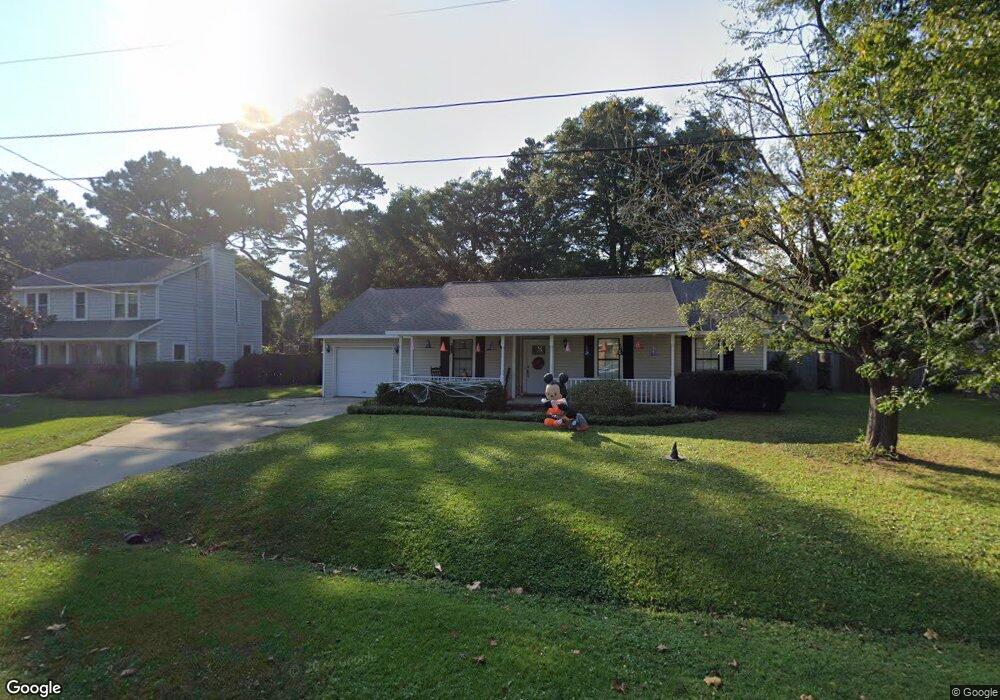
1069 Kingswood Dr Charleston, SC 29412
James Island NeighborhoodEstimated Value: $499,000 - $638,000
3
Beds
2
Baths
1,698
Sq Ft
$333/Sq Ft
Est. Value
About This Home
This home is located at 1069 Kingswood Dr, Charleston, SC 29412 and is currently estimated at $565,935, approximately $333 per square foot. 1069 Kingswood Dr is a home located in Charleston County with nearby schools including James Island Elementary School, Camp Road Middle, and James Island Charter High School.
Ownership History
Date
Name
Owned For
Owner Type
Purchase Details
Closed on
Jul 31, 2012
Sold by
Lannan Joseph A
Bought by
Jordan Caroline R and Bradley Caroline R
Current Estimated Value
Home Financials for this Owner
Home Financials are based on the most recent Mortgage that was taken out on this home.
Original Mortgage
$154,400
Outstanding Balance
$107,362
Interest Rate
3.75%
Mortgage Type
FHA
Estimated Equity
$458,573
Create a Home Valuation Report for This Property
The Home Valuation Report is an in-depth analysis detailing your home's value as well as a comparison with similar homes in the area
Home Values in the Area
Average Home Value in this Area
Purchase History
| Date | Buyer | Sale Price | Title Company |
|---|---|---|---|
| Jordan Caroline R | $160,000 | -- |
Source: Public Records
Mortgage History
| Date | Status | Borrower | Loan Amount |
|---|---|---|---|
| Open | Jordan Caroline R | $154,400 |
Source: Public Records
Tax History Compared to Growth
Tax History
| Year | Tax Paid | Tax Assessment Tax Assessment Total Assessment is a certain percentage of the fair market value that is determined by local assessors to be the total taxable value of land and additions on the property. | Land | Improvement |
|---|---|---|---|---|
| 2024 | $1,095 | $8,460 | $0 | $0 |
| 2023 | $1,095 | $8,460 | $0 | $0 |
| 2022 | $983 | $8,460 | $0 | $0 |
| 2021 | $1,049 | $8,460 | $0 | $0 |
| 2020 | $1,060 | $8,460 | $0 | $0 |
| 2019 | $973 | $7,360 | $0 | $0 |
| 2017 | $2,871 | $11,040 | $0 | $0 |
| 2016 | $2,776 | $11,040 | $0 | $0 |
| 2015 | $2,657 | $11,040 | $0 | $0 |
| 2014 | $2,263 | $0 | $0 | $0 |
| 2011 | -- | $0 | $0 | $0 |
Source: Public Records
Map
Nearby Homes
- 1014 Arborwood Dr
- 1030 Pauline Ave
- 1418 Kentwood Cir
- 1453 Camp Rd
- 1107 Secessionville Rd
- 1137 Rivercrest Dr
- 1135 Bellwood Rd
- 1 S Anderson Ave
- 1402 Camp Rd Unit 5E
- 1402 Camp Rd Unit 6E
- 1402 Camp Rd Unit 1H
- 1402 Camp Rd Unit 8B
- 1402 Camp Rd Unit 9C
- 1402 Camp Rd Unit 12F
- 17 S Anderson Ave Unit A,B,C, D
- 1153 Pauline Ave
- 1047 Bradford Ave
- 1152 Bradford Ave
- 1335 Camp Rd
- 1359 White House Blvd
- 1075 Kingswood Dr
- 1063 Kingswood Dr
- 1038 Arborwood Dr
- 1030 Arborwood Dr
- 1081 Kingswood Dr
- 1057 Kingswood Dr
- 1040 Arborwood Dr
- 1068 Kingswood Dr
- 1062 Kingswood Dr
- 1026 Arborwood Dr
- 1074 Kingswood Dr
- 1056 Kingswood Dr
- 1042 Arborwood Dr
- 1087 Kingswood Dr
- 1080 Kingswood Dr
- 1022 Arborwood Dr
- 1051 Kingswood Dr
- 1063 Renwood Dr
- 1031 Arborwood Dr
- 1035 Arborwood Dr