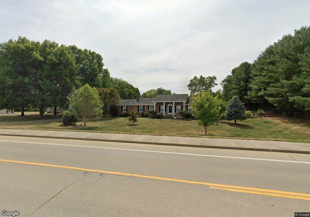
1069 N Bend Rd Hebron, KY 41048
Estimated Value: $364,000 - $426,415
3
Beds
2
Baths
1,680
Sq Ft
$236/Sq Ft
Est. Value
About This Home
This home is located at 1069 N Bend Rd, Hebron, KY 41048 and is currently estimated at $396,854, approximately $236 per square foot. 1069 N Bend Rd is a home located in Boone County with nearby schools including North Pointe Elementary School, Conner Middle School, and Conner High School.
Ownership History
Date
Name
Owned For
Owner Type
Purchase Details
Closed on
Dec 6, 2018
Sold by
Morris Arlene D
Bought by
King Karen Marie and King Christopher Howard
Current Estimated Value
Home Financials for this Owner
Home Financials are based on the most recent Mortgage that was taken out on this home.
Original Mortgage
$313,500
Outstanding Balance
$274,027
Interest Rate
4.8%
Mortgage Type
New Conventional
Estimated Equity
$122,827
Purchase Details
Closed on
Mar 21, 2007
Sold by
Fruge Cory F and Fruge Amanda H
Bought by
Morris Lewis and Morris Arlene D
Purchase Details
Closed on
Dec 11, 1998
Sold by
Mark Summe Trst
Bought by
Kenton County Airport Board
Create a Home Valuation Report for This Property
The Home Valuation Report is an in-depth analysis detailing your home's value as well as a comparison with similar homes in the area
Home Values in the Area
Average Home Value in this Area
Purchase History
| Date | Buyer | Sale Price | Title Company |
|---|---|---|---|
| King Karen Marie | $330,000 | Lawyers Title Of Cincinnati | |
| Morris Lewis | $300,000 | None Available | |
| Kenton County Airport Board | $1,286,753 | -- |
Source: Public Records
Mortgage History
| Date | Status | Borrower | Loan Amount |
|---|---|---|---|
| Open | King Karen Marie | $313,500 |
Source: Public Records
Tax History
| Year | Tax Paid | Tax Assessment Tax Assessment Total Assessment is a certain percentage of the fair market value that is determined by local assessors to be the total taxable value of land and additions on the property. | Land | Improvement |
|---|---|---|---|---|
| 2025 | $3,416 | $365,000 | $40,000 | $325,000 |
| 2024 | $3,021 | $330,000 | $30,000 | $300,000 |
| 2023 | $3,029 | $330,000 | $30,000 | $300,000 |
| 2022 | $3,105 | $330,000 | $30,000 | $300,000 |
| 2021 | $3,176 | $330,000 | $30,000 | $300,000 |
| 2020 | $3,600 | $330,000 | $30,000 | $300,000 |
| 2019 | $3,628 | $330,000 | $30,000 | $300,000 |
| 2018 | $2,914 | $300,000 | $30,000 | $270,000 |
| 2017 | $2,860 | $300,000 | $30,000 | $270,000 |
| 2015 | $2,847 | $300,000 | $0 | $300,000 |
| 2013 | -- | $300,000 | $0 | $300,000 |
Source: Public Records
Map
Nearby Homes
- 909 Surfridge Dr
- 1748 Ledgestone Way
- 1174 Crosspointe Dr
- 1 Rivers Pointe Dr
- 1745 Ledgestone Way
- 2432 Rivers Pointe Dr
- Larimer Square Plan at Rivers Pointe Estates - The Village Collection
- Broadmoor Plan at Rivers Pointe Estates - Courtyard Townhomes
- Lennox Plan at Rivers Pointe Estates - Courtyard Townhomes
- Hampton Plan at Rivers Pointe Estates - Courtyard Townhomes
- Savile Row Plan at Rivers Pointe Estates - The Village Collection
- Orchard Street Plan at Rivers Pointe Estates - The Village Collection
- East Bay Plan at Rivers Pointe Estates - The Village Collection
- Southport Plan at Rivers Pointe Estates - The Village Collection
- Greenbrier Plan at Rivers Pointe Estates - Courtyard Townhomes
- Hoxton Plan at Rivers Pointe Estates - Courtyard Townhomes
- Northport Plan at Rivers Pointe Estates - The Village Collection
- 2453 Rivers Pointe Dr
- Oak Hill Plan at Rivers Pointe Estates - Rivers Pointe Estates - 100'
- BEACHWOOD Plan at Rivers Pointe Estates - Rivers Pointes Villas
- 1047 N Bend Rd
- 1029 Bloomfield Ct
- 1105 N Bend Rd
- 1025 Bloomfield Ct
- 1021 Bloomfield Ct
- 1037 Bloomfield Ct
- 1017 Bloomfield Ct
- 13 Bloomfield Ct
- 3309 Cornerstone Dr
- 1041 Bloomfield Ct
- 900 Surfridge Dr
- 900 Surfridge Dr Unit L16
- 905 Surfridge Dr
- 1013 Bloomfield Ct
- 1026 Bloomfield Ct
- 1030 Bloomfield Ct
- 1022 Bloomfield Ct
- 1085 N Bend Rd
- 1037 N Bend Rd
- 1018 Bloomfield Ct
Your Personal Tour Guide
Ask me questions while you tour the home.