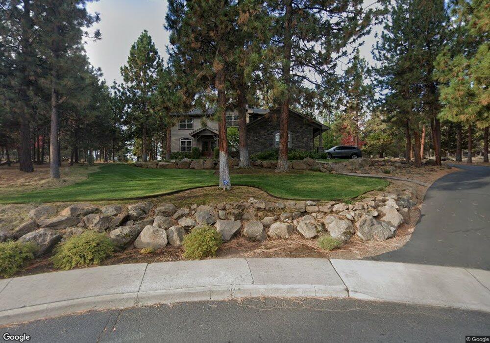
1069 NW Milton Ct Bend, OR 97701
Awbrey Butte NeighborhoodEstimated Value: $1,250,000 - $1,645,000
4
Beds
5
Baths
3,456
Sq Ft
$428/Sq Ft
Est. Value
About This Home
This home is located at 1069 NW Milton Ct, Bend, OR 97701 and is currently estimated at $1,479,461, approximately $428 per square foot. 1069 NW Milton Ct is a home located in Deschutes County with nearby schools including North Star Elementary School, Pacific Crest Middle School, and Summit High School.
Ownership History
Date
Name
Owned For
Owner Type
Purchase Details
Closed on
Jul 6, 2005
Sold by
Chrisman Anne and Chrisman James
Bought by
Chrisman James and Chrisman Anne F
Current Estimated Value
Home Financials for this Owner
Home Financials are based on the most recent Mortgage that was taken out on this home.
Original Mortgage
$326,000
Outstanding Balance
$167,130
Interest Rate
5.58%
Mortgage Type
New Conventional
Estimated Equity
$1,312,331
Purchase Details
Closed on
Feb 25, 2004
Sold by
Marvel Donald F and Marvel Vicki L
Bought by
Chrisman Anne and Chrisman James
Create a Home Valuation Report for This Property
The Home Valuation Report is an in-depth analysis detailing your home's value as well as a comparison with similar homes in the area
Home Values in the Area
Average Home Value in this Area
Purchase History
| Date | Buyer | Sale Price | Title Company |
|---|---|---|---|
| Chrisman James | -- | Western Title & Escrow Co | |
| Chrisman Anne | -- | -- |
Source: Public Records
Mortgage History
| Date | Status | Borrower | Loan Amount |
|---|---|---|---|
| Open | Chrisman James | $326,000 |
Source: Public Records
Tax History
| Year | Tax Paid | Tax Assessment Tax Assessment Total Assessment is a certain percentage of the fair market value that is determined by local assessors to be the total taxable value of land and additions on the property. | Land | Improvement |
|---|---|---|---|---|
| 2025 | $8,201 | $485,400 | -- | -- |
| 2024 | $7,891 | $471,270 | -- | -- |
| 2023 | $7,315 | $457,550 | $0 | $0 |
| 2022 | $6,825 | $431,300 | $0 | $0 |
| 2021 | $6,835 | $418,740 | $0 | $0 |
| 2020 | $6,484 | $418,740 | $0 | $0 |
| 2019 | $6,304 | $406,550 | $0 | $0 |
| 2018 | $6,126 | $394,710 | $0 | $0 |
| 2017 | $5,946 | $383,220 | $0 | $0 |
| 2016 | $5,671 | $372,060 | $0 | $0 |
| 2015 | $5,514 | $361,230 | $0 | $0 |
| 2014 | $5,351 | $350,710 | $0 | $0 |
Source: Public Records
Map
Nearby Homes
- 664 NW Powell Butte Loop
- 3061 NW Jewell Way
- 2616 NW Gill Ct
- 2850 NW Lucus Ct
- 1166 NW Redfield Cir
- 2545 NW Awbrey Rd
- 2975 NW Lucus Ct
- 3057 NW Colonial Dr
- 2980 NW Lucus Ct
- 2903 NW Fairway Heights Dr
- 1627 NW Summit Dr
- 625 NW Compass Ln
- 2580 N West Awbrey Point Cir Unit 1&2
- 520 NW Divot Dr
- 3122 NW Colonial Dr
- 3130 NW Colonial Dr
- 3031 NW Hidden Ridge Dr
- 2984 NW Hidden Ridge Dr
- 3160 NW Colonial Dr
- 1348 NW Vicksburg Ave
- 1047 NW Milton Ct
- 1078 NW Milton Ct
- 2708 NW Pickett Ct
- 1032 NW Milton Ct
- 2676 NW Pickett Ct
- 1025 NW Milton Ct
- 2760 NW Mccook Ct
- 1054 NW Milton Ct
- 2777 NW Mccook Ct
- 2714 NW Pickett Ct
- 1187 NW Promontory Dr
- 2642 NW Pickett Ct
- 2781 NW Mccook Ct
- 2497 N West Wyeth Place
- 1137 NW Clark Ct
- 1123 NW Promontory Dr
- 1029 NW Summit Dr
- 2497 NW Wyeth Place
- 1119 NW Clark Ct
- 1031 NW Summit Dr
Your Personal Tour Guide
Ask me questions while you tour the home.