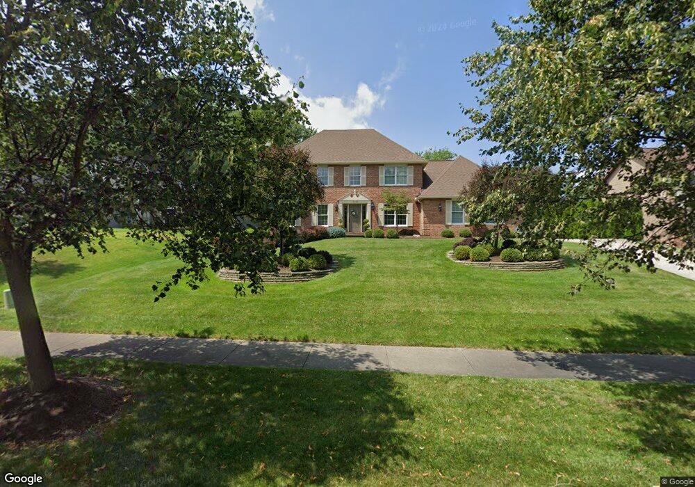
10690 Sherwood Trail North Royalton, OH 44133
Estimated Value: $461,008 - $503,000
4
Beds
4
Baths
2,700
Sq Ft
$178/Sq Ft
Est. Value
About This Home
This home is located at 10690 Sherwood Trail, North Royalton, OH 44133 and is currently estimated at $481,752, approximately $178 per square foot. 10690 Sherwood Trail is a home located in Cuyahoga County with nearby schools including North Royalton Middle School, North Royalton High School, and Saint Albert the Great Roman Catholic School.
Ownership History
Date
Name
Owned For
Owner Type
Purchase Details
Closed on
Jun 26, 2025
Sold by
Grewal Amritpal Singh and Grewal Amritral S
Bought by
Grewal Family Revocable Trust and Grewal
Current Estimated Value
Purchase Details
Closed on
Oct 15, 1999
Sold by
Mcadam Guy
Bought by
Grewal Amritral S and Grewal Baljeet
Home Financials for this Owner
Home Financials are based on the most recent Mortgage that was taken out on this home.
Original Mortgage
$140,593
Interest Rate
8.26%
Mortgage Type
FHA
Purchase Details
Closed on
Jan 12, 1995
Sold by
Poldruhi John
Bought by
Mcadam Guy and Mcadem Wendy Rummell
Home Financials for this Owner
Home Financials are based on the most recent Mortgage that was taken out on this home.
Original Mortgage
$203,000
Interest Rate
9.23%
Purchase Details
Closed on
Jan 1, 1989
Bought by
Poldruhi John and Poldruhi E
Create a Home Valuation Report for This Property
The Home Valuation Report is an in-depth analysis detailing your home's value as well as a comparison with similar homes in the area
Home Values in the Area
Average Home Value in this Area
Purchase History
| Date | Buyer | Sale Price | Title Company |
|---|---|---|---|
| Grewal Family Revocable Trust | -- | None Listed On Document | |
| Grewal Amritral S | $227,500 | Midland Title Security Inc | |
| Mcadam Guy | $235,000 | -- | |
| Poldruhi John | -- | -- |
Source: Public Records
Mortgage History
| Date | Status | Borrower | Loan Amount |
|---|---|---|---|
| Previous Owner | Grewal Amritral S | $140,593 | |
| Previous Owner | Mcadam Guy | $203,000 |
Source: Public Records
Tax History Compared to Growth
Tax History
| Year | Tax Paid | Tax Assessment Tax Assessment Total Assessment is a certain percentage of the fair market value that is determined by local assessors to be the total taxable value of land and additions on the property. | Land | Improvement |
|---|---|---|---|---|
| 2024 | $6,953 | $129,500 | $33,285 | $96,215 |
| 2023 | $6,094 | $105,390 | $30,770 | $74,620 |
| 2022 | $6,079 | $105,390 | $30,770 | $74,620 |
| 2021 | $6,143 | $105,390 | $30,770 | $74,620 |
| 2020 | $6,127 | $100,350 | $29,300 | $71,050 |
| 2019 | $5,948 | $286,700 | $83,700 | $203,000 |
| 2018 | $5,920 | $100,350 | $29,300 | $71,050 |
| 2017 | $5,620 | $90,550 | $23,700 | $66,850 |
| 2016 | $5,830 | $90,550 | $23,700 | $66,850 |
| 2015 | $5,342 | $90,550 | $23,700 | $66,850 |
| 2014 | $5,342 | $82,330 | $21,530 | $60,800 |
Source: Public Records
Map
Nearby Homes
- 5980 Wallings Rd
- 10620 Ridge Rd
- 10628 Devonshire Dr
- 6560 Queens Way
- 10229 State Rd
- 4863 Maple Ln
- 6451 Glenwillow Dr
- 7332 Creekwood Dr Unit 4B
- 12701 Gordon St
- 7595 Margaret Dr
- 7575 Margaret Dr
- 7564 Margaret Dr
- 7574 Margaret Dr
- 7600 Margaret Dr
- 7535 Margaret Dr
- 7585 Margaret Dr
- 7555 Margaret Dr
- 7545 Margaret Dr
- 7554 Margaret Dr
- S/L Margaret Dr
- 10710 Sherwood Trail
- 10680 Sherwood Trail
- 6821 Iron Gate Dr
- 10720 Sherwood Trail
- 10670 Sherwood Trail
- 10701 Sherwood Trail
- 10711 Sherwood Trail
- 10691 Sherwood Trail
- 10721 Sherwood Trail
- 10681 Sherwood Trail
- 6800 Iron Gate Dr
- 6810 Iron Gate Dr
- 10740 Sherwood Trail
- 10731 Sherwood Trail
- 10671 Sherwood Trail
- 6820 Iron Gate Dr
- 11359 Ridge Rd
- 11241 Ridge Rd
- 11255 Ridge Rd
- 10741 Sherwood Trail