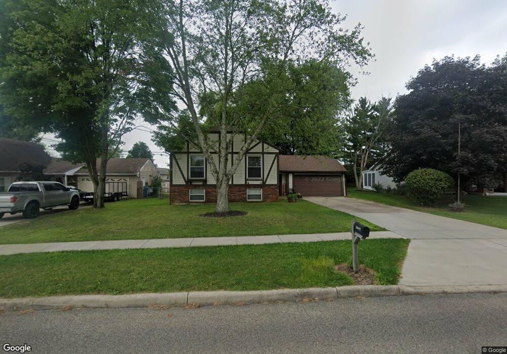
10691 West Rd Harrison, OH 45030
Estimated Value: $281,000 - $340,000
2
Beds
2
Baths
2,388
Sq Ft
$129/Sq Ft
Est. Value
About This Home
This home is located at 10691 West Rd, Harrison, OH 45030 and is currently estimated at $308,349, approximately $129 per square foot. 10691 West Rd is a home located in Hamilton County with nearby schools including William Henry Harrison High School, St. John The Baptist School, and Summit Academy of Southwest Ohio.
Ownership History
Date
Name
Owned For
Owner Type
Purchase Details
Closed on
Feb 3, 2004
Sold by
Noble Brian L and Noble Brian M
Bought by
Noble Brian L and Noble Pamela M
Current Estimated Value
Purchase Details
Closed on
Jul 27, 2001
Sold by
Hoerst Richard T and Hoerst Carol A
Bought by
Noble Brian M
Home Financials for this Owner
Home Financials are based on the most recent Mortgage that was taken out on this home.
Original Mortgage
$123,900
Outstanding Balance
$48,296
Interest Rate
7.14%
Estimated Equity
$260,053
Create a Home Valuation Report for This Property
The Home Valuation Report is an in-depth analysis detailing your home's value as well as a comparison with similar homes in the area
Home Values in the Area
Average Home Value in this Area
Purchase History
| Date | Buyer | Sale Price | Title Company |
|---|---|---|---|
| Noble Brian L | -- | Premier Title Services Inc | |
| Noble Brian M | $123,900 | -- |
Source: Public Records
Mortgage History
| Date | Status | Borrower | Loan Amount |
|---|---|---|---|
| Open | Noble Brian M | $123,900 |
Source: Public Records
Tax History Compared to Growth
Tax History
| Year | Tax Paid | Tax Assessment Tax Assessment Total Assessment is a certain percentage of the fair market value that is determined by local assessors to be the total taxable value of land and additions on the property. | Land | Improvement |
|---|---|---|---|---|
| 2024 | $3,250 | $73,129 | $12,740 | $60,389 |
| 2023 | $3,278 | $73,129 | $12,740 | $60,389 |
| 2022 | $2,544 | $49,700 | $11,172 | $38,528 |
| 2021 | $2,515 | $49,700 | $11,172 | $38,528 |
| 2020 | $2,545 | $49,700 | $11,172 | $38,528 |
| 2019 | $2,334 | $43,596 | $9,800 | $33,796 |
| 2018 | $2,347 | $43,596 | $9,800 | $33,796 |
| 2017 | $2,214 | $43,596 | $9,800 | $33,796 |
| 2016 | $2,019 | $43,033 | $8,883 | $34,150 |
| 2015 | $2,043 | $43,033 | $8,883 | $34,150 |
| 2014 | $1,947 | $43,033 | $8,883 | $34,150 |
| 2013 | $2,002 | $43,911 | $9,065 | $34,846 |
Source: Public Records
Map
Nearby Homes
- 10701 Stone Ridge Way
- 10612 Winding Way Dr
- 620 Wood Bluff Ln
- 10805 Stone Ridge Way Unit 16
- 10884 West Rd
- 576 Heritage Square
- 0 Campbell Rd Unit 1732658
- 0 Campbell Rd Unit 1729767
- 0 Campbell Rd Unit 1708716
- 623 Deerfield Dr
- 122 Hopping Ct
- 108 Carrie Dr
- 153 Country View Dr
- 314 Country View Dr
- 449 Featherwood Dr
- 328 Weathervane Ln
- 117 Westfield Dr
- 135 Turner Ridge Dr
- 133 Turner Ridge Dr
- 331 Miller Ct
- 10699 West Rd
- 10683 West Rd
- 10706 West Rd
- 10713 Stone Ridge Way
- 10703 Stone Ridge Way
- 10712 West Rd
- 10663 West Rd
- 10715 Stone Ridge Way
- 10661 West Rd
- 1418 Stone Dr
- 10702 Stone Ridge Way
- 10703 West Rd
- 10711 Stone Ridge Way
- 10707 Stone Ridge Way
- 1417 Stone Dr
- 10704 Stone Ridge Way
- 10717 Stone Ridge Way
- 10711 West Rd
- 10626 West Rd
- 10726 West Rd