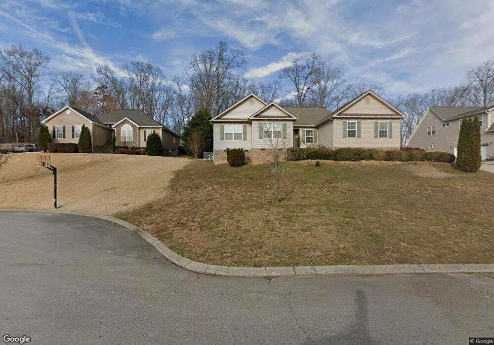
10697 Thatcher Crest Dr Unit 39 Soddy Daisy, TN 37379
Estimated Value: $312,000 - $486,000
--
Bed
2
Baths
1,912
Sq Ft
$210/Sq Ft
Est. Value
About This Home
This home is located at 10697 Thatcher Crest Dr Unit 39, Soddy Daisy, TN 37379 and is currently estimated at $401,215, approximately $209 per square foot. 10697 Thatcher Crest Dr Unit 39 is a home located in Hamilton County.
Ownership History
Date
Name
Owned For
Owner Type
Purchase Details
Closed on
Jan 27, 2023
Sold by
Jacobs Kendall
Bought by
Jacobs-Bowes Whitney N and Bowes Dustin T
Current Estimated Value
Home Financials for this Owner
Home Financials are based on the most recent Mortgage that was taken out on this home.
Original Mortgage
$194,000
Outstanding Balance
$187,690
Interest Rate
6.13%
Mortgage Type
New Conventional
Estimated Equity
$213,525
Purchase Details
Closed on
Nov 1, 2013
Sold by
Deprow George S and Deprow Rhonda W
Bought by
Jacobs Kendall and Jacobs Whitney
Home Financials for this Owner
Home Financials are based on the most recent Mortgage that was taken out on this home.
Original Mortgage
$189,525
Interest Rate
4.52%
Mortgage Type
New Conventional
Purchase Details
Closed on
Dec 18, 2009
Sold by
Merriman Michael E
Bought by
Deprow George S and Deprow Rhonda W
Home Financials for this Owner
Home Financials are based on the most recent Mortgage that was taken out on this home.
Original Mortgage
$148,400
Interest Rate
4.92%
Mortgage Type
New Conventional
Purchase Details
Closed on
Jan 11, 2008
Sold by
Bates Laura and Higgins Myra
Bought by
Merriman Michael E
Create a Home Valuation Report for This Property
The Home Valuation Report is an in-depth analysis detailing your home's value as well as a comparison with similar homes in the area
Home Values in the Area
Average Home Value in this Area
Purchase History
| Date | Buyer | Sale Price | Title Company |
|---|---|---|---|
| Jacobs-Bowes Whitney N | -- | None Listed On Document | |
| Jacobs Kendall | $199,500 | Lenders Title And Escrow Llc | |
| Deprow George S | $185,500 | Chattanooga Title Inc | |
| Merriman Michael E | -- | None Available |
Source: Public Records
Mortgage History
| Date | Status | Borrower | Loan Amount |
|---|---|---|---|
| Open | Jacobs-Bowes Whitney N | $194,000 | |
| Previous Owner | Jacobs Kendall | $189,525 | |
| Previous Owner | Deprow George S | $148,400 |
Source: Public Records
Tax History Compared to Growth
Tax History
| Year | Tax Paid | Tax Assessment Tax Assessment Total Assessment is a certain percentage of the fair market value that is determined by local assessors to be the total taxable value of land and additions on the property. | Land | Improvement |
|---|---|---|---|---|
| 2024 | $1,562 | $69,800 | $0 | $0 |
| 2023 | $1,571 | $69,800 | $0 | $0 |
| 2022 | $1,571 | $69,800 | $0 | $0 |
| 2021 | $1,571 | $69,800 | $0 | $0 |
| 2020 | $1,510 | $54,275 | $0 | $0 |
| 2019 | $1,510 | $54,275 | $0 | $0 |
| 2018 | $1,510 | $54,275 | $0 | $0 |
| 2017 | $1,510 | $54,275 | $0 | $0 |
| 2016 | $1,282 | $0 | $0 | $0 |
| 2015 | $1,282 | $46,050 | $0 | $0 |
| 2014 | $1,282 | $0 | $0 | $0 |
Source: Public Records
Map
Nearby Homes
- 1524 Green Pond Rd
- 10224 Tommys Ln
- 10496 Sovereign Pointe Dr
- 10627 Jeneva Ln
- 10428 Jeneva Ln
- 1230 Green Pond Rd
- 1270 Jacob Dr
- 1008 Trojan Run Dr
- 11036 High River Dr
- 10947 High River Dr
- 11015 High River Dr
- 2110 Autumn River Dr
- 1055 Apollo Dr
- 10166 Hunters Hollow Dr
- 10160 Hunters Hollow Dr
- 2137 Autumn River Dr
- 1724 Magnum Ln
- 1052 Trojan Run Dr
- 10041 Rolling Wind Dr
- 2338 Stonesage Rd
- 10697 Thatcher Crest Dr
- 10683 Thatcher Crest Dr
- 10711 Thatcher Crest Dr
- 10711 Thatcher Crest Dr Unit 40
- 10725 Thatcher Crest Dr
- 10665 Thatcher Crest Dr
- 10696 Thatcher Crest Dr
- 10718 Thatcher Crest Dr
- 1616 Thatcher Rd
- 10749 Thatcher Crest Dr
- 10740 Thatcher Crest Dr
- 10773 Thatcher Crest Dr
- 10754 Thatcher Crest Dr
- 10768 Thatcher Crest Dr
- 10768 Thatcher Crest Dr Unit 31
- 10782 Thatcher Crest Dr
- 10796 Thatcher Crest Dr
- 10823 Thatcher Crest Dr
- 10824 Thatcher Crest Dr
- 10824 Thatcher Crest Dr Unit 27