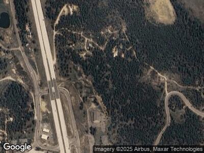
10698 Us Highway 285 Conifer, CO 80433
Pleasant Park Corridor NeighborhoodEstimated Value: $1,938,428
3
Beds
1
Bath
1,168
Sq Ft
$1,660/Sq Ft
Est. Value
About This Home
This home is located at 10698 Us Highway 285, Conifer, CO 80433 and is currently estimated at $1,938,428, approximately $1,659 per square foot. 10698 Us Highway 285 is a home located in Jefferson County with nearby schools including West Jefferson Elementary School, West Jefferson Middle School, and Conifer Senior High School.
Ownership History
Date
Name
Owned For
Owner Type
Purchase Details
Closed on
Mar 30, 2005
Sold by
Kunz Clarence and Kunz Gladys L
Bought by
Williams Development Llc
Current Estimated Value
Home Financials for this Owner
Home Financials are based on the most recent Mortgage that was taken out on this home.
Original Mortgage
$637,500
Interest Rate
7%
Mortgage Type
Unknown
Purchase Details
Closed on
Feb 28, 2000
Sold by
Trustee Kunz Clarence Trustee Kunz Gladys
Bought by
Department Of Transportation State Of Co
Create a Home Valuation Report for This Property
The Home Valuation Report is an in-depth analysis detailing your home's value as well as a comparison with similar homes in the area
Home Values in the Area
Average Home Value in this Area
Purchase History
| Date | Buyer | Sale Price | Title Company |
|---|---|---|---|
| Williams Development Llc | $750,000 | Security Title | |
| Department Of Transportation State Of Co | $301,730 | -- |
Source: Public Records
Mortgage History
| Date | Status | Borrower | Loan Amount |
|---|---|---|---|
| Closed | Williams Development Llc | $637,500 |
Source: Public Records
Tax History Compared to Growth
Tax History
| Year | Tax Paid | Tax Assessment Tax Assessment Total Assessment is a certain percentage of the fair market value that is determined by local assessors to be the total taxable value of land and additions on the property. | Land | Improvement |
|---|---|---|---|---|
| 2024 | $18,542 | $214,122 | $214,122 | -- |
| 2023 | $18,542 | $214,122 | $214,122 | $0 |
| 2022 | $17,989 | $203,615 | $203,615 | $0 |
| 2021 | $17,724 | $203,615 | $203,615 | $0 |
| 2020 | $17,671 | $203,615 | $203,615 | $0 |
| 2019 | $17,081 | $203,615 | $203,615 | $0 |
| 2018 | $16,861 | $202,115 | $202,115 | $0 |
| 2017 | $15,252 | $202,115 | $202,115 | $0 |
| 2016 | $14,836 | $183,164 | $183,164 | $0 |
| 2015 | $11,448 | $183,164 | $183,164 | $0 |
| 2014 | $11,448 | $132,095 | $132,095 | $0 |
Source: Public Records
Map
Nearby Homes
- 26349 Pleasant Park Rd
- 26764 Rascal Ln
- 26824 Rascal Ln
- 10550 Highway 73
- 10786 Marclif Rd
- 10178 Hutch Ln
- 0 S Foxton Rd Unit REC2666841
- 10250 Highway 73
- 26196 Rea Ave
- 26063 Morris Ave
- 27652 Shadow Mountain Dr
- 27802 Shadow Mountain Dr
- 0 Tallberg Ln Unit REC3294718
- 24927 Agate Ave
- 28192 Shadow Mountain Dr
- 11421 Belle Meade Dr
- 27271 Log Trail
- 27987 Pine Grove Trail
- 27231 Log Trail
- 0 Unknown Unit REC3630528
- 10698 Us Highway 285
- 10676 Us Highway 285
- 10686 Us Highway 285
- 26339 Pleasant Park Rd
- 10666 Us Highway 285
- 26343 Pleasant Park Rd
- 10674 Us Highway 285
- 26359 Pleasant Park Rd
- 10662 Us Highway 285
- 26379 Pleasant Park Rd
- 10661 Us Hwy 285
- 0 Us Hwy 285
- 10598 Us Highway 285
- 10654 Us Highway 285
- 0000 Annas Dr
- 10692 Us Highway 285
- 0 S 285 Hwy Unit 825080
- 10821 Highway 73
- 26764 R Ln
- 10831 Highway 73
