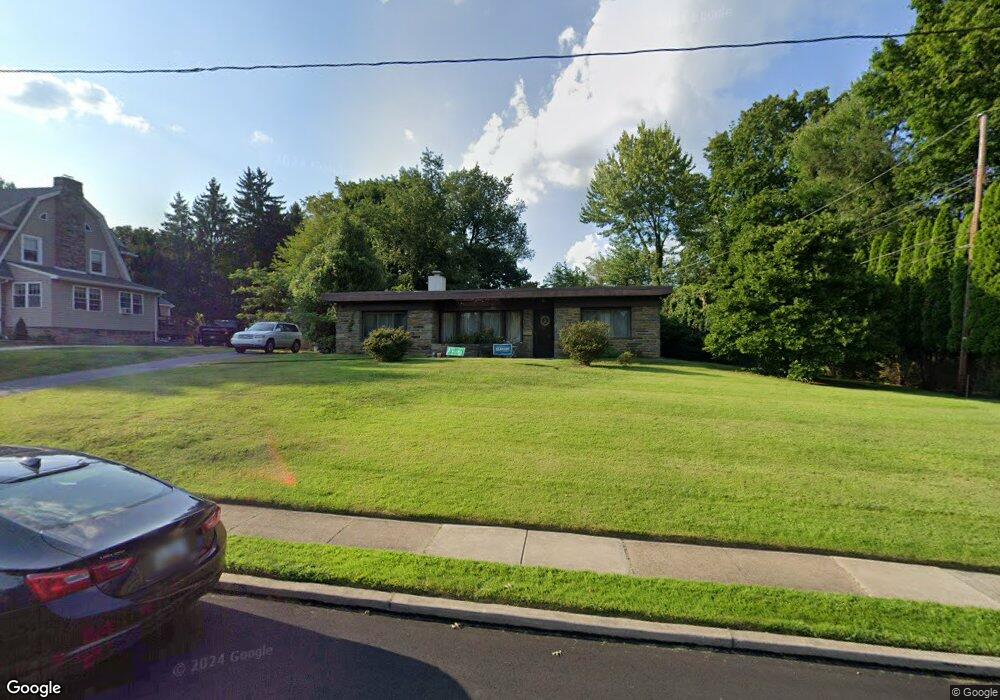
107 Broadview Rd Springfield, PA 19064
Estimated Value: $442,000 - $539,000
2
Beds
2
Baths
1,464
Sq Ft
$329/Sq Ft
Est. Value
About This Home
This home is located at 107 Broadview Rd, Springfield, PA 19064 and is currently estimated at $481,571, approximately $328 per square foot. 107 Broadview Rd is a home located in Delaware County with nearby schools including Springfield High School, St Francis Of Assisi School, and Holy Cross School.
Ownership History
Date
Name
Owned For
Owner Type
Purchase Details
Closed on
Sep 27, 2018
Sold by
Ziff Robert Green and Estate Of Margaret Morrow Ziff
Bought by
Ziff Tina Marie
Current Estimated Value
Purchase Details
Closed on
Oct 3, 2008
Sold by
Worrell James C and Worrell Christine M
Bought by
Ziff Morrow
Purchase Details
Closed on
May 6, 2002
Sold by
Cooper Arnold Warren and Cooper Barbara
Bought by
Worrell James C and Worrell Christine M
Home Financials for this Owner
Home Financials are based on the most recent Mortgage that was taken out on this home.
Original Mortgage
$139,200
Interest Rate
7.15%
Mortgage Type
Purchase Money Mortgage
Create a Home Valuation Report for This Property
The Home Valuation Report is an in-depth analysis detailing your home's value as well as a comparison with similar homes in the area
Home Values in the Area
Average Home Value in this Area
Purchase History
| Date | Buyer | Sale Price | Title Company |
|---|---|---|---|
| Ziff Tina Marie | -- | None Available | |
| Ziff Morrow | $223,000 | None Available | |
| Worrell James C | $174,000 | T A Title Insurance Company |
Source: Public Records
Mortgage History
| Date | Status | Borrower | Loan Amount |
|---|---|---|---|
| Previous Owner | Worrell James C | $139,200 | |
| Closed | Worrell James C | $17,400 |
Source: Public Records
Tax History
| Year | Tax Paid | Tax Assessment Tax Assessment Total Assessment is a certain percentage of the fair market value that is determined by local assessors to be the total taxable value of land and additions on the property. | Land | Improvement |
|---|---|---|---|---|
| 2025 | $7,808 | $277,780 | $124,730 | $153,050 |
| 2024 | $7,808 | $277,780 | $124,730 | $153,050 |
| 2023 | $7,518 | $277,780 | $124,730 | $153,050 |
| 2022 | $7,355 | $277,780 | $124,730 | $153,050 |
| 2021 | $11,391 | $277,780 | $124,730 | $153,050 |
| 2020 | $5,824 | $128,530 | $57,200 | $71,330 |
| 2019 | $5,688 | $128,530 | $57,200 | $71,330 |
| 2018 | $5,606 | $128,530 | $0 | $0 |
| 2017 | $5,476 | $128,530 | $0 | $0 |
| 2016 | $720 | $128,530 | $0 | $0 |
| 2015 | $720 | $128,530 | $0 | $0 |
| 2014 | $720 | $128,530 | $0 | $0 |
Source: Public Records
Map
Nearby Homes
- 412 N Rolling Rd
- 220 N Rolling Rd
- 68 Pilgrim Ln
- 4938 State Rd
- 4928 State Rd
- 501 Flora Cir
- 173 Hillview Dr
- 29 School Ln
- 114 Pilgrim Ln
- 736 Timber Trail Ln
- 120 W Springfield Rd
- 34 Schuyler Rd
- 472 Larchwood Rd
- 5032 Marvine Ave
- 908 Roberts Ave
- 842 Alexander Ave
- 837 Alexander Ave
- 606 W Springfield Rd
- 4400 School Ln
- 226 Lynbrooke Rd
- 115 Broadview Rd
- 121 Broadview Rd
- 400 N Rolling Rd
- 112 Broadview Rd
- 430 N Rolling Rd
- 106 Broadview Rd
- 118 Broadview Rd
- 127 Broadview Rd
- 358 N Rolling Rd
- 124 Broadview Rd
- 133 Broadview Rd
- 436 N Rolling Rd
- 477 N State Rd
- 417 N Rolling Rd
- 411 N Rolling Rd
- 401 N Rolling Rd
- 429 N Rolling Rd
- 100 Broadview Rd
- 465 N State Rd
- 139 Broadview Rd
Your Personal Tour Guide
Ask me questions while you tour the home.