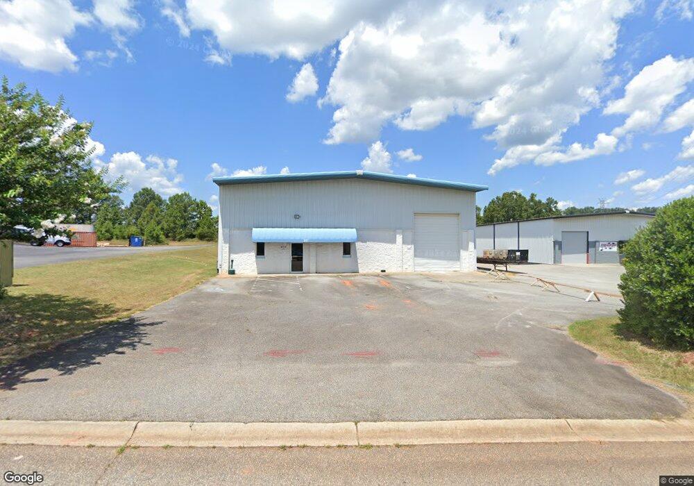
107 C-9-150a Anderson, SC 29625
Estimated Value: $499,341
--
Bed
--
Bath
6,042
Sq Ft
$83/Sq Ft
Est. Value
About This Home
This home is located at 107 C-9-150a, Anderson, SC 29625 and is currently estimated at $499,341, approximately $82 per square foot. 107 C-9-150a is a home located in Anderson County with nearby schools including Whitehall Elementary School, Westside High School, and Anderson Institute of Technology.
Ownership History
Date
Name
Owned For
Owner Type
Purchase Details
Closed on
Nov 8, 2023
Sold by
Dcd Property Holdings Llc
Bought by
Dt & Lt Properties Llc
Current Estimated Value
Home Financials for this Owner
Home Financials are based on the most recent Mortgage that was taken out on this home.
Original Mortgage
$382,500
Outstanding Balance
$376,580
Interest Rate
7.31%
Mortgage Type
Credit Line Revolving
Estimated Equity
$122,761
Purchase Details
Closed on
Jun 9, 2023
Sold by
Mcts Llc
Bought by
Dcd Property Holdings Llc
Home Financials for this Owner
Home Financials are based on the most recent Mortgage that was taken out on this home.
Original Mortgage
$424,516
Interest Rate
6.43%
Mortgage Type
New Conventional
Create a Home Valuation Report for This Property
The Home Valuation Report is an in-depth analysis detailing your home's value as well as a comparison with similar homes in the area
Home Values in the Area
Average Home Value in this Area
Purchase History
| Date | Buyer | Sale Price | Title Company |
|---|---|---|---|
| Dt & Lt Properties Llc | $450,000 | None Listed On Document | |
| Dcd Property Holdings Llc | $422,000 | None Listed On Document |
Source: Public Records
Mortgage History
| Date | Status | Borrower | Loan Amount |
|---|---|---|---|
| Open | Dt & Lt Properties Llc | $382,500 | |
| Previous Owner | Dcd Property Holdings Llc | $424,516 |
Source: Public Records
Tax History Compared to Growth
Tax History
| Year | Tax Paid | Tax Assessment Tax Assessment Total Assessment is a certain percentage of the fair market value that is determined by local assessors to be the total taxable value of land and additions on the property. | Land | Improvement |
|---|---|---|---|---|
| 2024 | $4,508 | $26,940 | $4,440 | $22,500 |
| 2023 | $4,508 | $15,440 | $4,440 | $11,000 |
| 2022 | $4,400 | $15,440 | $4,440 | $11,000 |
| 2021 | $3,985 | $13,500 | $4,440 | $9,060 |
| 2020 | $5,057 | $17,030 | $4,440 | $12,590 |
| 2019 | $5,057 | $17,030 | $4,440 | $12,590 |
| 2018 | $4,988 | $17,030 | $4,440 | $12,590 |
| 2017 | -- | $17,030 | $4,440 | $12,590 |
| 2016 | $4,576 | $16,020 | $4,030 | $11,990 |
| 2015 | $4,623 | $16,020 | $4,030 | $11,990 |
| 2014 | $4,555 | $16,020 | $4,030 | $11,990 |
Source: Public Records
Map
Nearby Homes
- 309 Hembree Rd
- 8 Rivanna Dr
- 216 Maplewood Rd
- 401 Phil Watson Rd
- 505 Brookgreen Ct
- 185 Norfolk Cir
- 2904 Birch St
- 211 Phil Watson Rd
- 408 Greenbriar Ln
- 3406 Dixon Rd
- 00 Martin Luther King jr Blvd
- 4115 Liberty Hwy
- 301 Woodlake Rd
- 207 Ashwood Ln
- 4214 Hembree Creek Rd
- 105-107 Independence Path
- 705 Whitehall Rd
- 212 Middleton Shores Dr
- 500 Whitehall Rd
- 100 Featherfilled Ct
- 112 C-9-150a
- 620 McGee Rd
- 624 McGee Rd
- 636 McGee Rd
- 111 Metro Dr
- 112 Metro Dr Unit A
- 112 Metro Dr
- 1716 Pearman Dairy Rd Unit A
- 1716 Pearman Dairy Rd Unit H
- 1716 Pearman Dairy Rd Unit F
- 1716 Pearman Dairy Rd Unit D/E
- 1716 Pearman Dairy Rd
- 109 C-9-382
- 609 McGee Rd
- 501 Camson Rd
- 1688 Pearman Dairy Rd
- 1711 Pearman Dairy Rd
- 1715 Pearman Dairy Rd
- 101 C-9-382
- 102 C-9-382