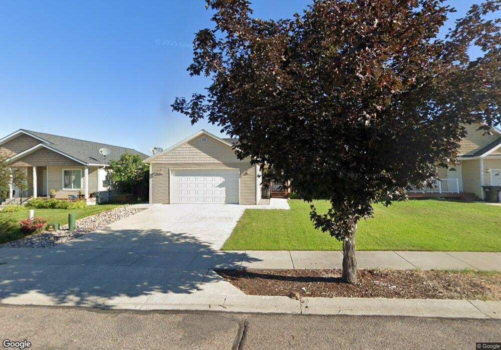
107 Cally Ln Kalispell, MT 59901
Estimated Value: $494,000 - $545,000
3
Beds
2
Baths
1,566
Sq Ft
$325/Sq Ft
Est. Value
About This Home
This home is located at 107 Cally Ln, Kalispell, MT 59901 and is currently estimated at $508,786, approximately $324 per square foot. 107 Cally Ln is a home located in Flathead County with nearby schools including West Valley Elementary School, West Valley Middle School, and Glacier High School.
Ownership History
Date
Name
Owned For
Owner Type
Purchase Details
Closed on
Aug 10, 2020
Sold by
Rodriguez Lois M
Bought by
Vigallon Sonny
Current Estimated Value
Purchase Details
Closed on
May 7, 2015
Sold by
Rodriguez Lois M and Marie V Rodriguez Revocable Tr
Bought by
Rodriguez Lois M
Purchase Details
Closed on
Apr 29, 2008
Sold by
Rodriguez Marie V and Rodriguez Lois M
Bought by
Rodriguez Marie V and Marie V Rodriguez Revocable Tr
Purchase Details
Closed on
May 23, 2006
Sold by
Eagles Nest Construction Llc
Bought by
Robriguez Marie V
Purchase Details
Closed on
Oct 4, 2005
Sold by
Slivers Andrews H and Siklvers Tricia L
Bought by
Eagle Nest Construction Llc
Home Financials for this Owner
Home Financials are based on the most recent Mortgage that was taken out on this home.
Original Mortgage
$128,500
Interest Rate
7%
Mortgage Type
Construction
Create a Home Valuation Report for This Property
The Home Valuation Report is an in-depth analysis detailing your home's value as well as a comparison with similar homes in the area
Purchase History
| Date | Buyer | Sale Price | Title Company |
|---|---|---|---|
| Vigallon Sonny | -- | None Available | |
| Rodriguez Lois M | -- | None Available | |
| Rodriguez Marie V | -- | None Available | |
| Robriguez Marie V | -- | Flathead County Title Comp | |
| Eagle Nest Construction Llc | -- | Citizens Title And Escrow Co |
Source: Public Records
Mortgage History
| Date | Status | Borrower | Loan Amount |
|---|---|---|---|
| Previous Owner | Eagle Nest Construction Llc | $128,500 |
Source: Public Records
Tax History
| Year | Tax Paid | Tax Assessment Tax Assessment Total Assessment is a certain percentage of the fair market value that is determined by local assessors to be the total taxable value of land and additions on the property. | Land | Improvement |
|---|---|---|---|---|
| 2025 | $931 | $503,200 | $0 | $0 |
| 2024 | $1,247 | $453,100 | $0 | $0 |
| 2023 | $2,684 | $453,100 | $0 | $0 |
| 2022 | $1,955 | $333,100 | $0 | $0 |
| 2021 | $1,941 | $333,100 | $0 | $0 |
| 2020 | $1,619 | $284,200 | $0 | $0 |
| 2019 | $1,599 | $284,200 | $0 | $0 |
| 2018 | $1,360 | $255,100 | $0 | $0 |
| 2017 | $1,357 | $255,100 | $0 | $0 |
| 2016 | $1,016 | $228,600 | $0 | $0 |
| 2015 | $1,019 | $228,600 | $0 | $0 |
| 2014 | $1,105 | $125,981 | $0 | $0 |
Source: Public Records
Map
Nearby Homes
- 38 Vanderbilt Dr
- 17 Empire Loop
- 63 Empire Loop
- 90 Empire Loop
- 287 Kara Dr
- 240 Kara Dr
- 408 Needlegrass Ln
- 417 Needlegrass Ln
- 224 Kara Dr
- 210 Kara Dr
- 433 Needlegrass Ln
- 174 Empire Loop
- 140 Barron Way
- 412 Needlegrass Ln
- 424 Needlegrass Ln
- 249 Three Mile Dr
- 420 Needlegrass Ln
- 429 Needlegrass Ln
- 255 Triple Creek Dr
- 119 Barron Way
Your Personal Tour Guide
Ask me questions while you tour the home.