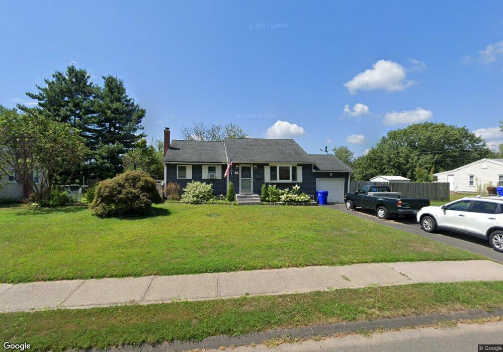
107 Cornell Dr Enfield, CT 06082
Estimated Value: $302,000 - $332,000
3
Beds
2
Baths
1,052
Sq Ft
$303/Sq Ft
Est. Value
About This Home
This home is located at 107 Cornell Dr, Enfield, CT 06082 and is currently estimated at $319,114, approximately $303 per square foot. 107 Cornell Dr is a home located in Hartford County with nearby schools including Nathan Hale Elementary School, Eli Whitney Elementary School, and Enfield High School.
Ownership History
Date
Name
Owned For
Owner Type
Purchase Details
Closed on
Dec 31, 2001
Sold by
Zeineddine Rafat
Bought by
Merrill Michael and Merrill Paula
Current Estimated Value
Purchase Details
Closed on
Apr 24, 1998
Sold by
Household Bank
Bought by
Zeineddine Rafat
Purchase Details
Closed on
Aug 22, 1989
Sold by
Markoski Elizabeth
Bought by
Romanowski Eugeniusz
Create a Home Valuation Report for This Property
The Home Valuation Report is an in-depth analysis detailing your home's value as well as a comparison with similar homes in the area
Home Values in the Area
Average Home Value in this Area
Purchase History
| Date | Buyer | Sale Price | Title Company |
|---|---|---|---|
| Merrill Michael | $145,000 | -- | |
| Zeineddine Rafat | $112,000 | -- | |
| Romanowski Eugeniusz | $139,000 | -- |
Source: Public Records
Mortgage History
| Date | Status | Borrower | Loan Amount |
|---|---|---|---|
| Open | Romanowski Eugeniusz | $124,000 | |
| Closed | Romanowski Eugeniusz | $45,000 | |
| Closed | Romanowski Eugeniusz | $40,000 |
Source: Public Records
Tax History
| Year | Tax Paid | Tax Assessment Tax Assessment Total Assessment is a certain percentage of the fair market value that is determined by local assessors to be the total taxable value of land and additions on the property. | Land | Improvement |
|---|---|---|---|---|
| 2025 | $5,139 | $146,400 | $56,600 | $89,800 |
| 2024 | $4,950 | $146,400 | $56,600 | $89,800 |
| 2023 | $4,913 | $146,400 | $56,600 | $89,800 |
| 2022 | $4,522 | $146,400 | $56,600 | $89,800 |
| 2021 | $4,476 | $119,140 | $46,890 | $72,250 |
| 2020 | $4,446 | $119,140 | $46,890 | $72,250 |
| 2019 | $4,440 | $119,140 | $46,890 | $72,250 |
| 2018 | $4,321 | $119,140 | $46,890 | $72,250 |
| 2017 | $4,060 | $119,140 | $46,890 | $72,250 |
| 2016 | $3,807 | $114,110 | $48,110 | $66,000 |
| 2015 | $2,046 | $114,110 | $48,110 | $66,000 |
| 2014 | $3,598 | $114,110 | $48,110 | $66,000 |
Source: Public Records
Map
Nearby Homes
- 99 Cornell Dr
- 115 Cornell Dr
- 112 Cornell Dr
- 104 Cornell Dr
- 120 Cornell Dr
- 123 Cornell Dr
- 146 Columbia Rd
- 91 Cornell Dr
- 96 Cornell Dr
- 154 Columbia Rd
- 138 Columbia Rd
- 128 Cornell Dr
- 130 Columbia Rd
- 162 Columbia Rd
- 88 Cornell Dr
- 83 Cornell Dr
- 149 Columbia Rd
- 131 Cornell Dr
- 141 Columbia Rd
- 157 Columbia Rd
Your Personal Tour Guide
Ask me questions while you tour the home.