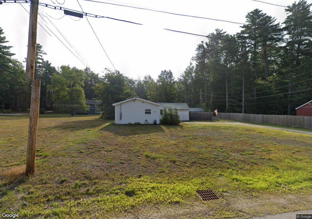
107 Depot Rd North Conway, NH 03860
Estimated Value: $358,728 - $479,000
3
Beds
3
Baths
1,433
Sq Ft
$306/Sq Ft
Est. Value
About This Home
This home is located at 107 Depot Rd, North Conway, NH 03860 and is currently estimated at $438,182, approximately $305 per square foot. 107 Depot Rd is a home located in Carroll County with nearby schools including A. Crosby Kennett Middle School, Kennett High School, and The Lilliputian School.
Ownership History
Date
Name
Owned For
Owner Type
Purchase Details
Closed on
Jun 17, 2005
Sold by
Blanchard White Carole
Bought by
Murray Michael C
Current Estimated Value
Home Financials for this Owner
Home Financials are based on the most recent Mortgage that was taken out on this home.
Original Mortgage
$85,000
Outstanding Balance
$44,432
Interest Rate
5.78%
Mortgage Type
Purchase Money Mortgage
Estimated Equity
$393,750
Create a Home Valuation Report for This Property
The Home Valuation Report is an in-depth analysis detailing your home's value as well as a comparison with similar homes in the area
Home Values in the Area
Average Home Value in this Area
Purchase History
| Date | Buyer | Sale Price | Title Company |
|---|---|---|---|
| Murray Michael C | $134,500 | -- |
Source: Public Records
Mortgage History
| Date | Status | Borrower | Loan Amount |
|---|---|---|---|
| Open | Murray Michael C | $85,000 |
Source: Public Records
Tax History Compared to Growth
Tax History
| Year | Tax Paid | Tax Assessment Tax Assessment Total Assessment is a certain percentage of the fair market value that is determined by local assessors to be the total taxable value of land and additions on the property. | Land | Improvement |
|---|---|---|---|---|
| 2024 | $3,399 | $269,800 | $124,800 | $145,000 |
| 2023 | $3,092 | $269,800 | $124,800 | $145,000 |
| 2022 | $2,445 | $127,500 | $57,800 | $69,700 |
| 2021 | $2,083 | $127,500 | $57,800 | $69,700 |
| 2020 | $2,380 | $127,500 | $57,800 | $69,700 |
| 2019 | $2,208 | $127,500 | $57,800 | $69,700 |
| 2018 | $1,972 | $89,100 | $33,300 | $55,800 |
| 2017 | $1,786 | $89,400 | $33,300 | $56,100 |
| 2016 | $1,726 | $89,400 | $33,300 | $56,100 |
| 2015 | $1,707 | $89,400 | $33,300 | $56,100 |
| 2014 | $1,686 | $89,400 | $33,300 | $56,100 |
| 2013 | $1,597 | $89,400 | $33,300 | $56,100 |
Source: Public Records
Map
Nearby Homes
- 00 Artist Falls Rd
- 00 White Mountain Hwy
- 11 Black Diamond Rd Unit 3
- 7 Black Diamond Rd Unit 2
- 137 Skimobile Rd Unit 3
- 2760 New Hampshire 16 Unit E008A Week 29
- 15 Black Diamond Rd Unit 4
- 243 Skimobile Rd Unit 352
- 243 Skimobile Rd Unit 252
- 243 Skimobile Rd Unit 355
- 243 Skimobile Rd Unit 255
- 235 Skimobile Rd Unit 1404
- 239 Skimobile Rd Unit 314
- 239 Skimobile Rd Unit 305
- 239 Skimobile Rd Unit 304
- 2906 White Mountain Hwy
- 168 Old Bartlett Rd Unit A
- 85 Amethyst Hill Rd
- 2955 White Mountain Hwy Unit 106 (W5)
- 2955 White Mountain Hwy Unit 123 (E20)
- 115 Depot Rd
- 93 Depot Rd
- 117 Depot Rd
- 102 Depot Rd
- 94 Depot Rd
- 122 Depot Rd
- 83 Depot Rd
- 88 Depot Rd
- 78 Depot Rd
- 119 Depot Rd
- 61 Depot Rd
- 226 Lot #226 Depot Rd
- 124 Depot Rd
- 65 Grove St
- 83 Grove St
- 2541 White Mountain Hwy Unit 8
- 2541 White Mountain Hwy Unit 8
- 2541 White Mountain Hwy Unit 5
- 2541 White Mountain Hwy Unit 5
- 2541 White Mountain Hwy Unit 3