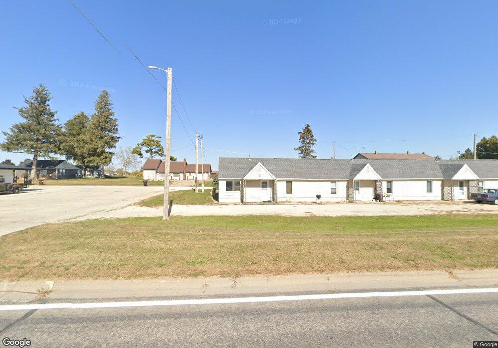
107 E Highway 52 Canton, MN 55922
Estimated Value: $87,000 - $184,000
1
Bed
2
Baths
752
Sq Ft
$153/Sq Ft
Est. Value
About This Home
This home is located at 107 E Highway 52, Canton, MN 55922 and is currently estimated at $114,874, approximately $152 per square foot. 107 E Highway 52 is a home with nearby schools including Mabel-Canton Elementary School, Mabel-Canton Secondary School, and Valley View.
Ownership History
Date
Name
Owned For
Owner Type
Purchase Details
Closed on
Jun 13, 2017
Sold by
Federal Home Loan Mortgage Corporation
Bought by
Knutson Jamie and Knutson Holly
Current Estimated Value
Home Financials for this Owner
Home Financials are based on the most recent Mortgage that was taken out on this home.
Original Mortgage
$18,000
Outstanding Balance
$14,972
Interest Rate
4.02%
Mortgage Type
Commercial
Estimated Equity
$99,902
Create a Home Valuation Report for This Property
The Home Valuation Report is an in-depth analysis detailing your home's value as well as a comparison with similar homes in the area
Purchase History
| Date | Buyer | Sale Price | Title Company |
|---|---|---|---|
| Knutson Jamie | -- | Title One |
Source: Public Records
Mortgage History
| Date | Status | Borrower | Loan Amount |
|---|---|---|---|
| Open | Knutson Jamie | $18,000 |
Source: Public Records
Tax History
| Year | Tax Paid | Tax Assessment Tax Assessment Total Assessment is a certain percentage of the fair market value that is determined by local assessors to be the total taxable value of land and additions on the property. | Land | Improvement |
|---|---|---|---|---|
| 2025 | $972 | $69,700 | $20,000 | $49,700 |
| 2024 | $972 | $66,200 | $20,000 | $46,200 |
| 2023 | $832 | $66,200 | $20,000 | $46,200 |
| 2022 | $832 | $55,700 | $22,500 | $33,200 |
| 2021 | $832 | $45,400 | $12,200 | $33,200 |
| 2020 | $788 | $45,400 | $12,200 | $33,200 |
| 2019 | $772 | $45,400 | $12,200 | $33,200 |
| 2018 | $644 | $45,400 | $12,200 | $33,200 |
| 2017 | -- | $35,700 | $12,200 | $23,500 |
| 2016 | $446 | $35,700 | $12,200 | $23,500 |
| 2015 | $480 | $24,000 | $7,320 | $16,680 |
| 2014 | $480 | $24,000 | $7,320 | $16,680 |
| 2013 | $480 | $23,900 | $7,326 | $16,574 |
Source: Public Records
Map
Nearby Homes
- 202 N Ash St
- 12549 County 21
- 15531 County Road 21
- 15514 341st Ave
- 39871 Highway 44
- 347 5th Ave SE Unit A
- 39871 State Hwy 44
- TBD ( Lot 6, Blk 2) 3rd Ave SE
- TBD (Lot 4 Blk2 ) 3rd Ave SE
- TBD ( Lot 2, Blk 2) 3rd Ave SE
- TBD (Lot 3, Blk 1) 3rd Ave SE
- TBD ( Lot 4, Blk 1) 3rd Ave SE
- TBD ( Lot 3, Blk 2) 3rd Ave SE
- TBD ( Lot 1, Blk 1) 3rd Ave SE
- 16325 351st Ave
- 160 Wickett Dr NW
- 331st Ave
- 15737 403rd Ave
- 315 Newburg Ave W
- 209 Oak St S
Your Personal Tour Guide
Ask me questions while you tour the home.