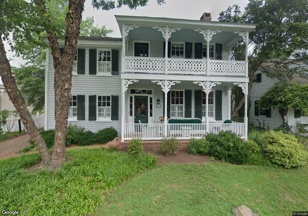
107 Green St Saint Michaels, MD 21663
Estimated Value: $746,000 - $1,134,000
--
Bed
2
Baths
1,404
Sq Ft
$642/Sq Ft
Est. Value
About This Home
This home is located at 107 Green St, Saint Michaels, MD 21663 and is currently estimated at $901,172, approximately $641 per square foot. 107 Green St is a home located in Talbot County with nearby schools including St. Michaels Elementary School, St. Michaels Middle/High School, and Easton High School.
Ownership History
Date
Name
Owned For
Owner Type
Purchase Details
Closed on
Sep 28, 2009
Sold by
Moyer Lois H
Bought by
Wald Alan C and Wald Karen E
Current Estimated Value
Home Financials for this Owner
Home Financials are based on the most recent Mortgage that was taken out on this home.
Original Mortgage
$300,000
Interest Rate
5.14%
Mortgage Type
Purchase Money Mortgage
Purchase Details
Closed on
Apr 20, 2006
Sold by
Moyer Willis D and Moyer Lois H
Bought by
Moyer Lois H and Moyer Lois H Trustee
Purchase Details
Closed on
Feb 27, 2006
Sold by
Moyer Willis D and Moyer Lois H
Bought by
Moyer Lois H and Moyer Lois H Trustee
Create a Home Valuation Report for This Property
The Home Valuation Report is an in-depth analysis detailing your home's value as well as a comparison with similar homes in the area
Home Values in the Area
Average Home Value in this Area
Purchase History
| Date | Buyer | Sale Price | Title Company |
|---|---|---|---|
| Wald Alan C | $600,000 | -- | |
| Moyer Lois H | -- | -- | |
| Moyer Lois H | -- | -- |
Source: Public Records
Mortgage History
| Date | Status | Borrower | Loan Amount |
|---|---|---|---|
| Closed | Wald Karen E | $50,000 | |
| Open | Wald Alan C | $250,000 | |
| Closed | Wald Karen E | $300,000 |
Source: Public Records
Tax History Compared to Growth
Tax History
| Year | Tax Paid | Tax Assessment Tax Assessment Total Assessment is a certain percentage of the fair market value that is determined by local assessors to be the total taxable value of land and additions on the property. | Land | Improvement |
|---|---|---|---|---|
| 2024 | $5,225 | $514,367 | $0 | $0 |
| 2023 | $4,992 | $480,033 | $0 | $0 |
| 2022 | $4,783 | $445,700 | $245,800 | $199,900 |
| 2021 | $4,732 | $442,467 | $0 | $0 |
| 2020 | $4,732 | $439,233 | $0 | $0 |
| 2019 | $4,728 | $436,000 | $217,700 | $218,300 |
| 2018 | $4,634 | $428,700 | $0 | $0 |
| 2017 | $4,480 | $421,400 | $0 | $0 |
| 2016 | $3,985 | $414,100 | $0 | $0 |
| 2015 | $4,728 | $414,100 | $0 | $0 |
| 2014 | $4,728 | $414,100 | $0 | $0 |
Source: Public Records
Map
Nearby Homes
- 103 Mulberry St
- 100 Mulberry St
- 408 Water St
- 222 E Chestnut St
- 205 E Chew Ave
- 113 Thompson St
- 109 Chesapeake Ave
- 204 W Chew Ave
- 602 S Talbot St
- 216 E Chew Ave
- 402 N Talbot St
- 204 E Marengo St
- Lot 2 Meadow St
- Lot 16A Meadow St
- 300 Perry St
- 0 Radcliff Ave Unit MDTA2007626
- 110 Lee St
- 900 Riverview Terrace
- 1026 Riverview Terrace
- 9171 Deepwater Point Rd