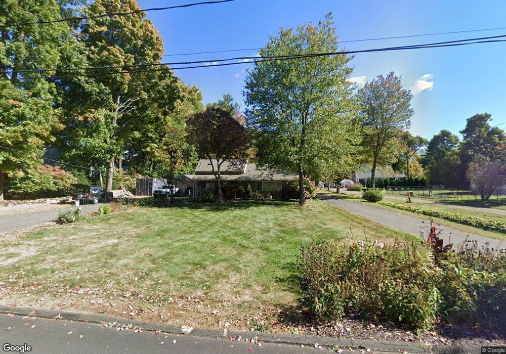
107 Grove Ave Bristol, CT 06010
Forestville NeighborhoodEstimated Value: $329,000 - $354,000
3
Beds
2
Baths
1,598
Sq Ft
$214/Sq Ft
Est. Value
About This Home
This home is located at 107 Grove Ave, Bristol, CT 06010 and is currently estimated at $342,300, approximately $214 per square foot. 107 Grove Ave is a home located in Hartford County with nearby schools including Northeast Middle School, Bristol Eastern High School, and St Matthew School.
Ownership History
Date
Name
Owned For
Owner Type
Purchase Details
Closed on
Sep 30, 2002
Sold by
Cook Ross and Cook Janis
Bought by
Regan Timothy
Current Estimated Value
Home Financials for this Owner
Home Financials are based on the most recent Mortgage that was taken out on this home.
Original Mortgage
$154,250
Interest Rate
6.25%
Purchase Details
Closed on
Apr 18, 1995
Sold by
Tarchini William F and Tarchini Linda S
Bought by
Cook Ross and Cook Janis
Create a Home Valuation Report for This Property
The Home Valuation Report is an in-depth analysis detailing your home's value as well as a comparison with similar homes in the area
Home Values in the Area
Average Home Value in this Area
Purchase History
| Date | Buyer | Sale Price | Title Company |
|---|---|---|---|
| Regan Timothy | $182,000 | -- | |
| Cook Ross | $97,000 | -- |
Source: Public Records
Mortgage History
| Date | Status | Borrower | Loan Amount |
|---|---|---|---|
| Open | Cook Ross | $154,400 | |
| Closed | Cook Ross | $150,000 | |
| Closed | Cook Ross | $154,250 | |
| Closed | Cook Ross | $10,000 |
Source: Public Records
Tax History Compared to Growth
Tax History
| Year | Tax Paid | Tax Assessment Tax Assessment Total Assessment is a certain percentage of the fair market value that is determined by local assessors to be the total taxable value of land and additions on the property. | Land | Improvement |
|---|---|---|---|---|
| 2025 | $5,450 | $161,490 | $44,030 | $117,460 |
| 2024 | $5,130 | $161,070 | $44,030 | $117,040 |
| 2023 | $4,888 | $161,070 | $44,030 | $117,040 |
| 2022 | $4,556 | $118,790 | $35,770 | $83,020 |
| 2021 | $4,556 | $118,790 | $35,770 | $83,020 |
| 2020 | $4,556 | $118,790 | $35,770 | $83,020 |
| 2019 | $4,520 | $118,790 | $35,770 | $83,020 |
| 2018 | $4,381 | $118,790 | $35,770 | $83,020 |
| 2017 | $4,424 | $122,780 | $44,380 | $78,400 |
| 2016 | $4,424 | $122,780 | $44,380 | $78,400 |
| 2015 | $4,249 | $122,780 | $44,380 | $78,400 |
| 2014 | $4,249 | $122,780 | $44,380 | $78,400 |
Source: Public Records
Map
Nearby Homes
- 73 Grove Ave
- 46 Pleasant Ave
- 35 Buckley Ave
- 336 Washington St
- 418 Washington St
- 245 Mark St
- 437 Stafford Ave
- 3 Bushel Rd Unit 3
- 44 Cabot St
- 302 Brook St
- 16 Mechanic St
- 0 Overlook Dr Unit Lot 4 24092448
- 0 Overlook Dr Unit Lot 3 24092446
- 41 E New St
- 16 Knox Place
- 158 E Main St
- 12 Currey Ct
- 96 Kenney St
- 205 Camp St
- 196 Frederick St
- 10 Nicholas Dr Unit 12
- 123 Grove Ave
- 9 Nicholas Dr Unit 13
- 114 Grove Ave
- 84 Grove Ave
- 93 Grove Ave
- 87 Grove Ave
- 124 Grove Ave
- 58 Nicholas Dr
- 60 Nicholas Dr
- 60 Nicholas Dr Unit 60
- 111 Grove Ave
- 26 Nicholas Dr
- 57 Nicholas Dr
- 72 Grove Ave
- 125 Fair St
- 59 Nicholas Dr
- 59 Nicholas Dr Unit 59
- 34 Nicholas Dr
- 135 Fair St