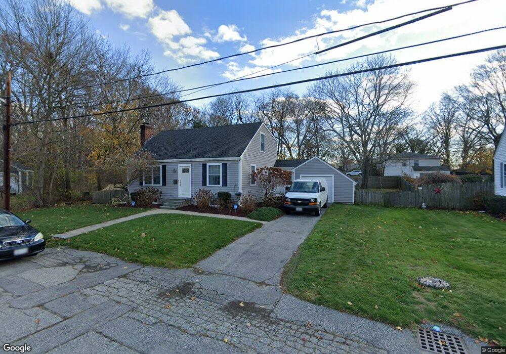
107 Merritt Rd Riverside, RI 02915
Kent Heights NeighborhoodEstimated Value: $430,000 - $494,000
3
Beds
2
Baths
1,400
Sq Ft
$333/Sq Ft
Est. Value
About This Home
This home is located at 107 Merritt Rd, Riverside, RI 02915 and is currently estimated at $466,727, approximately $333 per square foot. 107 Merritt Rd is a home located in Providence County with nearby schools including East Providence High School, St Mary Academy-Bay View, and The Gordon School.
Ownership History
Date
Name
Owned For
Owner Type
Purchase Details
Closed on
Jul 9, 2009
Sold by
Mahoney Joseph and Mahoney Kelly
Bought by
Soares Natalie M and Camelo Miguel
Current Estimated Value
Home Financials for this Owner
Home Financials are based on the most recent Mortgage that was taken out on this home.
Original Mortgage
$265,109
Outstanding Balance
$168,940
Interest Rate
4.93%
Mortgage Type
Purchase Money Mortgage
Estimated Equity
$297,787
Purchase Details
Closed on
May 27, 2004
Sold by
Powers Madge
Bought by
Mahoney Joseph and Woodward Kelly
Home Financials for this Owner
Home Financials are based on the most recent Mortgage that was taken out on this home.
Original Mortgage
$214,700
Interest Rate
5.88%
Mortgage Type
Purchase Money Mortgage
Create a Home Valuation Report for This Property
The Home Valuation Report is an in-depth analysis detailing your home's value as well as a comparison with similar homes in the area
Home Values in the Area
Average Home Value in this Area
Purchase History
| Date | Buyer | Sale Price | Title Company |
|---|---|---|---|
| Soares Natalie M | $270,000 | -- | |
| Mahoney Joseph | $226,000 | -- |
Source: Public Records
Mortgage History
| Date | Status | Borrower | Loan Amount |
|---|---|---|---|
| Open | Mahoney Joseph | $265,109 | |
| Previous Owner | Mahoney Joseph | $12,900 | |
| Previous Owner | Mahoney Joseph | $214,700 |
Source: Public Records
Tax History Compared to Growth
Tax History
| Year | Tax Paid | Tax Assessment Tax Assessment Total Assessment is a certain percentage of the fair market value that is determined by local assessors to be the total taxable value of land and additions on the property. | Land | Improvement |
|---|---|---|---|---|
| 2025 | $5,800 | $443,800 | $176,900 | $266,900 |
| 2024 | $5,873 | $383,100 | $147,500 | $235,600 |
| 2023 | $5,655 | $383,100 | $147,500 | $235,600 |
| 2022 | $5,843 | $267,300 | $91,000 | $176,300 |
| 2021 | $5,747 | $267,300 | $91,000 | $176,300 |
| 2020 | $5,504 | $267,300 | $91,000 | $176,300 |
| 2019 | $5,351 | $267,300 | $91,000 | $176,300 |
| 2018 | $4,988 | $218,000 | $70,500 | $147,500 |
| 2017 | $4,877 | $218,000 | $70,500 | $147,500 |
| 2016 | $4,853 | $218,000 | $70,500 | $147,500 |
| 2015 | $4,764 | $207,600 | $65,200 | $142,400 |
| 2014 | $4,764 | $207,600 | $65,200 | $142,400 |
Source: Public Records
Map
Nearby Homes
- 59 Merritt Rd
- 108 Ivan Ave
- 10 Fairfield Ave
- 14 Waterview Ave Unit 16
- 53 Wampanoag Trail
- 36 Gerald St
- 50 Kettle Point Ave Unit 50
- 3421 Pawtucket Ave
- 180 Grassmere Ave
- 87 Vincent Ave
- 6 Fuller Ave
- 740 Veterans Memorial Pkwy
- 25 Ide Ave
- 25 Bullocks Point Ave Unit 5C
- 1 Fales St
- 31 Bullocks Point Ave Unit 2A
- 43 Bullocks Point Ave Unit 4C
- 1463 S Broadway
- 74 Brookhaven Dr
- 151 Willett Ave Unit 2
- 103 Merritt Rd
- 115 Merritt Rd
- 157 Brookfield Rd
- 150 Brookfield Rd
- 97 Merritt Rd
- 104 Merritt Rd
- 110 Merritt Rd
- 153 Brookfield Rd
- 96 Merritt Rd
- 93 Merritt Rd
- 104 Brookfield Rd
- 90 Merritt Rd
- 96 Brookfield Rd
- 83 Merritt Rd
- 149 Brookfield Rd
- 88 Brookfield Rd
- 121 Elder Ave
- 84 Merritt Rd
- 77 Merritt Rd
- 115 Brookfield Rd