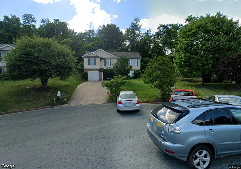
107 Mummert Cir Winchester, VA 22601
Estimated Value: $391,926 - $421,000
4
Beds
3
Baths
1,210
Sq Ft
$335/Sq Ft
Est. Value
About This Home
This home is located at 107 Mummert Cir, Winchester, VA 22601 and is currently estimated at $405,232, approximately $334 per square foot. 107 Mummert Cir is a home located in Frederick County with nearby schools including Apple Pie Ridge Elementary School, Frederick County Middle School, and James Wood High School.
Ownership History
Date
Name
Owned For
Owner Type
Purchase Details
Closed on
Sep 4, 2003
Sold by
Michael Preup Inc
Bought by
Bange Roger L
Current Estimated Value
Home Financials for this Owner
Home Financials are based on the most recent Mortgage that was taken out on this home.
Original Mortgage
$134,900
Outstanding Balance
$61,632
Interest Rate
6.02%
Mortgage Type
New Conventional
Estimated Equity
$343,600
Purchase Details
Closed on
May 31, 2002
Sold by
Jeni Company
Bought by
Michael G Prelip Inc
Home Financials for this Owner
Home Financials are based on the most recent Mortgage that was taken out on this home.
Original Mortgage
$125,000
Interest Rate
6.9%
Create a Home Valuation Report for This Property
The Home Valuation Report is an in-depth analysis detailing your home's value as well as a comparison with similar homes in the area
Home Values in the Area
Average Home Value in this Area
Purchase History
| Date | Buyer | Sale Price | Title Company |
|---|---|---|---|
| Bange Roger L | $219,000 | -- | |
| Michael G Prelip Inc | $75,000 | -- |
Source: Public Records
Mortgage History
| Date | Status | Borrower | Loan Amount |
|---|---|---|---|
| Open | Bange Roger L | $134,900 | |
| Previous Owner | Michael G Prelip Inc | $125,000 |
Source: Public Records
Tax History Compared to Growth
Tax History
| Year | Tax Paid | Tax Assessment Tax Assessment Total Assessment is a certain percentage of the fair market value that is determined by local assessors to be the total taxable value of land and additions on the property. | Land | Improvement |
|---|---|---|---|---|
| 2025 | $1,763 | $367,300 | $78,000 | $289,300 |
| 2024 | $780 | $305,700 | $62,000 | $243,700 |
| 2023 | $1,559 | $305,700 | $62,000 | $243,700 |
| 2022 | $1,502 | $246,300 | $57,000 | $189,300 |
| 2021 | $1,502 | $246,300 | $57,000 | $189,300 |
| 2020 | $1,357 | $222,500 | $57,000 | $165,500 |
| 2019 | $1,357 | $222,500 | $57,000 | $165,500 |
| 2018 | $1,293 | $211,900 | $57,000 | $154,900 |
| 2017 | $1,271 | $211,900 | $57,000 | $154,900 |
| 2016 | $1,157 | $192,800 | $44,500 | $148,300 |
| 2015 | $1,080 | $192,800 | $44,500 | $148,300 |
| 2014 | $536 | $181,900 | $44,500 | $137,400 |
Source: Public Records
Map
Nearby Homes
- 163 Margaret Ln
- 110 Clevenger Ct
- 1629 Pondview Dr
- 792 Fox Dr
- 611 Tudor Dr
- 509 Marion St
- 1667 N Frederick Pike
- 110 Lawford Way
- 2110 Carnation Way
- 0 N Frederick Pike Unit VAFV2037314
- 0 N Frederick Pike Unit VAWI2007698
- 0 N Frederick Pike Unit VAFV2024246
- 320 Linden Dr
- 341 Wood Ave
- 1033 Sunnyside Dr
- 154 Ashton Dr
- 159 Ashton Dr
- Lot 84 Purcell Ln
- 1818 Blythe Way
- 1810 Blythe Way
- 109 Mummert Cir
- 105 Mummert Cir
- 103 Mummert Cir
- 181 Margaret Ln
- 110 Mummert Cir
- 108 Mummert Cir
- 104 Mummert Cir
- 191 Margaret Ln
- 1675 Fort Braddock Ct
- 107 Clevenger Ct
- 109 Clevenger Ct
- 105 Clevenger Ct
- 103 Clevenger Ct
- 155 Margaret Ln
- 1665 Fort Braddock Ct
- 186 Margaret Ln
- 176 Margaret Ln
- 101 Clevenger Ct
- 204 Margaret Ln
- 1645 Fort Braddock Ct