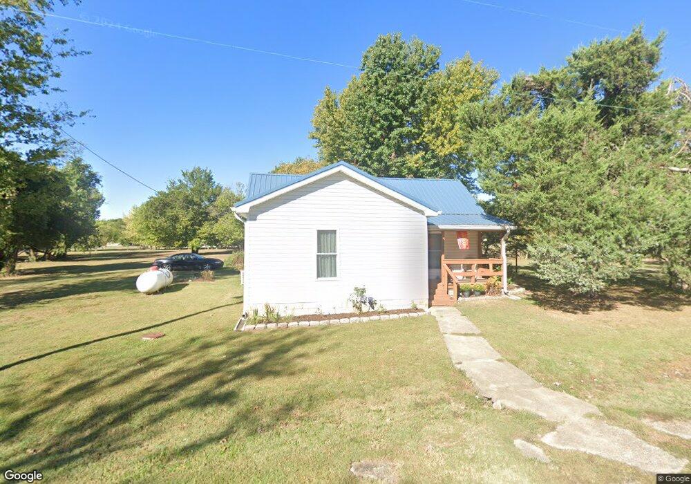
107 N Abbott Rd Pittsburg, KS 66762
Estimated Value: $100,018 - $266,000
3
Beds
2
Baths
1,596
Sq Ft
$117/Sq Ft
Est. Value
About This Home
This home is located at 107 N Abbott Rd, Pittsburg, KS 66762 and is currently estimated at $186,005, approximately $116 per square foot. 107 N Abbott Rd is a home located in Crawford County with nearby schools including R.V. Haderlein Elementary School, Girard Middle School, and Girard High School.
Ownership History
Date
Name
Owned For
Owner Type
Purchase Details
Closed on
May 2, 2018
Sold by
Ware Ronald F and Ware Dora L
Bought by
Grubb Joel and Grubb Angela
Current Estimated Value
Home Financials for this Owner
Home Financials are based on the most recent Mortgage that was taken out on this home.
Original Mortgage
$20,000
Outstanding Balance
$17,240
Interest Rate
4.45%
Mortgage Type
New Conventional
Estimated Equity
$168,765
Purchase Details
Closed on
Aug 1, 1986
Bought by
Ware Ronald F and Ware Dora L
Create a Home Valuation Report for This Property
The Home Valuation Report is an in-depth analysis detailing your home's value as well as a comparison with similar homes in the area
Home Values in the Area
Average Home Value in this Area
Purchase History
| Date | Buyer | Sale Price | Title Company |
|---|---|---|---|
| Grubb Joel | $25,000 | Crawford Cnty Abstract Co Inc | |
| Ware Ronald F | $18,000 | -- |
Source: Public Records
Mortgage History
| Date | Status | Borrower | Loan Amount |
|---|---|---|---|
| Open | Grubb Joel | $20,000 |
Source: Public Records
Tax History Compared to Growth
Tax History
| Year | Tax Paid | Tax Assessment Tax Assessment Total Assessment is a certain percentage of the fair market value that is determined by local assessors to be the total taxable value of land and additions on the property. | Land | Improvement |
|---|---|---|---|---|
| 2025 | $503 | $5,301 | $1,521 | $3,780 |
| 2024 | $503 | $4,954 | $1,521 | $3,433 |
| 2023 | $458 | $4,503 | $707 | $3,796 |
| 2022 | $444 | $4,350 | $354 | $3,996 |
| 2021 | $450 | $4,013 | $354 | $3,659 |
| 2020 | $259 | $2,461 | $320 | $2,141 |
| 2019 | $259 | $2,461 | $320 | $2,141 |
| 2018 | $345 | $3,151 | $320 | $2,831 |
| 2017 | $347 | $3,151 | $277 | $2,874 |
| 2016 | $329 | $3,151 | $277 | $2,874 |
| 2015 | $465 | $3,151 | $277 | $2,874 |
| 2014 | $465 | $3,151 | $277 | $2,874 |
Source: Public Records
Map
Nearby Homes
- 305 S 170th St
- 576 E 47 Hwy
- 00000 E 610th Ave
- 0000 E 610th Ave
- 000 E 610th Ave
- 00 E 610th Ave
- 0 E 610th Ave
- 531 E 630th Ave
- 215 Countryview Dr
- 00000 W Atkinson Rd
- 4094 Parkview Dr
- 4073 Parkview Dr
- 274 N 200th St
- 4070 Parkview Dr
- 110 S Williams St
- 558 E 640th Ave
- W Atkinson Ave
- 409 W Atkinson Rd
- 308 Caroline Dr
- 106 W Carlton St
- 107 N Abbott Rd
- 107 W Costello Rd
- 201 N Abbott St
- 201 N Abbott Rd
- 101 W Radley Ave
- 101 W Radley Ave
- 209 W Costello Rd
- 105 W Costello Rd
- 210 W Costello Rd
- 213 W Radley Ave
- 203 N East Ave
- 104 E Radley Ave
- 105 N Bailey Rd
- 203 N Bailey Rd
- 209 N East Ave N A
- 209 N East Ave
- 402 N East Ave Unit 400
- 416 N East Ave Unit 400
- 204 W Emerson Dr
- 111 N Presley Rd