Estimated Value: $446,347 - $483,000
3
Beds
2
Baths
1,040
Sq Ft
$450/Sq Ft
Est. Value
About This Home
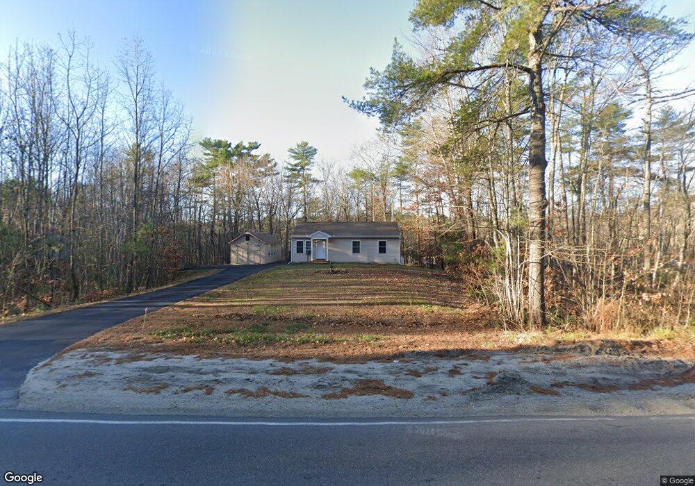
This home is located at 107 N Raymond Rd, Gray, ME 04039 and is currently estimated at $467,837, approximately $449 per square foot. 107 N Raymond Rd is a home with nearby schools including Gray-New Gloucester High School and Fiddlehead School of Arts & Science.
Ownership History
Date
Name
Owned For
Owner Type
Purchase Details
Closed on
Nov 9, 2016
Sold by
Bailey Peter A
Bought by
Baldawi Amera F
Current Estimated Value
Home Financials for this Owner
Home Financials are based on the most recent Mortgage that was taken out on this home.
Original Mortgage
$186,290
Outstanding Balance
$162,155
Interest Rate
3.42%
Mortgage Type
Purchase Money Mortgage
Estimated Equity
$305,682
Purchase Details
Closed on
Jul 30, 2015
Sold by
Wilson Earle F and Wilson Nancy C
Bought by
Bailey Peter A
Purchase Details
Closed on
Sep 1, 2005
Sold by
Wilson Lt
Bought by
Wilson Earle F and Wilson Nancy C
Create a Home Valuation Report for This Property
The Home Valuation Report is an in-depth analysis detailing your home's value as well as a comparison with similar homes in the area
Home Values in the Area
Average Home Value in this Area
Purchase History
| Date | Buyer | Sale Price | Title Company |
|---|---|---|---|
| Baldawi Amera F | -- | -- | |
| Bailey Peter A | -- | -- | |
| Wilson Earle F | -- | -- |
Source: Public Records
Mortgage History
| Date | Status | Borrower | Loan Amount |
|---|---|---|---|
| Open | Baldawi Amera F | $186,290 |
Source: Public Records
Tax History Compared to Growth
Tax History
| Year | Tax Paid | Tax Assessment Tax Assessment Total Assessment is a certain percentage of the fair market value that is determined by local assessors to be the total taxable value of land and additions on the property. | Land | Improvement |
|---|---|---|---|---|
| 2025 | $3,291 | $340,000 | $125,700 | $214,300 |
| 2024 | $3,254 | $335,500 | $125,700 | $209,800 |
| 2023 | $3,508 | $231,100 | $70,400 | $160,700 |
| 2022 | $3,224 | $231,100 | $70,400 | $160,700 |
| 2021 | $3,061 | $209,500 | $70,400 | $139,100 |
| 2020 | $3,090 | $209,500 | $70,400 | $139,100 |
| 2019 | $3,090 | $209,500 | $70,400 | $139,100 |
| 2018 | $2,933 | $209,500 | $70,400 | $139,100 |
| 2017 | $628 | $34,800 | $34,800 | $0 |
| 2016 | $637 | $34,800 | $34,800 | $0 |
| 2015 | $633 | $34,800 | $34,800 | $0 |
| 2014 | $633 | $34,800 | $34,800 | $0 |
| 2012 | -- | $34,800 | $34,800 | $0 |
Source: Public Records
Map
Nearby Homes
- 112 N Raymond Rd
- 4 Chelsey Ln
- 15 May Meadow Dr
- 74 May Meadow Dr
- 00 N Shore Rd
- 21 Westwood Rd
- M011-006 Westwood Rd
- 11-007 Westwood Rd
- 4 Wanda Ln
- 13 Mill Brook Rd Unit A
- 127 Shaker Rd Unit 41
- 157 Egypt Rd
- TBD Targett Rd
- 2 Dr
- 423 Sabbathday Rd
- 17 Callaway Dr Unit 17
- 27 Callaway Dr Unit 27B
- 2 Gore Rd
- 0 Mayall
- 27 Boulder Dr