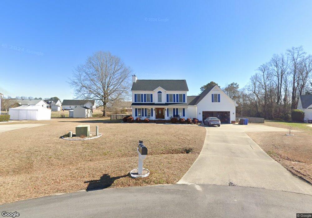
107 Pine Croft Rd Angier, NC 27501
Estimated Value: $341,709 - $392,000
3
Beds
3
Baths
2,071
Sq Ft
$179/Sq Ft
Est. Value
About This Home
This home is located at 107 Pine Croft Rd, Angier, NC 27501 and is currently estimated at $371,177, approximately $179 per square foot. 107 Pine Croft Rd is a home located in Harnett County with nearby schools including North Harnett Primary School, Angier Elementary School, and Harnett Central Middle School.
Ownership History
Date
Name
Owned For
Owner Type
Purchase Details
Closed on
Oct 9, 2019
Sold by
Lane Jospeh A and Lane Janice
Bought by
Eason Delores S and Eason Michael A
Current Estimated Value
Home Financials for this Owner
Home Financials are based on the most recent Mortgage that was taken out on this home.
Original Mortgage
$245,471
Outstanding Balance
$214,469
Interest Rate
3.37%
Mortgage Type
FHA
Estimated Equity
$156,708
Purchase Details
Closed on
Jun 17, 2003
Bought by
Lane Joseph A
Create a Home Valuation Report for This Property
The Home Valuation Report is an in-depth analysis detailing your home's value as well as a comparison with similar homes in the area
Home Values in the Area
Average Home Value in this Area
Purchase History
| Date | Buyer | Sale Price | Title Company |
|---|---|---|---|
| Eason Delores S | $250,000 | None Available | |
| Lane Joseph A | -- | -- |
Source: Public Records
Mortgage History
| Date | Status | Borrower | Loan Amount |
|---|---|---|---|
| Open | Eason Delores S | $245,471 |
Source: Public Records
Tax History
| Year | Tax Paid | Tax Assessment Tax Assessment Total Assessment is a certain percentage of the fair market value that is determined by local assessors to be the total taxable value of land and additions on the property. | Land | Improvement |
|---|---|---|---|---|
| 2025 | $1,757 | $247,363 | $0 | $0 |
| 2024 | $1,757 | $247,363 | $0 | $0 |
| 2023 | $1,732 | $247,363 | $0 | $0 |
| 2022 | $1,730 | $247,363 | $0 | $0 |
| 2021 | $1,730 | $200,550 | $0 | $0 |
| 2020 | $1,730 | $200,550 | $0 | $0 |
| 2019 | $1,715 | $200,550 | $0 | $0 |
| 2018 | $1,715 | $200,550 | $0 | $0 |
| 2017 | $1,715 | $200,550 | $0 | $0 |
| 2016 | $1,845 | $216,440 | $0 | $0 |
| 2015 | $1,845 | $216,440 | $0 | $0 |
| 2014 | $1,845 | $216,440 | $0 | $0 |
Source: Public Records
Map
Nearby Homes
- 146 Wheat Dr
- 91 Wheat Dr
- 182 Scotts Ln
- 228 Shelby Meadow Ln
- 400 Shelby Meadow Ln
- 68 Norris Farm Dr
- 380 Shelby Meadow Ln
- 315 Adams Pointe Ct
- 658 James Norris Rd
- 237 Chedworth Dr
- 467 Adams Pointe Ct
- 61 New River Ct
- 358 Coleshill Rd
- 60 Coleshill Rd
- 59 Two Belles Ct
- 59 Ara Ct
- 90 Foxton Place
- 55 Ara Ct
- 51 Ara Ct
- 47 Ara Ct
- 101 Pine Croft Rd
- 106 Pine Croft Rd
- 224 Ashton Ln
- 256 Golden Oats Dr
- 240 Golden Oats Dr
- 238 Ashton Ln
- 207 Ashton Ln
- 272 Golden Oats Dr
- 238 Ashton Ln
- 207 Ashton Ln
- 165 Ashton Ln
- 118 Ashton Ln
- 220 Golden Oats Dr
- 229 Ashton Ln
- 290 Golden Oats Dr
- 239 Ashton Ln
- 141 Ashton Ln
- 200 Golden Oats Dr
- 271 Golden Oats Dr
Your Personal Tour Guide
Ask me questions while you tour the home.